
Enhanced Risk issued for large hail and severe wind gusts in parts of north and central Texas
An Enhanced Risk (level 3/5) for severe thunderstorms has been issued across parts of west and central Texas for Sunday, May 10, 2026. Supercells capable of producing hailstones larger than 5 cm (2 inches) and wind gusts above 113 km/h (70 mph) are forecast to develop during the afternoon and evening hours. The severe-weather threat extends east-northeastward into the Ark-La-Tex region and parts of the lower Mississippi Valley.
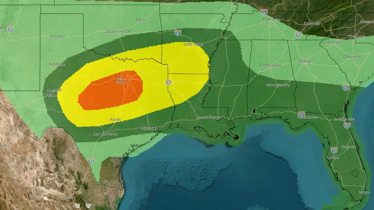
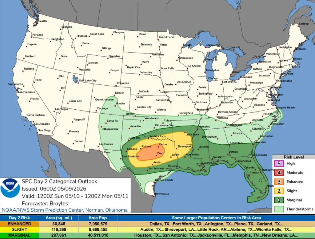
Convective Outlook valid 14:00 EDT on May 10 to 14:00 EDT on May 11, 2026. Credit: NWS/SPC
The Storm Prediction Center (SPC) issued an Enhanced Risk of severe thunderstorms for parts of west-central and north-central Texas for Sunday, May 10, with storms capable of producing hail larger than 5 cm (2 inches) and wind gusts above 113 km/h (70 mph) during the afternoon and evening.
A positively tilted mid-level disturbance will move southeast into the southern Plains, while a cold front pushes southward across west and north Texas towards the Ark-La-Tex region. South of the front, surface dewpoints are forecast to remain between 18 and 21°C (65 and 70°F), supporting moderate destabilization as daytime heating intensifies through the afternoon.
Thunderstorms are forecast to develop near the frontal boundary around midday before expanding into a larger convective complex moving southeastward across north and central Texas later in the day.
The combination of instability and vertical wind shear will support semi-discrete supercells capable of producing large hail of over 5 cm (2 inches) in diameter, particularly over west-central and north-central Texas.
There is a risk of severe wind gusts reaching over 113 km/h (70 mph) as storms organize into larger clusters and move southeastward through the afternoon and evening.
The Enhanced Risk area covers about 79 900 km² (30 845 mi²) and includes an estimated population of 7 080 680 people. Some of the larger population centers within the risk area include Dallas, Fort Worth, Arlington, and Garland, Texas.
Areas farther east across the Ark-La-Tex region and the lower Mississippi Valley may also experience severe thunderstorms capable of producing damaging winds and hail.
Across the Southeast, a very moist air mass is expected from the central Gulf Coast states eastward to the Atlantic. Storm development may be more isolated because large-scale storm support will be limited, but boundaries forming inland from the coast during the afternoon could support storms capable of isolated severe wind gusts.
References:
1 Day 2 Convective Outlook – SPC – May 9, 2026

I am an Assistant Editor and Severe Weather & Science Journalist at The Watchers, specializing in real-time severe weather coverage, geophysical event reporting, and research-driven scientific analysis. You can reach me at rishav(at)watchers(.)news.
Commenting rules and guidelines
We value the thoughts and opinions of our readers and welcome healthy discussions on our website. In order to maintain a respectful and positive community, we ask that all commenters follow these rules.