• Visitors ordered to evacuate Hatteras Island as coastal storm threatens N.C. Highway 12, U.S.

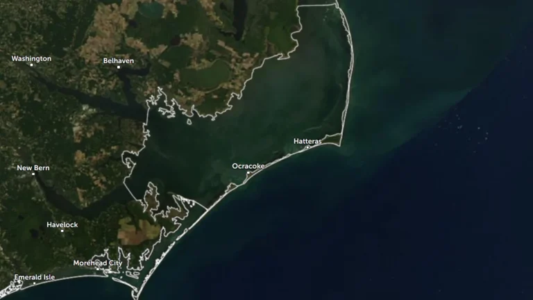
    Dare County ordered all visitors to evacuate Hatteras Island beginning at 20:00 EDT on October 16 (00:00 UTC on October 17) after declaring a state of emergency ahead of a developing coastal nor’easter. A Coastal Flood Warning is valid from 17:00 EDT (21:00 UTC) on October 17 to 08:00 EDT (12:00 UTC) on October 20, with 0.6–1.2 m (2–4 feet) of inundation above ground level and 2.4–4.3 m (8–14 feet) breaking surf forecast in vulnerable areas.
  • Typhoon and Flood watches cover Mariana Islands as Tropical Storm Champi approaches

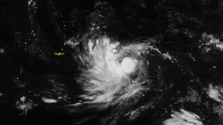
    Typhoon and Flood watches were in effect for Guam, Rota, Tinian and Saipan early October 16 as Tropical Storm Champi moved west toward the Mariana Islands. NWS Guam said damaging winds were likely late October 17 and on October 18, while storm-total rainfall of 152–305 mm (6–12 inches) could cause flooding in urban, low-lying and poorly drained areas.

  • Life-threatening flash flooding reported across Oklahoma City, major flooding forecast on Canadian River

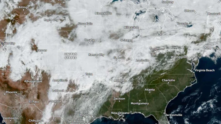
    Life-threatening flash flooding was reported across the Oklahoma City metropolitan area on October 14 after thunderstorms produced 76–152 mm (3–6 inches) of rain, while radar indicated 102–279 mm (4–11 inches) farther west, according to the National Weather Service (NWS) in Norman. Major flooding was forecast on the Canadian River near Bridgeport, while the Weather Prediction Center (WPC) maintained a Moderate Risk of excessive rainfall from Oklahoma into the Red River Valley of Texas through 12:00 UTC on October 15.

  • Hurricane Isaias leaves at least six dead, hundreds of thousands without power after Florida landfall

    At least six people died after Hurricane Isaias made landfall near Destin, Florida, as a Category 2 hurricane at about 20:30 LT on October 9 (01:30 UTC on October 10). Approximately 408 000 customer accounts remained without power across Florida, Alabama, Georgia and Mississippi shortly before 13:00 UTC on October 11, while the post-tropical cyclone continued producing flooding and wind hazards farther northeast.

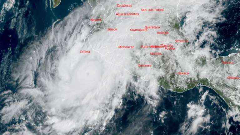
  • Category 4 Hurricane Simon approaches western Mexico with catastrophic wind and storm-surge threat

    Category 4 Hurricane Simon was located 185 km (115 miles) south-southwest of Manzanillo, Mexico, at 09:00 LT (15:00 UTC) on October 10, 2026, with maximum sustained winds of 240 km/h (150 mph) and a minimum pressure of 938 hPa. The National Hurricane Center (NHC) said additional strengthening remained possible before Simon approached west-central Mexico as a major hurricane late October 10 or early October 11.

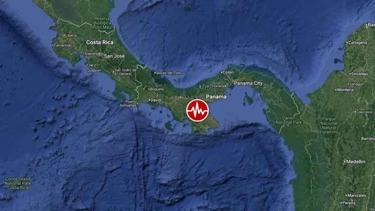
  • Major M7.6 earthquake damages buildings across Panama, tsunami threat ends

    A major M7.6 earthquake struck central Panama at 17:56 UTC (12:56 local time) on October 9, 2026, causing structural damage, injuries, widespread evacuations and disruptions to electricity, transportation and public services. The Pacific Tsunami Warning Center (PTWC) ended the associated tsunami threat at 19:40 UTC, while authorities continued assessing damage and monitoring aftershocks.

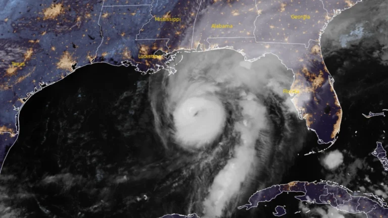
  • Tornado threat forecast as Hurricane Isaias strengthens ahead of northern Gulf Coast landfall, United States

    The Storm Prediction Center (SPC) issued a Slight Risk of severe thunderstorms for parts of the Florida Panhandle, southeastern Alabama, and southwestern Georgia on October 9, 2026, as rainbands from Hurricane Isaias were forecast to bring a tornado threat from the afternoon into the overnight hours. At 09:00 UTC, the National Hurricane Center (NHC) said Isaias had strengthened to 175 km/h (110 mph), with a minimum central pressure of 963 hPa, ahead of an expected northern Gulf Coast landfall Friday night or early Saturday.

  • Life-threatening storm surge of up to 2 m (7 feet) forecast as Hurricane Isaias approaches U.S. Gulf Coast

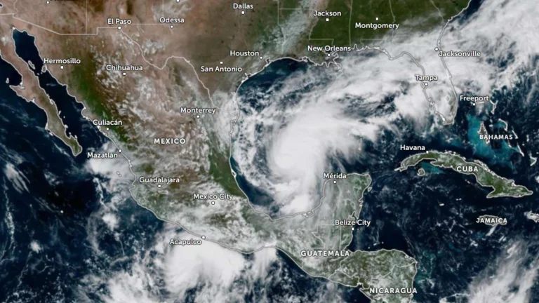
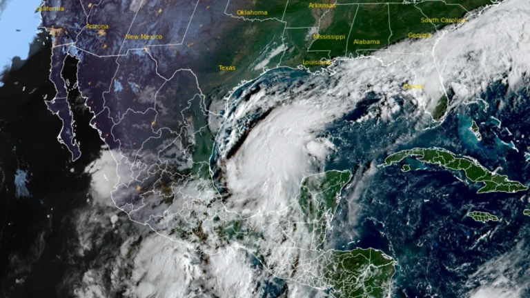
    Life-threatening storm surge is forecast along the northern U.S. Gulf Coast as Hurricane Isaias approaches landfall. NHC said water could rise 1.5–2 m (5–7 feet) above ground between Ocean Springs, Mississippi, and Indian Pass, Florida, and within Mobile Bay if the peak surge coincides with high tide.saias is forecast to produce 75–180 mm (3–7 inches) of rain from southeastern Louisiana to Florida’s Big Bend from Friday through the weekend, with localized totals approaching 380 mm (15 inches) in the Florida Panhandle and Big Bend. NHC warned of considerable flash and urban flooding and significant river flooding.

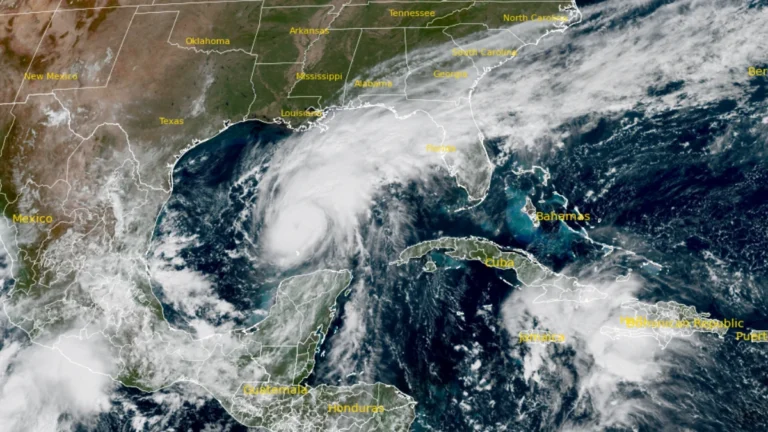
  • Hurricane and storm surge watches issued for northern Gulf Coast as Isaias strengthens, U.S.

    Hurricane, storm surge and tropical storm watches were issued for portions of the U.S. northern Gulf Coast on Wednesday morning, October 7, 2026, as Tropical Storm Isaias strengthened over the Gulf of America, according to the National Hurricane Center (NHC). The watches extend from the mouth of the Mississippi River eastward to Yankeetown, Florida.