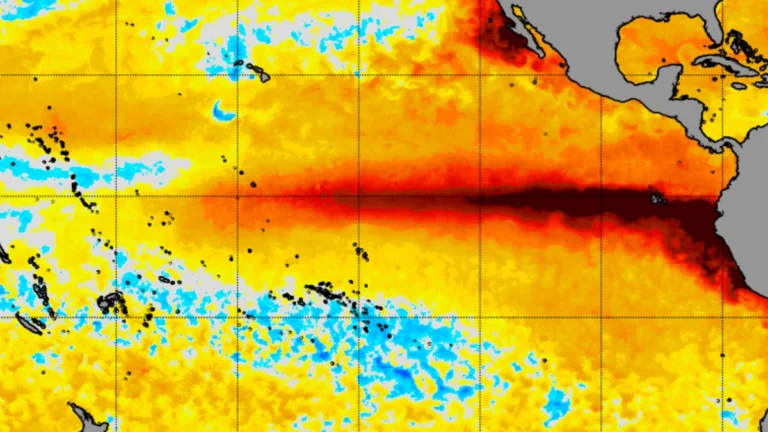
• California declares statewide emergency as very strong El Niño develops ahead of 2026-27 winter

    California Governor Gavin Newsom proclaimed a statewide emergency on September 21, 2026, to accelerate preparations for potential flooding, landslides, coastal hazards and other winter impacts as a strengthening El Niño develops in the tropical Pacific. NOAA said there is a greater than 90% chance the event will become very strong during Northern Hemisphere autumn and winter 2026–27.
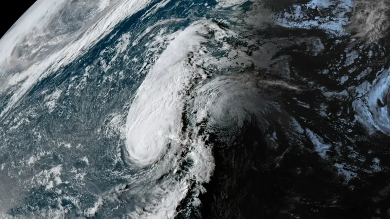
  • Rapidly intensifying Tropical Storm Polo forecast to become major hurricane near southwestern Mexico

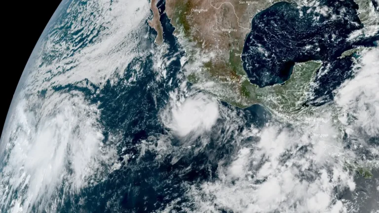
    Tropical Storm Polo was rapidly intensifying off southwestern Mexico on September 21, 2026, with maximum sustained winds reaching 100 km/h (65 mph) at 09:00 CST (15:00 UTC), according to the National Hurricane Center (NHC). NHC forecasts Polo to become a hurricane later Monday and a major hurricane on Tuesday while moving near the southwestern Mexican coast, where a Tropical Storm Watch is already in effect.

  • Typhoon Dujuan brings record rainfall to eastern Japan, JMA issues Level 5 landslide warning for Oshima

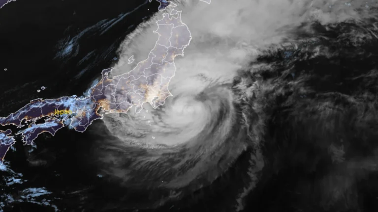
    Rainfall on Oshima reached 600 mm (23.6 inches) in the 24 hours ending at 14:00 LT (05:00 UTC) on September 21, 2026, as Typhoon Dujuan passed the Izu Islands and approached eastern Japan. The record September rainfall prompted a Level 5 landslide special warning, while flooding, landslides and transport disruption affected parts of the Kanto region.

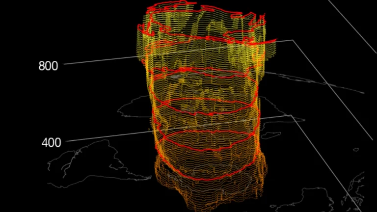
  • Polar vortex strengthens over Arctic, very strong El Niño supports mid-winter weakening signal

    The Northern Hemisphere polar vortex is forming normally over the Arctic and was stronger than average by NASA’s wind diagnostic in mid-September 2026. The developing very strong El Niño could favor atmospheric wave patterns that weaken the vortex later in winter, with seasonal guidance showing a possible weakening during January and February 2027.

  • Heat Advisories span 12 states from Texas to Indiana, heat index up to 46°C (114°F) forecast

    Heat Advisories issued by 16 National Weather Service (NWS) forecast offices cover portions of 12 U.S. states from September 14 through September 16, 2026, with heat index values forecast to reach 46°C (114°F) in southern Texas. The advisories extend from Texas and Oklahoma through the Lower Mississippi Valley and Mid-South into Indiana and Kentucky.

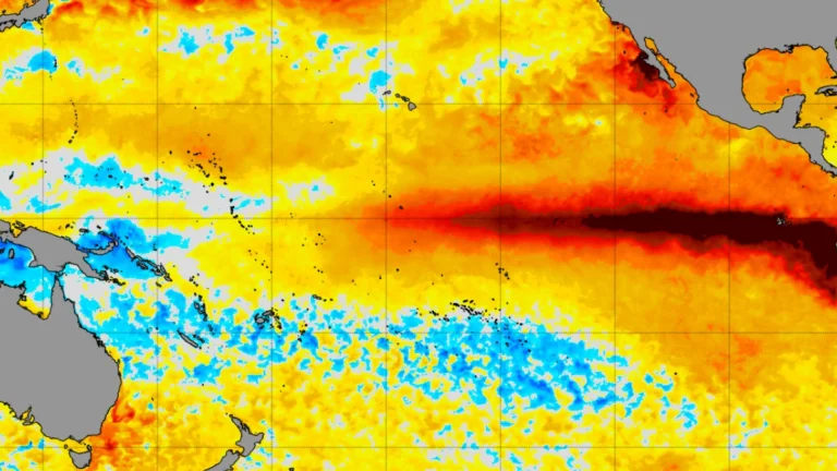
  • NOAA raises chance of historic-strength El Niño to 75% for October–December 2026

    The Climate Prediction Center (CPC) raised the probability of a historic-strength El Niño during October–December 2026 to 75% on September 10, up from 69% in August, after the coupled ocean-atmosphere event strengthened further across the tropical Pacific. CPC also raised the probability of a very strong event during the same three-month period from 95% to 98%.

  • 1 dead as Hurricane Lowell passes west of Niʻihau, knocks out power to 90% of Kauaʻi, Hawaii

    One person died on Oʻahu as Hurricane Lowell passed the Hawaiian Islands late on September 7, 2026 (local time), while the storm’s core passed near Niʻihau with maximum sustained winds of 175 km/h (110 mph). Approximately 90% of Kauaʻi Island Utility Cooperative customers were without power the following morning, while numerous roads and Port Allen Small-Boat Harbor sustained severe damage. Preliminary National Weather Service (NWS) observations included a gust of approximately 150 km/h (92 mph) at Puʻu Lua and a 72-hour rainfall total of 536.2 mm (21.11 inches) at Kilohana.

  • Hurricane Lowell approaches Kauaʻi County with destructive winds, flooding, storm surge and tornado threat, Hawaii

    Flooding and transportation disruptions were already affecting Kauaʻi late September 7, 2026, as Hurricane Lowell moved toward the island with maximum sustained winds of 175 km/h (110 mph). The hurricane was about 215 km (135 miles) southwest of Līhuʻe at 20:00 HST (06:00 UTC on September 8), with its core forecast to pass near or just west of Niʻihau overnight.