
Scientists directly observe how submarine landslides unfold in western Canada
The distinction between observed duration and modeled ground-motion amplitude is important for interpreting what the study establishes. The model provides estimates of shaking strength and its attenuation with distance, but the researchers explicitly state that it does not capture the duration of shaking. A 54-minute average in the Apollo records should not be interpreted as a duration prediction produced by the new model.
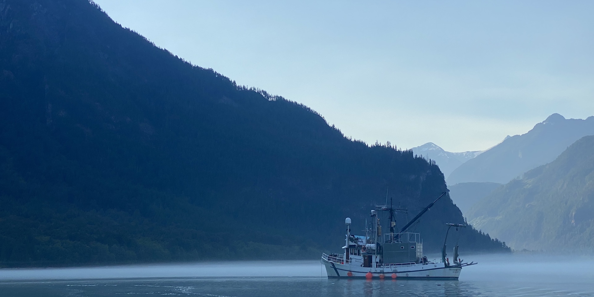
Research vessel in Bute Inlet, British Columbia, where scientists monitored naturally occurring submarine landslides during the 2022 field campaign. Credit: Rebecca Englert/MBARI
The first direct natural observations of fully submarine landslides came from an 18-day monitoring campaign at the Homathko Delta, at the head of Bute Inlet in British Columbia, Canada, in 2022. Englert et al. (2026) reported the findings in Science on November 12, 2026, documenting how sandy underwater slopes retreat progressively through a failure mechanism known as breaching.
The distinction matters because seabed structures can be exposed to prolonged slope movement and sediment flows rather than only a brief collapse. Before these observations, researchers had relied largely on laboratory experiments, computer models, evidence left by past failures and observations of landslides triggered by human activities such as dredging. The new measurements connect a naturally failing submarine slope directly with the currents it generates, providing evidence for assessing hazards to seabed cables, pipelines and offshore infrastructure.
The international team, led by Rebecca Englert of the Monterey Bay Aquarium Research Institute (MBARI) and Matthieu Cartigny of Durham University, detected around 30 landslides over the 18-day campaign. Approximately 30 small failures occurred during 11 days of activity, and three were captured in sufficient detail to follow their development.
Rather than failing all at once, the edges of the landslides gradually retreated upslope at 2–27 mm/s (0.08–1.06 inches/s). Individual monitored events lasted 38–100 minutes. The movement was not perfectly steady: slower retreat was sometimes interrupted by sudden collapses, showing greater variability than some previous models had suggested.
Breaching occurs when densely packed, water-saturated sand begins to loosen at a steep underwater slope. As sediment grains move apart, the pressure of the water between them decreases, creating suction that temporarily helps hold the sediment together. Water gradually enters the expanding spaces between the grains, the suction weakens, and sediment falls away from the slope. The steep failure face then retreats farther upslope, allowing the process to continue over minutes or hours.
This differs from liquefaction, in which increasing pore-water pressure reduces the effective contact forces between sediment grains and can cause rapid loss of strength. The researchers identified breaching as the principal failure mechanism in the monitored Homathko Delta landslides. The direct measurements establish that progressive breaching can occur naturally at a submarine delta front, rather than remaining a mechanism inferred mainly from controlled experiments or post-event evidence.
The Homathko River delivers large amounts of sediment and organic carbon during the summer snowmelt season. Where the river enters Bute Inlet, sediment accumulates on the submerged delta front. Offshore, the delta connects with a submarine channel system approximately 50 km (31 miles) long, providing a route through which remobilized material can travel away from the coast.
To observe the unstable delta front, the research team deployed two sonar systems beneath an anchored boat and recorded acoustic images once every second. The instruments used sound to monitor changes in the underwater slope and the sediment-filled water moving above it. Daily multibeam seabed surveys mapped changes in the delta’s shape, while a moored sensor positioned around 700 m (2 300 feet) downslope monitored suspended sediment.
Acoustic monitoring was important because sediment clouds can obscure direct optical observations. By repeatedly measuring the same submerged area, the team could track the retreating failure face while observing the downstream sediment flow. The combination of measurements helped distinguish gradual breaching from abrupt slope collapse and connected the development of the landslide with the resulting turbidity current.
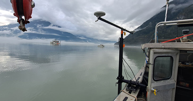
The most detailed observation occurred on September 7, 2022, when a submarine landslide began directly in front of the anchored research boat. Over approximately 40 minutes, sonar measurements recorded the steep sand face retreating and a sediment-laden current developing beneath the vessel. Researchers also heard a noise and observed sediment clouds and standing waves near the water surface.
Seabed mapping later that afternoon showed that the event removed approximately 2 600 m³ (91 800 ft³) of sediment and cut as far as 11 m (36 feet) back into the delta edge. These measurements allowed the researchers to connect the observed underwater movement with the amount of material removed from the slope.
Each monitored landslide generated a turbidity current, a downslope flow of water carrying suspended sediment. The resulting currents traveled at least 2 km (1.2 miles) through the submarine channel. At the downstream monitoring site, suspended sediment remained elevated for 12–14 hours. That duration describes the persistence of the sediment signal and should not be interpreted as proof that the entire current maintained the same velocity throughout that period.
The repeated failures collectively removed around 61 000 m³ (2.15 million ft³) of sediment from the delta front during the monitoring period. Durham University reported that this volume represented approximately 20% of the sand delivered by the river over the same period. The observations demonstrate how relatively small, repeated submarine failures can transfer a considerable fraction of newly supplied sediment into offshore channels.
The sediment movements are also relevant to the transfer of organic carbon and pollutants from coastal environments toward deeper water. Rivers carry these materials to delta fronts, where submarine landslides and turbidity currents can redistribute them offshore. The Homathko measurements establish a direct connection between the failure of the sediment source and the currents carrying material into the submarine channel system.
All of the recorded landslides occurred during high river flow and falling tides. The researchers identify these conditions as possible influences on failure initiation, but the campaign does not establish whether the same combination is necessary at other deltas. Changes in sediment accumulation, underwater slope geometry and water pressure may also affect when failures begin.
Understanding the distinction between breaching and sudden liquefaction has practical consequences for marine engineering. Prolonged slope retreat can expose nearby seabed structures to loading over a longer period, while the resulting turbidity currents may erode, bury or place additional forces on infrastructure located farther downslope. Newcastle University identified subsea cables, pipelines and offshore wind installations among the infrastructure types relevant to this hazard.
The findings do not demonstrate that the observed landslides damaged infrastructure, produced a tsunami or could have been predicted in advance. Instead, they provide field measurements that can be used to test models of submarine slope stability, sediment-flow generation and the forces that underwater failures may exert on seabed structures.

MBARI reports that the Homathko findings are relevant to other sandy deltas and submarine canyon heads where similar conditions may allow breaching to develop. Monterey Bay’s submarine canyon is one possible comparison, although the Canadian measurements alone cannot establish how frequently the mechanism operates elsewhere or whether failures at other locations develop at comparable rates.
The monitoring campaign also demonstrates how high-frequency acoustic measurements can fill gaps left by traditional before-and-after seabed surveys. A post-event survey can show where sediment was removed or deposited, but it generally cannot reveal the timing of successive slope failures or how each stage contributed to the formation of a turbidity current. Continuous sonar observations provide that missing temporal information.
The main limitation is the short duration and geographic concentration of the measurements. The detailed observations cover three naturally occurring landslides at one sandy delta, within a wider campaign that detected approximately 30 failures. Determining whether breaching dominates at other submarine slopes will require comparable direct observations under different sediment, tidal and river-flow conditions. Those measurements could also help establish which environmental changes precede failure and how prolonged submarine landslides influence the intensity and duration of the currents they generate.
References:
1 Englert, R. G., Cartigny, M. J. B., Baker, M. L., Acikalin, S., Mastbergen, D., Tracey, N., Ruffell, S. C., Shugar, D. H., Lintern, D. G., Aggarwal, R., Bailey, L., Bell, D., Clare, M. A., Hubbard, S. M., Lobato, G., Parsons, D., Simmons, S. M., Stacey, C., Talling, P., & Tilston, M. (2026). Direct monitoring of breaching in deltaic submarine landslides. Science, 394(6825), 758–762. DOI: 10.1126/science.aef8444
2 New research provides important insight into submarine landslides – Monterey Bay Aquarium Research Institute – November 12, 2026
3 Scientists capture underwater landslides as they happen – Durham University – November 13, 2026
4 Underwater landslides caught in the act reveal hidden risks to seabed infrastructure – Loughborough University – November 13, 2026
5 Direct observation of a submarine landslide reveals seafloor processes – Newcastle University – November 12, 2026

I’m a science journalist and researcher at The Watchers, contributing to the Epicenter edition, where I cover peer-reviewed scientific research and emerging discoveries across Earth and space sciences. With a background in astronomy and a passion for environmental science, I’ve worked in shark and coral conservation in Fiji, conducting reef and shark-behavior research, contributing to mangrove restoration, and earning PADI Open Water and Coral Reef Certifications. I bring a blend of scientific rigor and storytelling to illuminate the discoveries shaping our planet and beyond.
Published in the last 24 hours
- Odisha evacuated 983,642 people before Phailin crossed near Gopalpur on 12 October 2013 with winds of 200-210 km/h gusting to 220, and 44 died, against 9,885 in the 1999 super cyclone. Cyclone Akvan crossed the same coast on 20 November 2026. Epicenter
- Lava fountains reached 1,900 feet (580 m) at Kīlauea Iki in 1959, the highest ever recorded at Kīlauea, as USGS forecasts episode 57 fountaining at Halemaʻumaʻu for November 22-26. Epicenter
- Novarupta in Alaska erupted about 3 cubic miles of magma in roughly 60 hours from 6 June 1912, 30 times Mount St. Helens in 1980, and strong northwesterly winds lifted that same loose ash on 16 November 2026, prompting an NWS SIGMET. Epicenter
- A fog linked to about 12 000 excess deaths in London in 1952 puzzled scientists for decades, until researchers reconstructed how coal smoke formed acidic haze Epicenter
