
Novarupta in Alaska erupted about 3 cubic miles of magma in roughly 60 hours from 6 June 1912, 30 times Mount St. Helens in 1980, and strong northwesterly winds lifted that same loose ash on 16 November 2026, prompting an NWS SIGMET.
Strong northwesterly winds lifted ash deposited by the 1912 Novarupta-Katmai eruption back into the atmosphere over Alaska on November 16, 2026, producing a cloud to about 1.8 km (6 000 feet) above sea level and prompting an NWS SIGMET. No eruption was taking place: the episode was another example of a process documented for decades in which wind reworks old volcanic deposits into airborne ash capable of affecting aviation more than a century after eruptive activity ended.
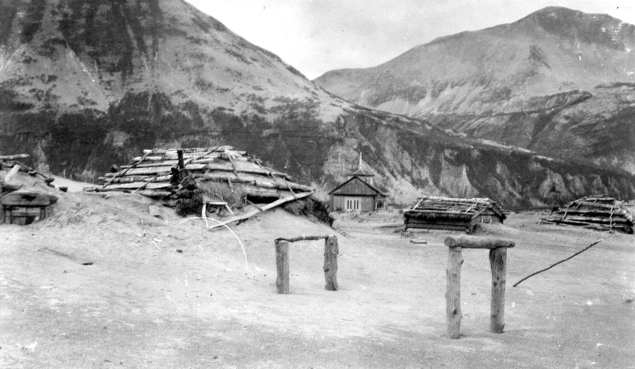
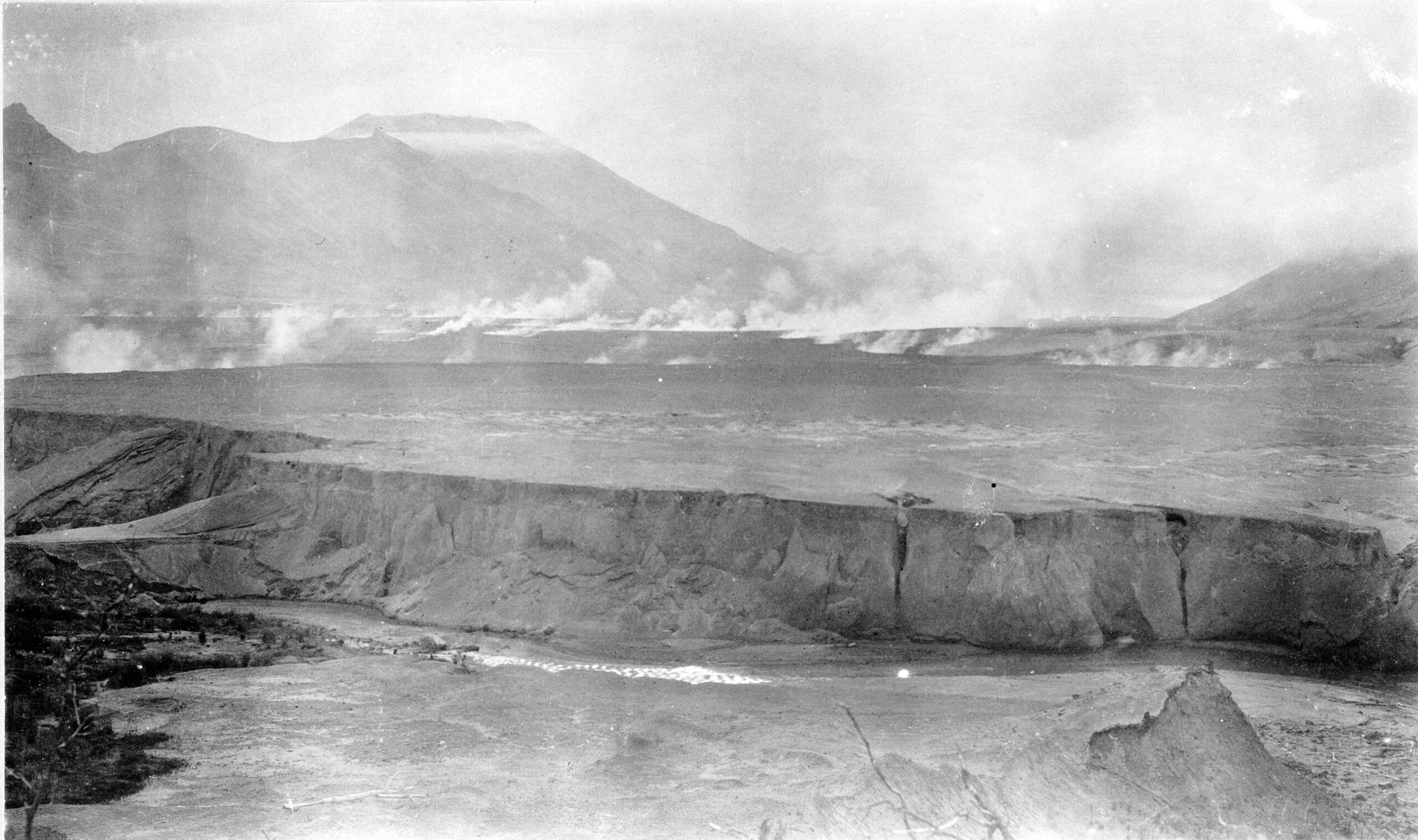
After novarupta eruption 1912. Credit: Library Web Team, USGS (public domain), via Wikimedia Commons.
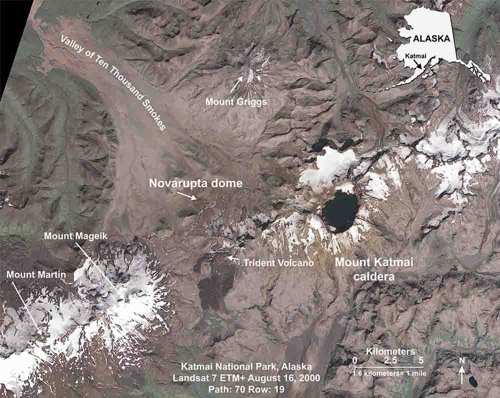
The Alaska Volcano Observatory (AVO) issued its Katmai notice at 10:48 AKST (19:48 UTC) on November 16. Strong northwesterly winds near Katmai and the Valley of Ten Thousand Smokes were picking up loose material from the 1912 deposits and carrying it southeast. The National Weather Service issued a SIGMET for the low-level ash, with the maximum cloud height estimated at about 1.8 km (6 000 feet) above sea level.
The significance extends beyond a single aviation notice. Katmai is a documented example of volcanic material remaining vulnerable to wind erosion more than a century after deposition. Field observations, satellite imagery and laboratory experiments show how exposed fine-grained deposits can become airborne again when the surface is sufficiently dry and near-surface winds exert enough stress to mobilize particles.
AVO explicitly classified the November 16 activity as resuspended volcanic ash rather than ash from a new eruption. The Volcano Observatory Notice for Aviation listed the activity status as “RE-SUSPENDED VA,” recorded no eruption onset or duration and stated that the material originated from ground level. Griggs, Katmai, Novarupta, Mageik, Martin, Snowy and Trident remained at Aviation Color Code GREEN and Alert Level NORMAL.
The November event was one of several Katmai ash-resuspension episodes recorded in 2026. AVO also issued notices for resuspended ash on November 14, August 31, August 29 and July 24. The repeated events show that the deposits remain available for transport whenever suitable surface and meteorological conditions develop.
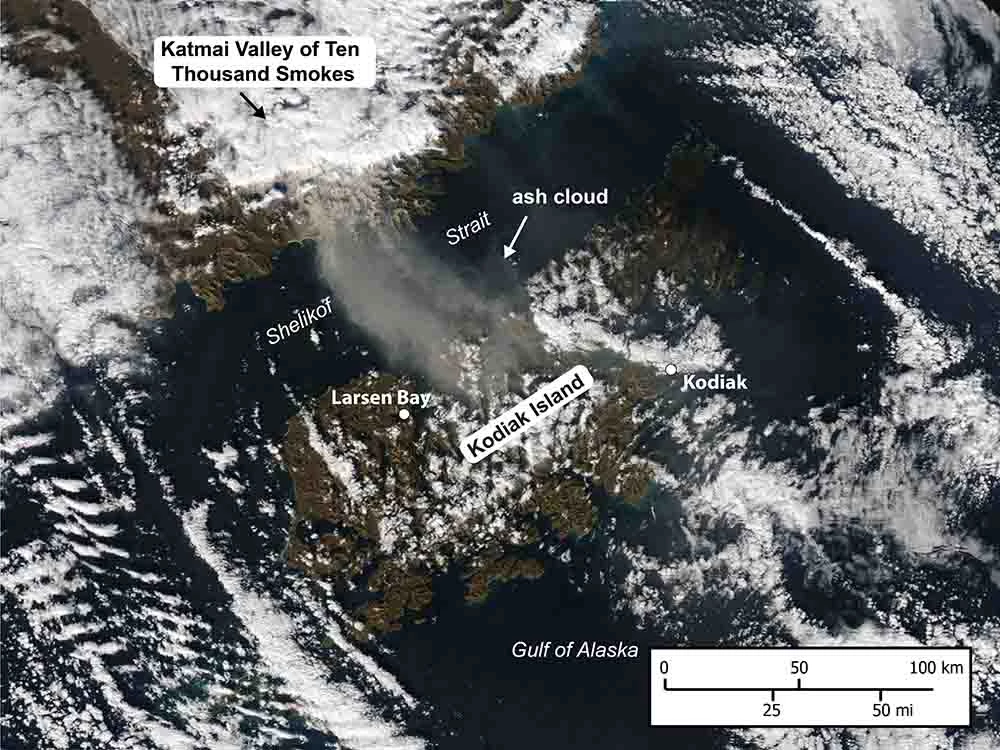
Satellite observations captured the November 16 episode directly. GOES-18 Dust RGB imagery showed ash moving offshore from the Katmai region across Shelikof Strait toward Kodiak Island from November 16 into November 17. Additional near-infrared and true-color imagery traced the material emerging from lower elevations in the Valley of Ten Thousand Smokes, while volcanic ash advisory polygons were issued as the cloud moved through the region.
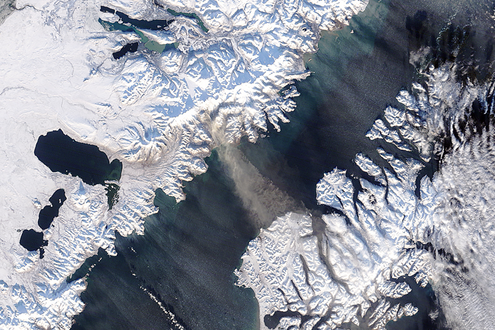
The same process has been studied in detail during earlier events. Hadley et al. (2004) examined a major resuspension episode on September 20–21, 2003, when strong northwesterly winds continuously lifted relic volcanic ash from the Katmai volcanic cluster and the Valley of Ten Thousand Smokes. The ash cloud reached more than 1.6 km (5 249 feet) above sea level and extended more than 230 km (143 miles) into the Gulf of Alaska.
The 2003 observations showed that wind speed was only part of the process. The atmosphere and land surface had been very dry before the event, leaving loose material more susceptible to entrainment. Complex terrain around the Katmai volcanoes altered airflow through mountains, valleys, channels and gaps, while the vertical structure of the atmosphere helped produce the turbulent winds responsible for lifting and transporting the ash.
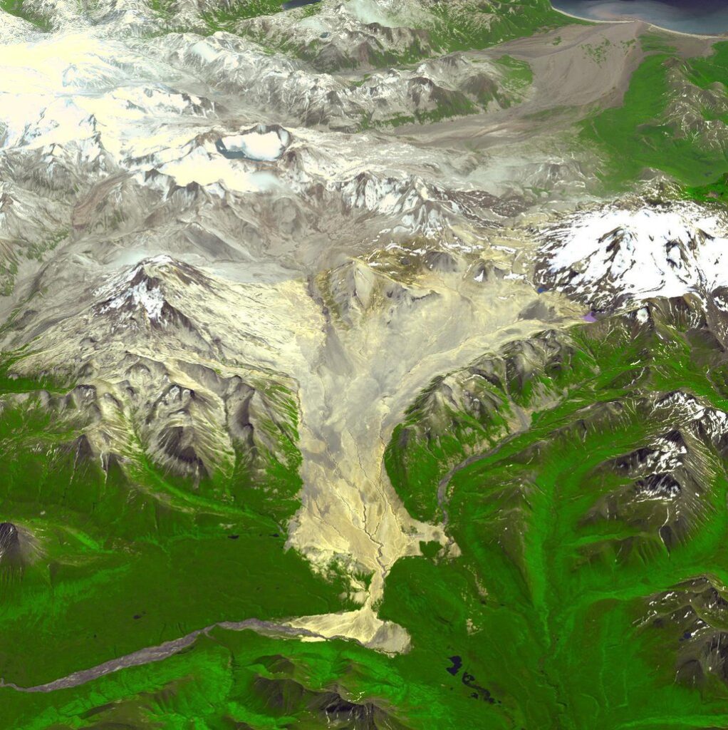
Hadley and colleagues also documented operational consequences during the 2003 event. The National Weather Service Alaska Aviation Weather Unit issued a SIGMET, pilots reported reduced visibility near Kodiak, trace ashfall was reported in the Kodiak area and a regional airline cancelled two flights into Brooks Camp until the episode had ended. Those impacts belong specifically to the 2003 event; comparable flight cancellations have not been verified for the November 2026 episode.
The physical process begins at the ground. Moving air creates turbulent stress across a surface, and particles start to move when that stress exceeds the forces keeping them in place. Researchers commonly describe this threshold using shear velocity, a quantity related to the aerodynamic stress acting close to the surface rather than the ordinary wind speed reported by a weather station.
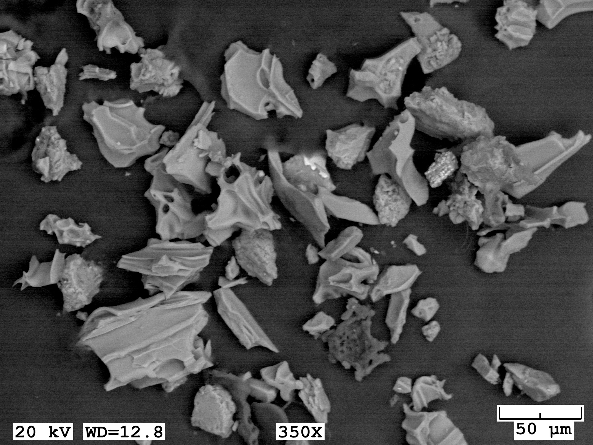
Etyemezian et al. (2019) tested the process experimentally using ash collected from the Valley of Ten Thousand Smokes and material from the 1980 Mount St. Helens eruption. Samples were prepared in a laboratory chamber and exposed to controlled wind stress under relative humidity ranging from 25% to 75%. Separate experiments simulated rainfall followed by drying.
At 50% relative humidity and shear velocities between approximately 0.4 and 0.8 m/s, PM10 emissions from the tested volcanic ash ranged from about 10 to more than 100 mg m−2 s−1. PM10 refers to airborne particles with aerodynamic diameters of 10 micrometres or less, a fine fraction capable of remaining suspended and being transported away from the source.
The laboratory measurements also showed how surface moisture changes the response. After samples from the Valley of Ten Thousand Smokes received water equivalent to 5 mm (0.20 inches) of rainfall, their emissions remained reduced for at least 12 days. The same treatment had less persistent influence on the Mount St. Helens material, demonstrating that wind erosion depends on the characteristics and condition of an individual deposit as well as atmospheric wind.
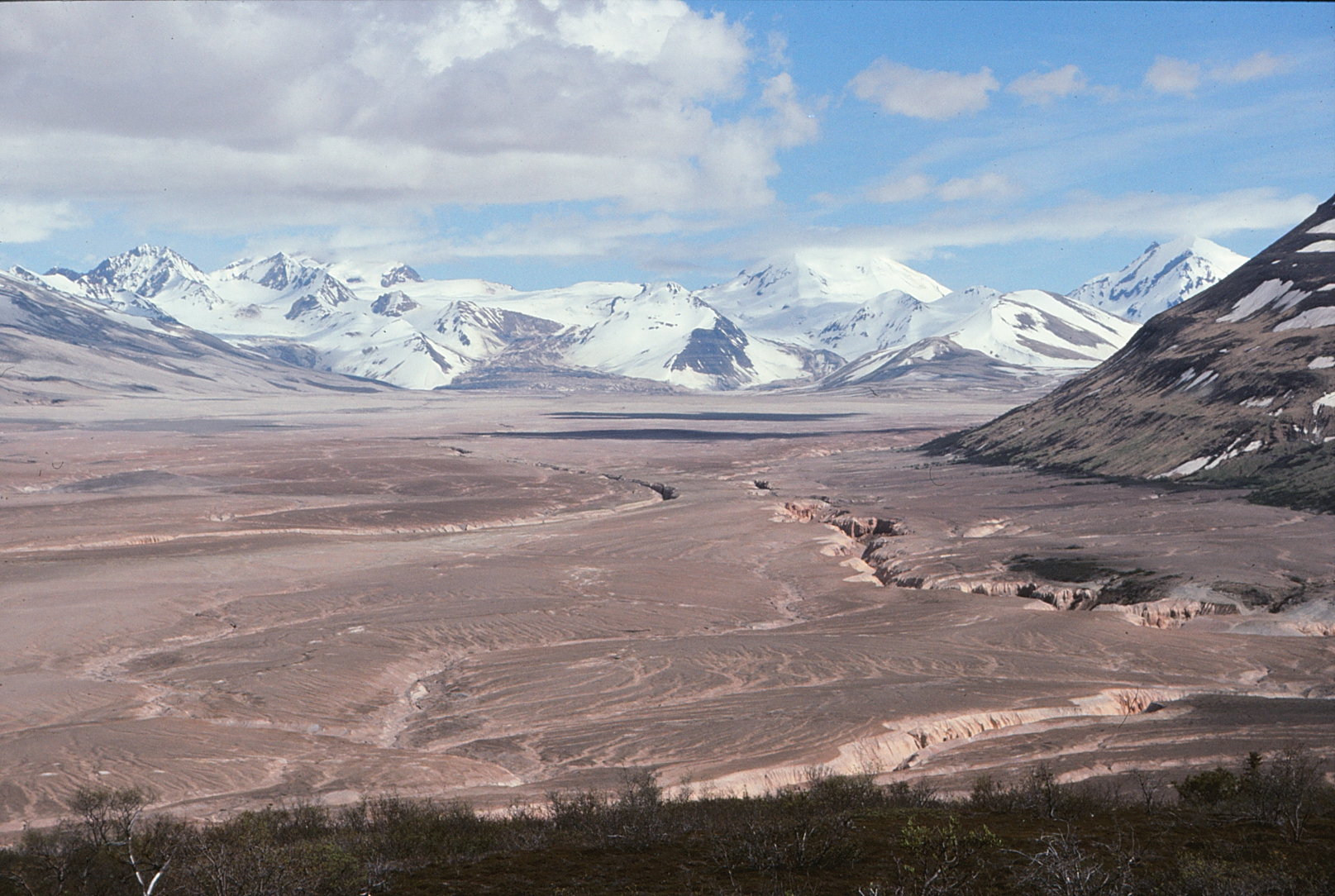
Etyemezian and colleagues found that particle emissions from volcanic ash under wind erosion can exceed those measured over most desert surfaces and approach some of the highest emissions documented in comparable experiments. Their work provides an experimental basis for understanding how an apparently inactive volcanic landscape can repeatedly become a source of airborne fine material.
The source at Katmai is unusually extensive. The 1912 eruption produced about 17 km3 (4.1 mi3) of ash deposits and about 11 km3 (2.6 mi3) of pyroclastic-flow material that filled nearby valleys and formed the landscape now known as the Valley of Ten Thousand Smokes. The deposits reach about 200 m (660 feet) thick in places, and much of the valley remains almost free of vegetation.
Those figures describe the volume of deposited material, not the magma-volume estimate for the eruption. Keeping the quantities separate is important because fallout, pyroclastic-flow deposits and dense-rock or magma-volume estimates represent different measurements of the eruptive sequence and cannot be substituted for one another.
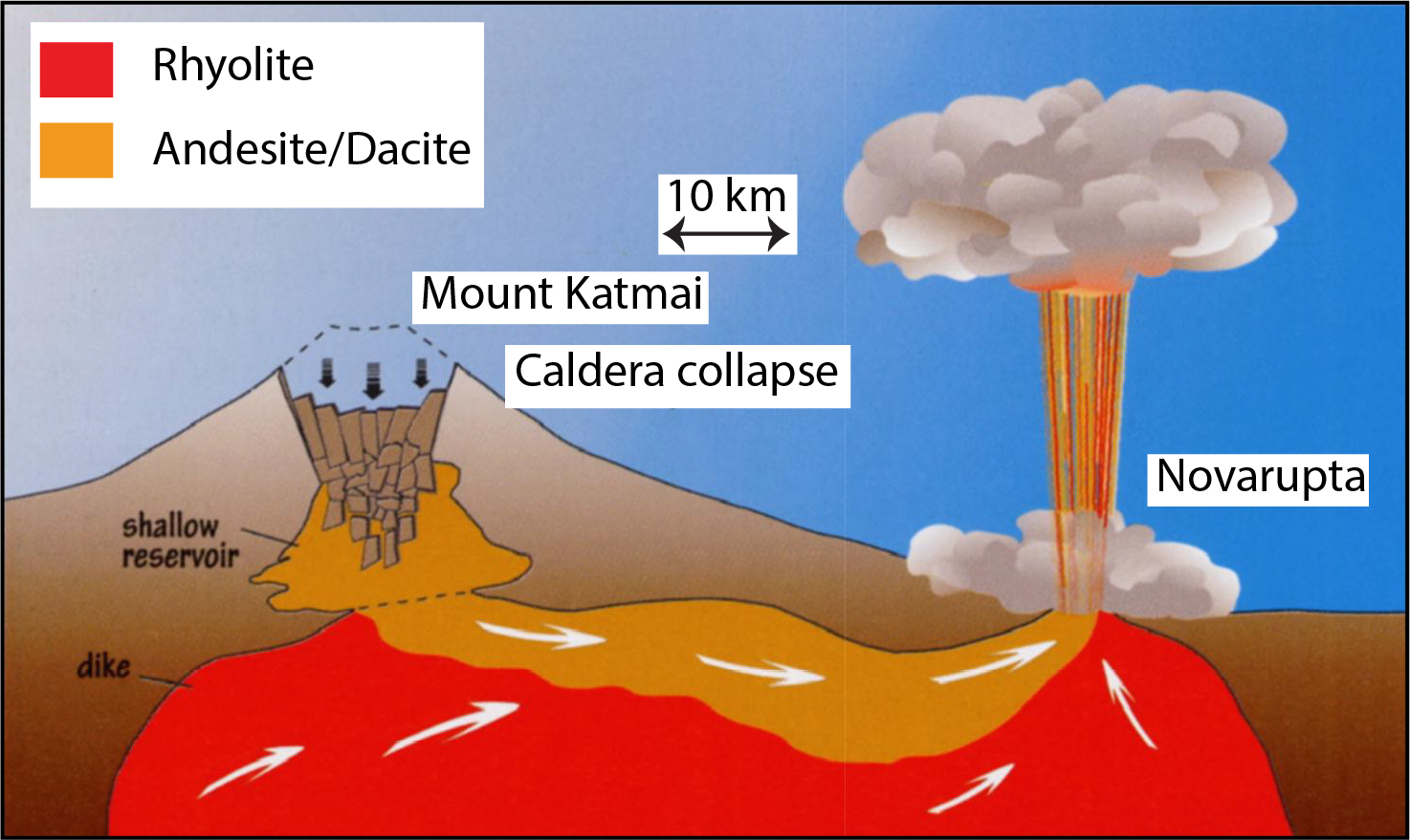
The lack of vegetation across much of the valley leaves large surfaces exposed to wind. Satellite observations over several decades have repeatedly captured ash leaving this source area, crossing Shelikof Strait and moving toward Kodiak Island or farther over the Gulf of Alaska. Earlier documented clouds have reached approximately 1–3 km (3 300–9 800 feet) above sea level and extended as far as about 250 km (155 miles) from the source region.
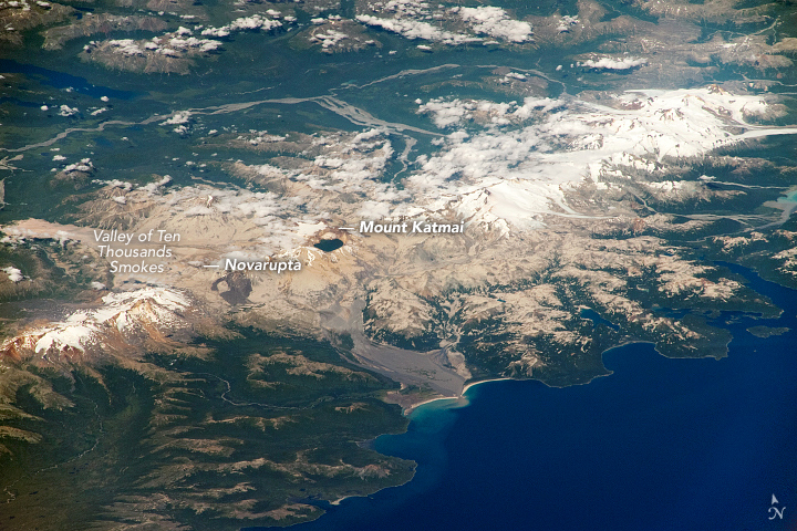
Resuspended ash differs fundamentally from an eruptive ash plume. During an eruption, fragmented volcanic material enters the atmosphere directly from an active vent or associated eruptive processes. During resuspension, wind entrains particles that were deposited earlier and remained exposed at the surface.
The different source mechanism does not remove the aviation hazard. Fine volcanic particles can reduce visibility and enter airspace used by aircraft even when no magma is reaching the surface. AVO therefore distinguishes wind-resuspended ash from active volcanic emissions while the National Weather Service issues the operational aviation products associated with the airborne hazard.
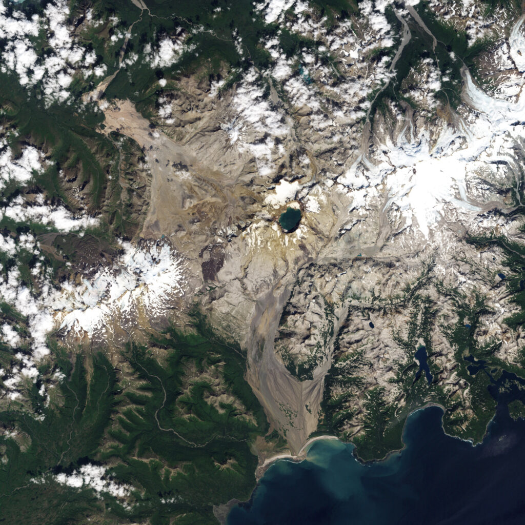
The November 16 notice illustrates that separation clearly. AVO reported no eruption, maintained GREEN/NORMAL status and identified the ash source as ground-level deposits, while the NWS SIGMET addressed the resulting airborne cloud. The presence of ash therefore did not represent an escalation in volcanic unrest.
Forecasting the amount of material that will enter the atmosphere during any individual event remains more difficult than identifying favorable conditions. Laboratory work constrains the surface stress needed for particle movement and shows how moisture alters emissions, while field studies demonstrate the influence of terrain, atmospheric stability and the changing condition of the deposits. Reliable plume forecasts must combine those controls with current meteorological observations and satellite monitoring rather than treating strong wind alone as a sufficient predictor.
More than a century after the 1912 eruption, Katmai therefore remains both a geological archive and an active source of secondary airborne volcanic material. The eruption is long over, but erosion of the deposits it created continues, allowing weather to reconnect a historic volcanic event with modern aviation whenever exposed ash, dry surfaces and sufficiently strong winds occur together.
References:
1 Resuspended ash observed from 1912 eruption. Aviation color code and alert level remain at GREEN/NORMAL – Alaska Volcano Observatory – November 16, 2026, 19:48 UTC
2 Hadley, D., Hufford, G. L., & Simpson, J. J. (2004). Resuspension of relic volcanic ash and dust from Katmai: Still an aviation hazard. Weather and Forecasting, 19(5), 829–840. DOI: 10.1175/1520-0434(2004)019<0829:RORVAA>2.0.CO;2
3 Etyemezian, V., Gillies, J. A., Mastin, L. G., Crawford, A., Hasson, R., Van Eaton, A. R., & Nikolich, G. (2019). Laboratory experiments of volcanic ash resuspension by wind. Journal of Geophysical Research: Atmospheres, 124(16), 9534–9560. DOI: 10.1029/2018JD030076

I’m a science journalist and researcher at The Watchers, contributing to the Epicenter edition, where I cover peer-reviewed scientific research and emerging discoveries across Earth and space sciences. With a background in astronomy and a passion for environmental science, I’ve worked in shark and coral conservation in Fiji, conducting reef and shark-behavior research, contributing to mangrove restoration, and earning PADI Open Water and Coral Reef Certifications. I bring a blend of scientific rigor and storytelling to illuminate the discoveries shaping our planet and beyond.
Published in the last 24 hours
- Lava fountains reached 1,900 feet (580 m) at Kīlauea Iki in 1959, the highest ever recorded at Kīlauea, as USGS forecasts episode 57 fountaining at Halemaʻumaʻu for November 22-26. Epicenter
- A fog linked to about 12 000 excess deaths in London in 1952 puzzled scientists for decades, until researchers reconstructed how coal smoke formed acidic haze Epicenter
- In 2012, cameras filming a thunderstorm in western China caught ball lightning by accident, and its 1.64-second glow carried iron, silicon, and calcium from the soil it rose out of Epicenter
- Strong El Niño reinforces above-normal winter precipitation outlook across southern and eastern U.S.
