
Odisha evacuated 983,642 people before Phailin crossed near Gopalpur on 12 October 2013 with winds of 200-210 km/h gusting to 220, and 44 died, against 9,885 in the 1999 super cyclone. Cyclone Akvan crossed the same coast on 20 November 2026.
A cyclone that struck Diviseema, Andhra Pradesh, on November 19, 1977 drove a tidal wave about 5 m (16 feet) above mean sea level across the Krishna River delta, pushing water up to 12 km (7.5 miles) inland and killing about 10 000 people, including 8 000 in Divi Taluka alone. Forty-nine years later, Cyclone Akvan crossed the north Andhra Pradesh–south Odisha coast near Gopalpur on November 20, 2026, bringing the disaster back into focus without approaching its documented human toll.
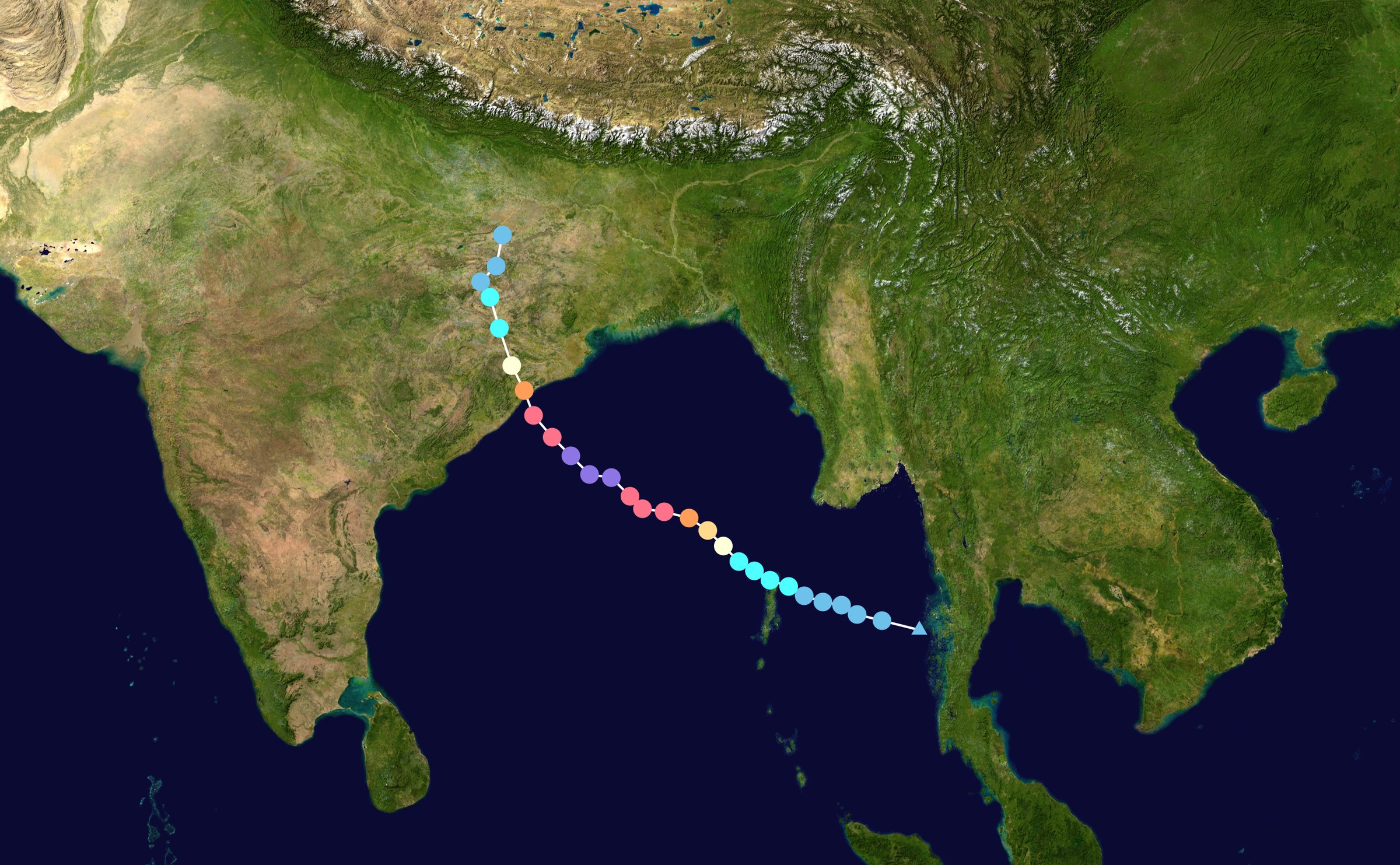
Phailin 2013 track. Credit: Supportstorm (public domain), via Wikimedia Commons.
The November 1977 cyclone developed over the Bay of Bengal before reaching the Andhra Pradesh coast at Diviseema on November 19. India Meteorological Department research later documented a tidal wave about 5 m (16 feet) above mean sea level affecting Divi, Eduramondi and Eletidibba islands at the Krishna River estuary and the mainland coast south of Machilipatnam.
The historical sources use the term “tidal wave,” but the water rise was generated by the cyclone rather than by an earthquake or other tsunami-producing process. Desai and Huparikar found that the astronomical tide contributed little to the observed water level and identified storm surge as the principal component of the extreme coastal inundation.
The water extended as far as 12 km (7.5 miles) inland across parts of Diviseema. That reach placed communities well beyond the immediate shoreline inside the inundation zone, turning the low-lying Krishna delta into the center of the cyclone’s deadliest effects.
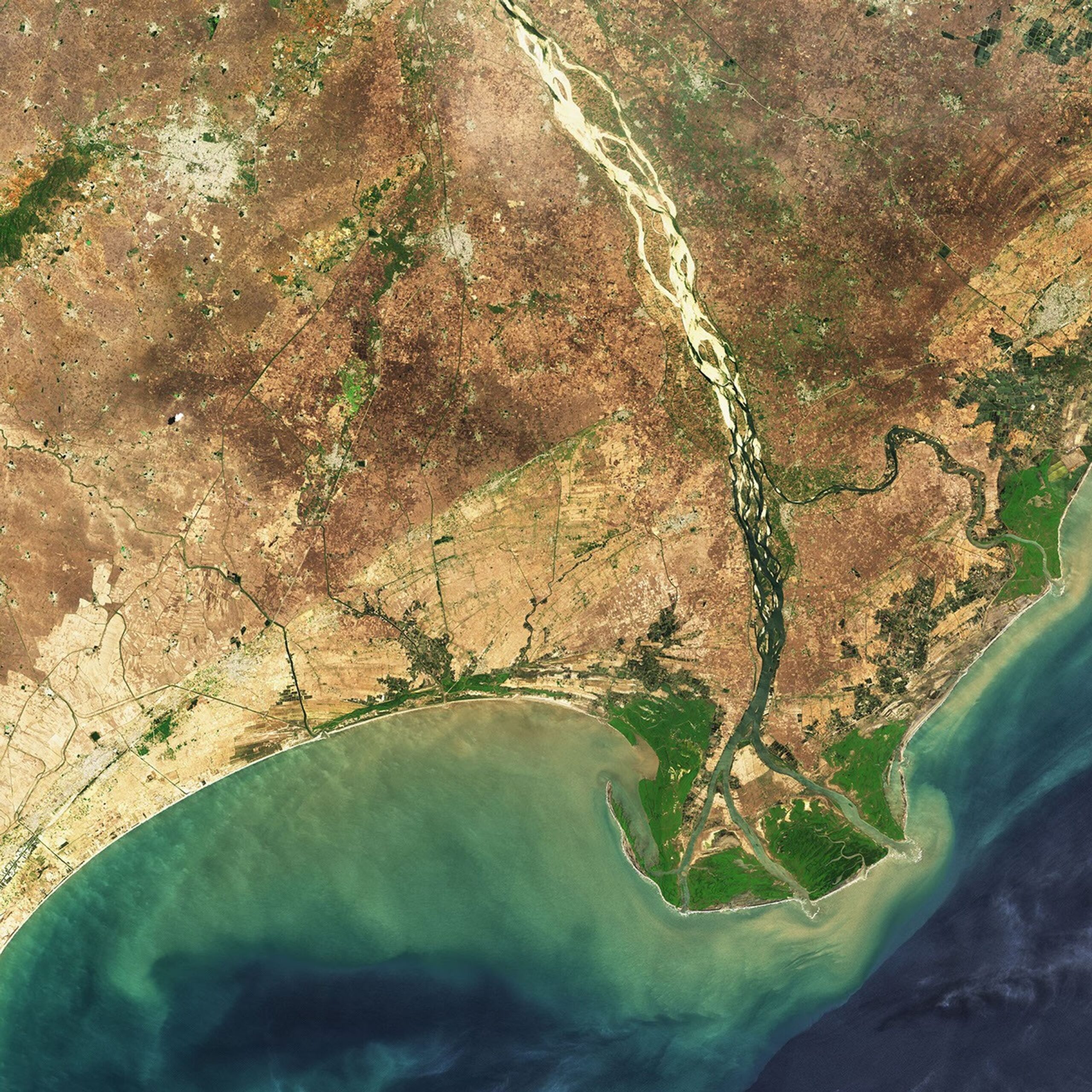
The delta image provides modern geographic context rather than a view of the 1977 disaster itself. The Krishna divides into multiple distributaries before reaching the Bay of Bengal, creating islands, floodplain and coastal lowlands around the estuary where the 1977 surge penetrated far inland.
Desai and Huparikar recorded about 10 000 deaths from the cyclone, with 8 000 in Divi Taluka alone. Their 2004 comparison of the 1977 cyclone with the October 1999 Odisha super cyclonic storm also recorded exceptionally heavy rainfall around the affected coast, including 480 mm (18.9 inches) at Repalle on November 20.
A separate Central Marine Fisheries Research Institute assessment documented the impact at village level. Seventeen villages with 58 hamlets in Divi Taluka and 14 villages with 33 hamlets in Bandar Taluka, situated as far as 15 km (9.3 miles) from the coast, were struck by the tidal wave. Nearly 80 000 people in Divi Taluka and 12 000 in Bandar Taluka were affected.
Fishing villages including Palakayatippa, Hamsaladivi, Nali and Sorlagondi in Divi Taluka, together with Cambelpeta, Malaikayalanka and Garaladibba in Bandar Taluka, were described by CMFRI as completely washed away. The institute recorded about 8 000 deaths in Krishna district and reported that approximately 300 000 houses were destroyed there.
CMFRI also documented damage to irrigation sources, flood banks, roads, buildings, drinking-water infrastructure, fishing vessels and fishing gear. An estimated 91 310 acres (36 952 ha) of agricultural land belonging to 33 850 farmers were affected in 78 villages of Bandar and Divi taluks, while 222 tanks and 406 wells were affected by the tidal wave.
Sorlagondi provides one of the clearest records of how the surge overwhelmed structures being used as shelters. About 400 people who entered school buildings for protection died when tidal water about 5 m (16 feet) high submerged the buildings. Thirty people occupying the sanctum sanctorum of a nearby Rama temple survived after the incoming water was deflected before entering that part of the structure.
At Nali, CMFRI reported that about 600 fishing-community residents survived after taking shelter in a temple and the village’s only brick house. At Cambelpeta, the report recorded no loss of life despite the village being washed away because residents had taken shelter in the Rama temple.
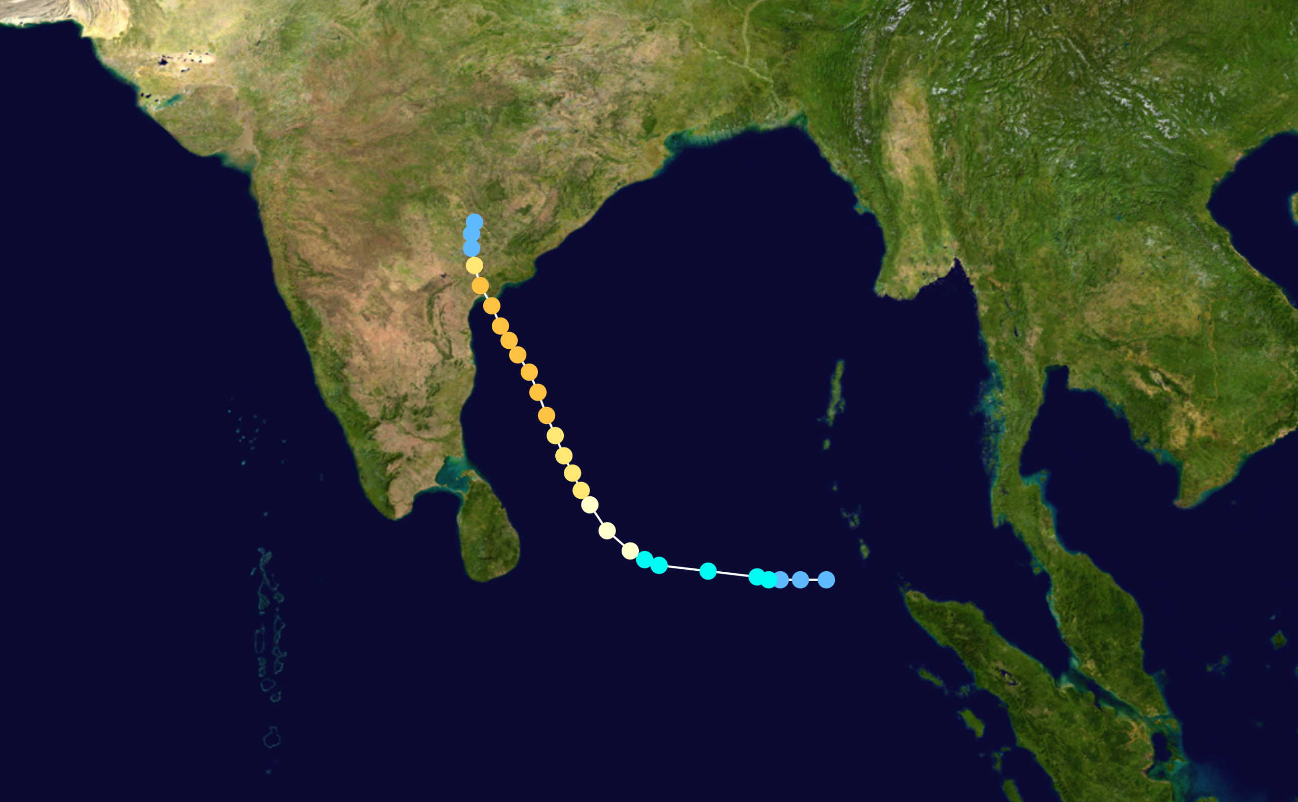
The cyclone approached Andhra Pradesh after moving northwestward across the Bay of Bengal. The track map above uses later IBTrACS data and provides geographic context for the storm’s movement; the scientific impact measurements in this article come from the Indian meteorological and fisheries records rather than from the map itself.
Heavy rain occurred alongside the coastal inundation. Desai and Huparikar recorded 480 mm (18.9 inches) at Repalle on November 20, 450 mm (17.7 inches) at Bapatla and Palnad, and 400 mm (15.7 inches) at Guntur. The rainfall and storm surge were separate components of the cyclone’s impact, with the approximately 5 m rise in coastal water producing the extreme inundation documented around Diviseema.
The two principal historical sources use somewhat different geographic frames for the human losses. Desai and Huparikar give about 10 000 deaths from the cyclone and specify that 8 000 occurred in Divi Taluka. CMFRI, writing from a fisheries and district-impact perspective, reported more than 9 000 deaths across Andhra Pradesh and about 8 000 deaths in Krishna district. Those figures are not interchangeable, so the statewide, district and taluka totals are kept distinct.
The historical classification also varies with the source and terminology in use. Desai and Huparikar treated the 1977 system as a super cyclonic storm in their later comparison with the 1999 Odisha cyclone. Other official historical records have used different cyclone classifications. The physical measurements of the inundation and its consequences are therefore more useful for understanding the event than applying a modern label retrospectively without qualification.
The 49th anniversary fell immediately before another Bay of Bengal cyclone reached India’s east coast. Cyclone Akvan weakened from a severe cyclonic storm to a cyclonic storm at 02:30 IST (21:00 UTC on November 19) before crossing the north Andhra Pradesh and south Odisha coasts close to Gopalpur during 07:30–08:30 IST (02:00–03:00 UTC) on November 20, 2026.
IMD placed Akvan’s coastal crossing near 19.1°N, 84.8°E and reported maximum sustained winds of 70–80 km/h (43–50 mph), gusting to 90 km/h (56 mph). The storm then moved over south coastal Odisha and adjoining north coastal Andhra Pradesh and continued to weaken.
Akvan’s landfall occurred one day after the 49th anniversary of the Diviseema cyclone, but much farther north than the center of the 1977 disaster. The temporal proximity gives the historical event a contemporary peg; it does not establish equivalence between the two storms in landfall location, inundation or human impact.
The 1977 disaster remains a documented example of how cyclone-driven water can penetrate deep into a populated delta. Its strongest measurements — about 5 m (16 feet) of surge, inundation reaching up to 12 km (7.5 miles) inland and 8 000 deaths in Divi Taluka — show why the physical geography of a cyclone landfall can matter as much as the storm’s atmospheric intensity.
References:
1 Desai, D. S., & Huparikar, M. G. (2004). Comparison of two super cyclonic storms over the Bay of Bengal (i) 14–20 November 1977, (ii) 25–31 October 1999. MAUSAM, 55(4), 713–720. DOI: 10.54302/mausam.v55i4.1444
2 Venkataraman, G., & Alagaraja, K. (1980). Cyclones and fisheries: Aftermath of four cyclones in Andhra Pradesh during 1976 to 1979. Marine Fisheries Information Service, Technical and Extension Series, 16, 1–11. Central Marine Fisheries Research Institute
3 Cyclonic Storm “Akvan” crossed north Andhra Pradesh & south Odisha coasts close to Gopalpur – India Meteorological Department – November 20, 2026

I’m a science journalist and researcher at The Watchers, contributing to the Epicenter edition, where I cover peer-reviewed scientific research and emerging discoveries across Earth and space sciences. With a background in astronomy and a passion for environmental science, I’ve worked in shark and coral conservation in Fiji, conducting reef and shark-behavior research, contributing to mangrove restoration, and earning PADI Open Water and Coral Reef Certifications. I bring a blend of scientific rigor and storytelling to illuminate the discoveries shaping our planet and beyond.
Published in the last 24 hours
- Lava fountains reached 1,900 feet (580 m) at Kīlauea Iki in 1959, the highest ever recorded at Kīlauea, as USGS forecasts episode 57 fountaining at Halemaʻumaʻu for November 22-26. Epicenter
- Novarupta in Alaska erupted about 3 cubic miles of magma in roughly 60 hours from 6 June 1912, 30 times Mount St. Helens in 1980, and strong northwesterly winds lifted that same loose ash on 16 November 2026, prompting an NWS SIGMET. Epicenter
- A fog linked to about 12 000 excess deaths in London in 1952 puzzled scientists for decades, until researchers reconstructed how coal smoke formed acidic haze Epicenter
- In 2012, cameras filming a thunderstorm in western China caught ball lightning by accident, and its 1.64-second glow carried iron, silicon, and calcium from the soil it rose out of Epicenter
