
Visitors ordered to evacuate Hatteras Island as coastal storm threatens N.C. Highway 12, U.S.
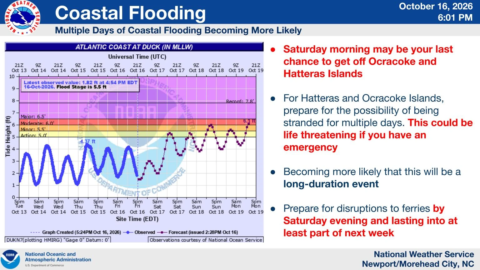
Dare County ordered all visitors to evacuate Hatteras Island beginning at 20:00 EDT on October 16 (00:00 UTC on October 17) after declaring a state of emergency ahead of a developing coastal nor’easter. A Coastal Flood Warning is valid from 17:00 EDT (21:00 UTC) on October 17 to 08:00 EDT (12:00 UTC) on October 20, with 0.6–1.2 m (2–4 feet) of inundation above ground level and 2.4–4.3 m (8–14 feet) breaking surf forecast in vulnerable areas.
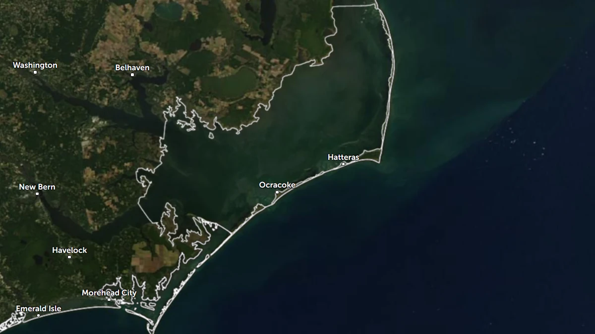
Satellite image of Hatteras Island on October 16, 2026. Credit: NASA/GSFC/EOSDIS, Aqua Modis, Zoom Earth
The state of emergency took effect at 18:00 EDT (22:00 UTC) on October 16, followed by the mandatory visitor evacuation two hours later. The order covers Rodanthe, Waves, Salvo, Avon, Buxton, Frisco, and Hatteras Village; no evacuation was issued for Hatteras Island residents or areas north of Oregon Inlet.
The National Weather Service (NWS) Newport/Morehead City upgraded Hatteras Island from a Coastal Flood Watch to a Coastal Flood Warning at 03:35 EDT (07:35 UTC) on October 17.
The warning forecasts flooding extending inland from the waterfront, with some homes and businesses threatened, numerous road closures and vehicle flooding possible, and vulnerable sections of N.C. Highway 12 subject to inundation around high tide.
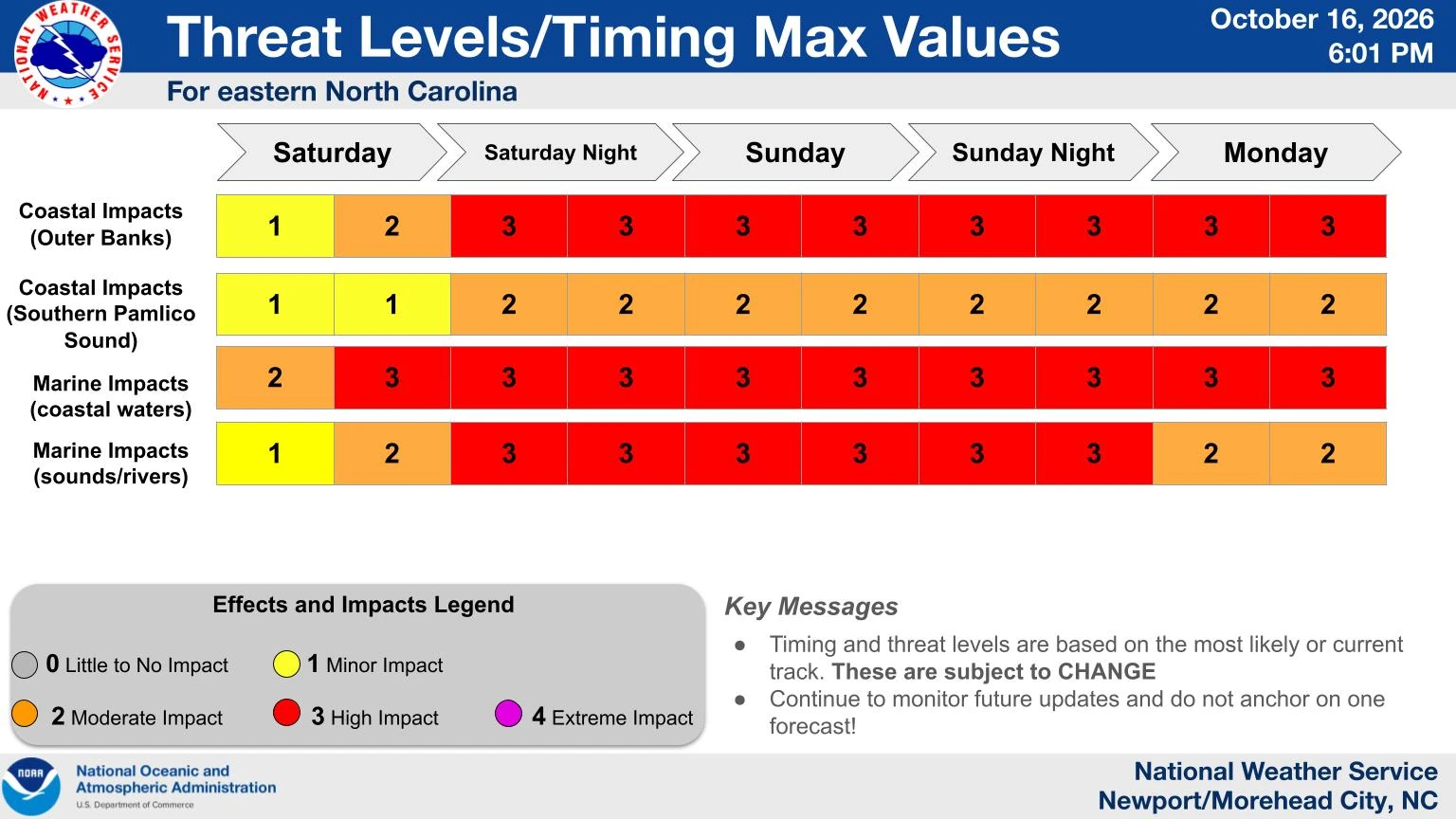
A High Surf Advisory is valid from 14:00 EDT (18:00 UTC) on October 17 to 08:00 EDT (12:00 UTC) on October 20. A Beach Hazards Statement covering dangerous rip currents, large breaking waves, and strong longshore currents is valid from 08:00–20:00 EDT on October 17 (12:00 UTC on October 17–00:00 UTC on October 18).
A Wind Advisory is valid from 12:00 EDT (16:00 UTC) on October 17 to 20:00 EDT on October 19 (00:00 UTC on October 20). North winds of 48–64 km/h (30–40 mph), with gusts up to 80 km/h (50 mph), are forecast across Hatteras Island, Ocracoke Island and the northern Outer Banks.
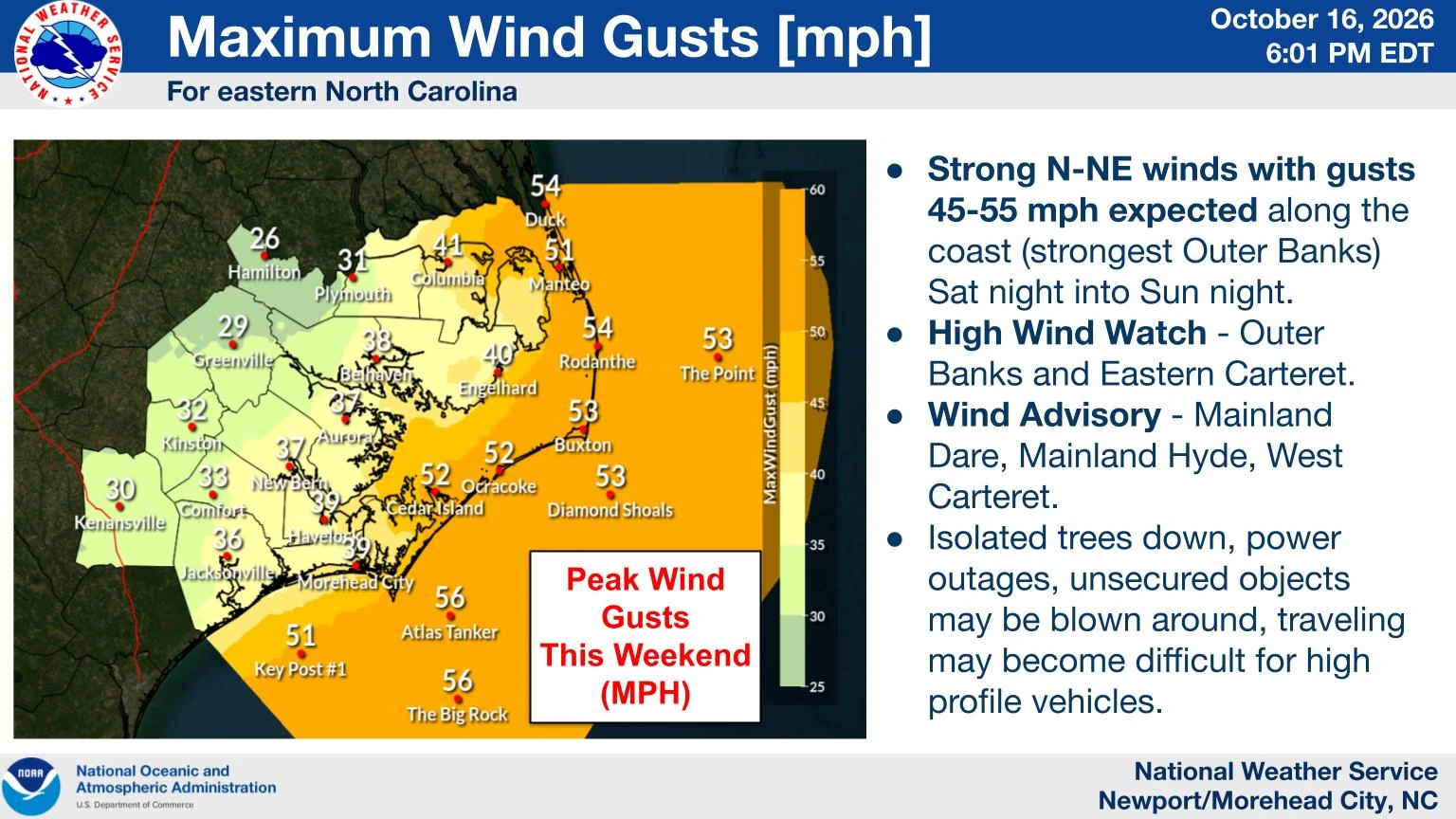
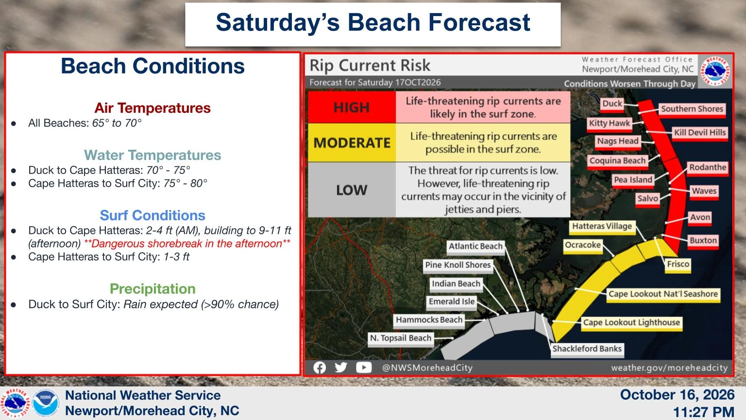
Dare County said prolonged coastal flooding and repeated ocean overwash were likely to close N.C. Highway 12 on Hatteras Island for an extended period, potentially cutting off road access to and from the island. The first period of greatest overwash potential was expected around the high tide at approximately 13:00 EDT (17:00 UTC) on October 17, with conditions expected to deteriorate as winds and seas build into October 18.
The North Carolina Department of Transportation (NCDOT) fortified protective dunes along N.C. Highway 12 on Pea, Hatteras and Ocracoke islands and worked to improve road drainage. Crews staged equipment in vulnerable areas, while ferry personnel prepared vessels, equipment, trailers and signs at the Rodanthe and Stumpy Point emergency ferry terminals in case the emergency route needs to be reactivated.
NCDOT said temporary closures of N.C. Highway 12 and other exposed coastal roads were possible as strong winds, waves and overwash developed.

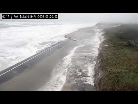
The preparations follow a late-September nor’easter that damaged about 300 m (1 000 feet) of N.C. Highway 12 on Pea Island and forced NCDOT to activate the Rodanthe–Stumpy Point emergency ferry route for the first time since 2013. NCDOT reopened the damaged section on September 29 using a temporary one-lane gravel road while longer-term repairs continued.
References:
1 Coastal Hazard Message – NWS Newport/Morehead City – October 17, 2026
2 Mandatory Evacuation Ordered for Hatteras Island Visitors Due to Anticipated Extended Closure of N.C. Highway 12 – Dare County – October 16, 2026

Rishav Kothari is Editor-in-Chief of The Watchers, where he runs the newsroom and covers earthquakes, volcanoes, severe weather and space weather.
