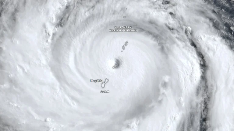
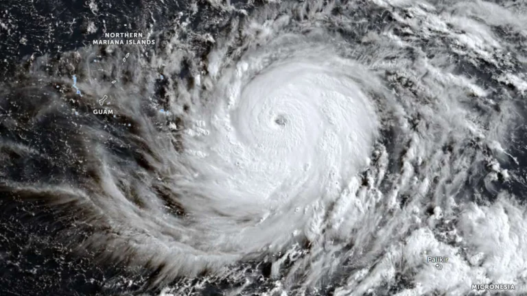
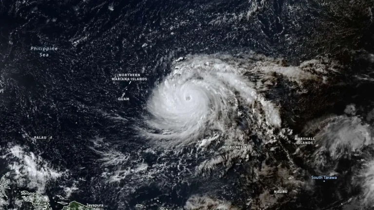
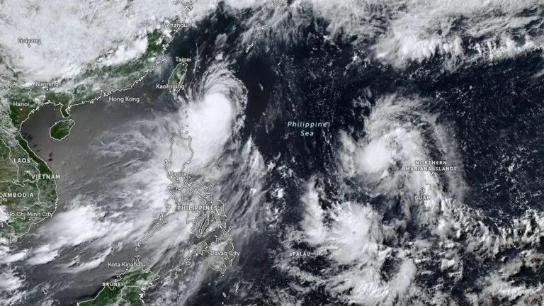
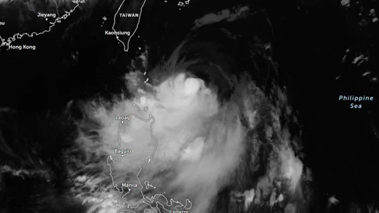
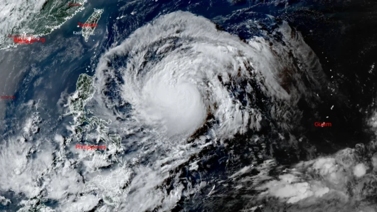
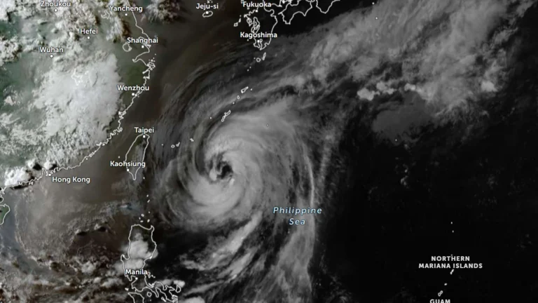
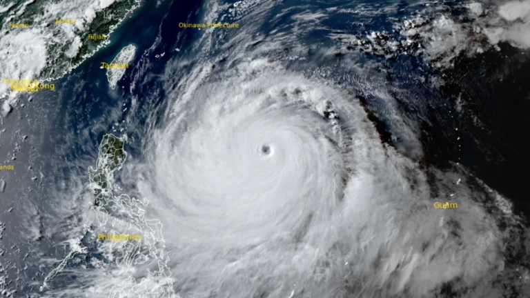
• Severe Tropical Storm Jangmi leaves 23 injured, 60 000 without power after landfall in Wakayama, Japan

    Severe Tropical Storm Jangmi made landfall over southern Wakayama Prefecture at 04:30 JST on June 3 (19:30 UTC on June 2), bringing heavy rainfall and strong winds that injured at least 23 people, damaged 57 homes, left more than 60 000 customers without power, and prompted evacuation orders affecting more than 400 000 residents. The storm also triggered the first Level 5 Special Flood Warning issued under Japan’s new five-level disaster alert system.

  • Tropical Storm Hagupit moves through Yap State, expected to enter PAR as Caloy

    Tropical Storm Hagupit was moving west through Yap State at 22:00 ChST (12:00 UTC) on May 8, 2026, with maximum sustained winds of 70 km/h (45 mph). Tropical Storm Warnings remained in effect for Ulithi, Ngulu, Fais, Yap Proper, and adjacent coastal waters. PAGASA expects the system to enter the Philippine Area of Responsibility on May 9 and be named Caloy.

  • Super Typhoon Sinlaku cripples power, roads and key infrastructure on Saipan and Tinian

    Super Typhoon Sinlaku struck the Northern Mariana Islands late on April 14, 2026, bringing sustained winds near 241 km/h (150 mph) at peak impact and unusually slow movement that kept destructive conditions over populated islands for hours. The islands of Saipan and Tinian sustained widespread infrastructure damage, prolonged utility outages, blocked roads, and flooding, with officials warning that full restoration in some hard-hit areas could take days to weeks.

  • Super Typhoon Sinlaku nears Saipan and Tinian with destructive winds, flooding and dangerous surf

    Super Typhoon Sinlaku approached Saipan and Tinian on April 14, 2026, with destructive typhoon-force winds, life-threatening coastal flooding and torrential rain expected through Wednesday. The National Weather Service said the storm’s center was just southeast of the islands Tuesday afternoon local time, with the eyewall nearing both islands and dangerous conditions already affecting parts of the Marianas.

  • Typhoon Sinlaku forecast to reach super typhoon strength before nearing the Marianas, Typhoon Warnings issued for Rota, Tinian and Saipan

    Typhoon Sinlaku intensified into a dangerous major typhoon over the western Pacific on April 12, 2026, as officials issued typhoon warnings for Rota, Tinian and Saipan, and a tropical storm warning for Guam. The storm was forecast to strengthen further on April 13, reaching super typhoon strength, before nearing the Marianas, where destructive winds, coastal inundation, and flash flooding are possible from late April 13 into April 14.

  • Tropical Storm Sinlaku strengthens, rapid intensification forecast as it tracks toward Guam

    Tropical Storm Sinlaku formed on April 9, 2026, in the western Pacific and strengthened to 102 km/h (63 mph) by 15:00 UTC on April 10, approximately 904 km (562 miles) southeast of Andersen Air Force Base, Guam. The system is becoming more organized and is forecast to undergo rapid intensification while tracking toward the Mariana Islands, with a potentially dangerous passage near or over Guam.

  • Tropical Storm Penha leaves 8 dead and 645 612 affected after crossing southern-central Philippines

    Tropical Depression Penha crossed southern-central Philippines from February 5–7, 2026, leaving at least eight people dead and 645 612 affected across six regions, according to the National Disaster Risk Reduction and Management Council (NDRRMC) as of February 10. More than 86 000 people were displaced, including nearly 60 000 staying in 438 evacuation centres, while enhanced rainfall from a shear line continues to affect central and southern parts of the country.

  • Tropical Storm Penha (Basyang) expected to make multiple landfalls over Mindanao and Visayas, Philippines

    Tropical Storm Basyang is forecast to make multiple landfalls across the southern and central Philippines, beginning with Surigao del Sur late February 5 or early February 6, 2026. The system is forecast to cross Mindanao and may pass close to or make landfall over Siquijor and southern Negros Oriental before moving toward Palawan.