
Typhoon Dolphin reintensifies to Category 4 strength, landfall forecast in Okinawa by August 7
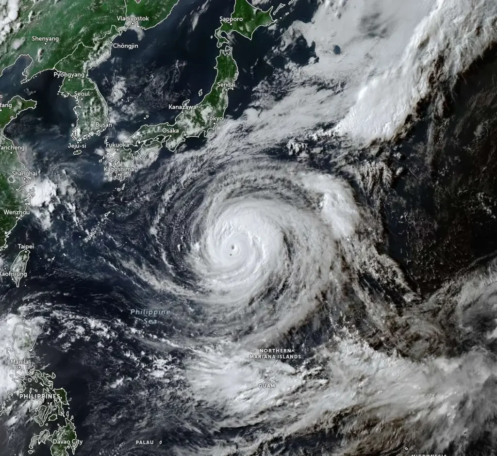
Typhoon Dolphin reintensified into a Category 4 equivalent typhoon northeast of Iwo To in Ogasawara, Japan, on August 4, 2026, after completing its fourth eyewall replacement cycle. The system is moving westwards and is forecast to cross the Ryukyu Islands, Japan, and make landfall on Okinawa by August 7.

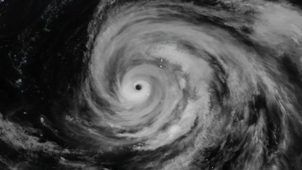
Satellite image of Typhoon Dolphin at 07:20 UTC on August 4, 2026. Credit: JMA/Himawari-9, Zoom Earth, The Watchers
Former Super Typhoon Dolphin reintensified to Category 4 strength with winds reaching 215 km/h (130 mph) northeast of Iwo To on August 4, after completing its fourth eyewall replacement cycle.
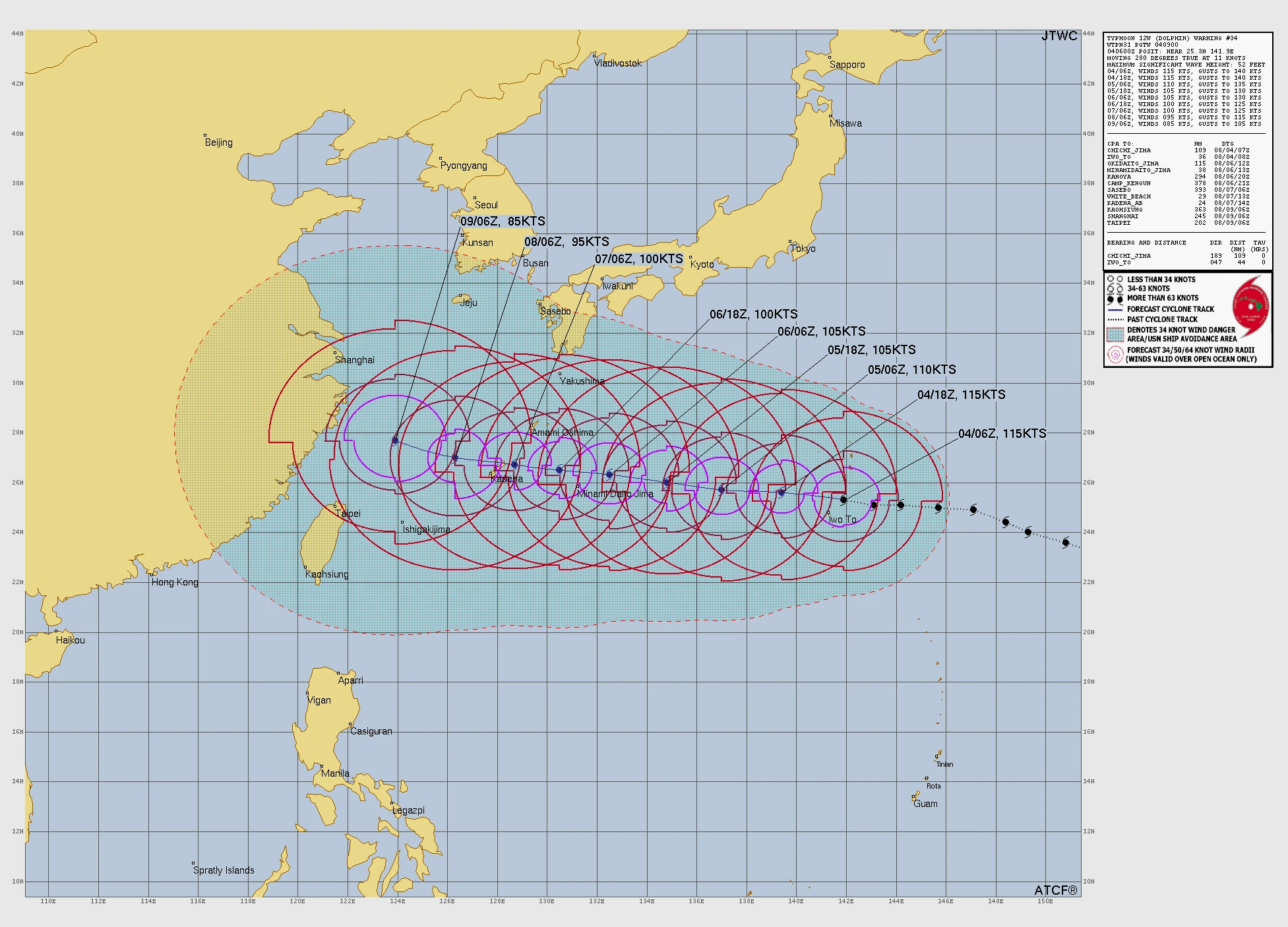
Dolphin’s center was located approximately 81 km (51 miles) northeast of Iwo To, at 18:00 JST (09:00 UTC) on August 4. 10-minute maximum sustained winds were registered at 215 km/h (130 mph). The system was moving west at 20 km/h (13 mph), with 3-second gusts reaching approximately 260 km/h (160 mph) and significant wave heights of 16 m (52 feet).
Hurricane-force winds extended as far as 148 km (92 miles) northeast of the center, while gale-force winds reached approximately 398 km (247 miles) into the northeastern quadrant and 370 km (230 miles) into the northwestern quadrant.
Dolphin is forecast to briefly intensify to approximately 220 km/h (140 mph) within several hours before beginning slow, stepwise weakening.
Winds are forecast to remain near 215 km/h (130 mph) at 12 hours, lowered to approximately 205 km/h (125 mph) at 24 hours, with winds of approximately 185 km/h (115 mph) at 15:00 JST (06:00 UTC) on August 7. Landfall on Okinawa is forecast shortly after that time.
Dolphin’s renewed strengthening followed completion of its fourth eyewall replacement cycle. Microwave observations between 22:00 UTC on August 3 and 04:13 UTC on August 4 showed an outer convective ring about 185 km (115 miles) from the center fragmenting and weakening while the inner eyewall consolidated and became fully enclosed. Multispectral satellite imagery showed a cloud-free eye approximately 28 km (17 miles) wide passing directly over North Iwo To.
JTWC reported that the eye was showing signs of enlarging and that satellite imagery suggested a larger eyewall was beginning to form. The agency expected the forecast fifth intensity peak to be short-lived as the inner core expanded and the cyclone’s broad circulation increased oceanic upwelling along its path.
Environmental conditions remained favorable, with sea-surface temperatures of 29–30°C (84–86°F), strong radial outflow and deep-layer wind shear of approximately 9–19 km/h (5–10 mph). Shallow ocean heat content, oceanic upwelling, and stronger northwesterly shear in the upper troposphere are among the factors expected to limit sustained strengthening.
Track guidance remained tightly grouped through 60–72 hours, supporting high confidence in the near-term westward forecast.
The ECMWF and UK Met Office models, major ensemble means and available artificial-intelligence trackers carried Dolphin westward into the East China Sea while gradually slowing.
The GFS, NAVGEM and JGSM models developed a competing scenario in which the cyclone slowed near Okinawa and turned north toward the area between Amami Oshima and Yakushima. JTWC maintains the westward track, assigning medium track confidence after 72 hours and low extended-range intensity confidence.
Typhoon Dolphin was named by the Japan Meteorological Administration (JMA) on July 27 and began rapidly intensifying, reaching Category 4 equivalent strength on July 28. It then underwent its first eyewall replacement cycle.
It began intensifying soon after reaching Category 5 equivalent status on July 30, before weakening slightly and beginning a second eyewall replacement cycle. It then re-intensified to Category 5 strength before entering unfavorable conditions and weakening by August 1.
References:
1 Prognostic reasoning for Typhoon Dolphin Warning Nr 34 – JTWC – August 4, 2026

Rishav Kothari is Editor-in-Chief of The Watchers, where he runs the newsroom and covers earthquakes, volcanoes, severe weather and space weather.
Published in the last 24 hours
- Bay of Bengal system to become Cyclone Akvan, landfall forecast between Nellore and Tuni on November 20, India
- Tropical Cyclone Xavier reaches Category 2 over Northern Cook Islands, gale warning for Manihiki and Rakahanga
- El Niño floods kill 2 in Guayaquil as 172.8 mm of rain swamps Milagro, Ecuador's toll rises to 14
- Southern Thailand braces for heavy rain, 15 provinces on flood and landslide alert for November 18-22
