
Tropical Storm Kiko forms in the eastern Pacific, forecast to reach hurricane strength on September 2
Tropical Storm Kiko formed over the eastern Pacific Ocean at 09:00 MDT (15:00 UTC) on August 31, 2025. The system is currently tracking westward over open waters, well removed from land, with environmental conditions expected to favor strengthening into a hurricane by Tuesday, September 2.
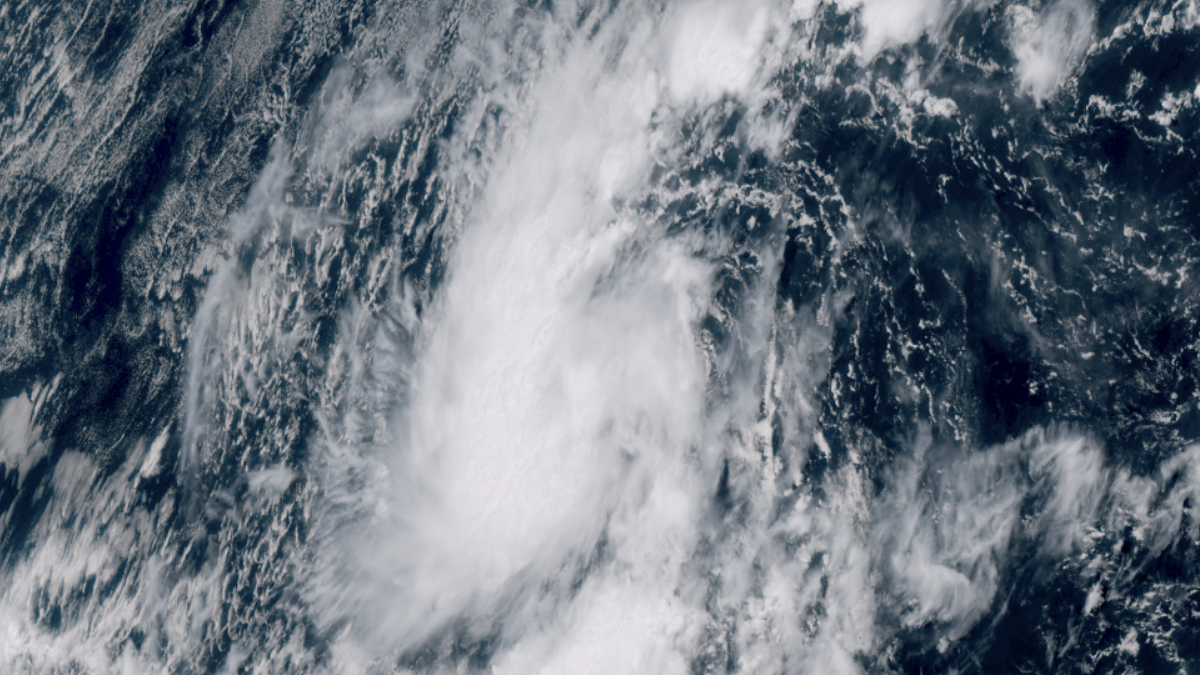
Satellite image of Tropical Storm Kiko as of 20:00 UTC on August 31, 2025. Credit: GOES-19, RAMMB CIRA, The Watchers
Tropical Storm Kiko formed in the Pacific Ocean at 15:00 UTC on August 31 as the 13th named storm of the 2025 Pacific hurricane season.
At the time, the storm was located about 1 090 miles (1 760 km) west-southwest of the southern tip of Baja California.
As of 09:00 UTC on September 1, Kiko was centered approximately 1 910 km (1 185 miles) west-southwest of the southern tip of Baja California. It had maximum sustained winds of 75 km/h (45 mph), with tropical-storm-force winds extending outward up to 75 km (45 miles) from the center.
The estimated minimum central pressure was 1 004 hPa. Kiko was moving west at 13 km/h (8 mph), embedded within the low-latitude trade-wind flow.
Kiko is a compact tropical cyclone and is expected to remain relatively small in size. The storm is forecast to continue moving westward over the next four to five days, steered by a strong subtropical ridge located to its north.
It is forecast to strengthen over the next couple of days and become a hurricane by September 2.
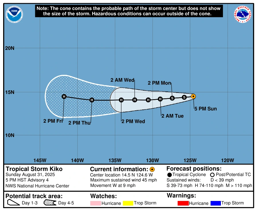
On its current trajectory, Kiko is expected to enter the central Pacific basin by September 4 or 5. At that point, forecasting responsibility will shift from the NHC to the Central Pacific Hurricane Center (CPHC) in Honolulu, Hawaii.

Rishav Kothari is Editor-in-Chief of The Watchers, where he runs the newsroom and covers earthquakes, volcanoes, severe weather and space weather.
