
Predecessor rain event (PRE) from Hurricane Priscilla to bring multi-day rainfall to the Southwestern U.S.
A predecessor rain event (PRE) associated with Hurricane Priscilla is forecast to produce sustained rainfall across the Southwestern United States, particularly Arizona and New Mexico, between October 9 and 11, 2025.
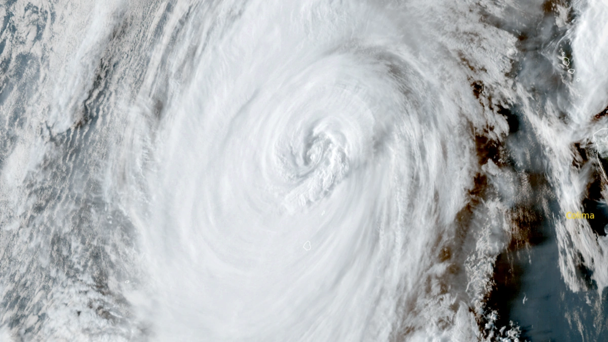
Satellite image of Hurricane Priscilla at 00:00 UTC on October 8, 2025. Credit: NOAA GOES-19, RAMMB/CIRA, The Watchers
A predecessor rain event (PRE) associated with Hurricane Priscilla is forecast to bring sustained rainfall to the southwestern United States between Thursday, October 9, and Saturday, October 11.
PRE refers to a period of heavy rainfall that develops well ahead of a tropical cyclone, often hundreds or even more than a thousand kilometers from the storm’s center. Predecessor rain events occur when tropical moisture from the cyclone interacts with existing mid-latitude weather systems, such as a frontal boundary or an upper-level trough.
In this setup, warm, moisture-laden air from the tropics is drawn northward and lifted by the jet stream or a low-pressure system already present over the region. The result is a band of sustained, sometimes intense rainfall, which can persist for one to two days before the main storm’s arrival.
Although the tropical cyclone itself may remain far offshore or take a different track, the PRE can still lead to significant hydrological impacts. Prolonged precipitation can saturate soils, elevate river levels, and increase the risk of flash flooding, particularly in mountainous or urban areas.
According to the Center of Western Weather and Water Extremes (CW3E), inland moisture transport shows integrated water vapor (IWV) > 44 mm, with ascent enhanced beneath an equatorward jet-entrance region. This configuration is expected to maintain widespread precipitation.
A deep upper-level trough and cutoff low will move ashore over Northern California and the Pacific Northwest early Friday, October 10, producing 25–50 mm (1–2 inches) of rain, locally higher over elevated terrain, and some high-elevation snowfall.

“Some influx of moisture is forecast to continue across portions of Arizona and New Mexico today with a weak front at the surface,” NWS forecaster Tate noted.
This will lead to scattered showers and thunderstorms for these areas, and a Marginal Risk (level 1/4) is in place for isolated flash flooding potential today, with burn scars at particular risk. “Into Thursday, moisture from what is currently Hurricane Priscilla is forecast to continue streaming northward and produce locally heavy rain across the Desert Southwest into the Four Corners region, with isolated instances of flash flooding.
“This will only be the start, as heavy rain and flash flooding potential from Priscilla’s moisture should continue across the Southwest late week into the weekend,” Tate said.
The CW3E West-WRF AR-Scale ensemble indicates AR2-strength conditions over central Arizona, with about 50 % of ensemble members reaching AR3 or greater inland.
CW3E model output shows integrated-vapor-transport (IVT) > 500 kg m-1s-1 persisting through Monday, October 13, sustaining precipitation across the Interior West.
According to the U.S. Weather Prediction Center (WPC), five-day totals between October 7 and October exceed 75 mm (3 inches) over central Arizona and southwestern Colorado, with 25–75 mm (1–3 inches) elsewhere in the Colorado River Basin.

WPC Excessive Rainfall Outlooks (EROs) identify a marginal risk (≥ 5 %) each day from October 9 to 12, and a slight risk (≥ 15 %) centered on the Four Corners for October 11–12.
CW3E, citing data from the NWS Colorado River Basin River Forecast Center (CBRFC), reports projected streamflow rises of 0.6–1.2 m (2–4 feet) at multiple sites, including the Gila River (central Arizona) and San Juan River (northern New Mexico). These numbers summarize CBRFC hydrologic model forecasts compiled by CW3E.

Forecast uncertainty remains in the exact timing and trajectory of the upper-level trough, which could shift the distribution of maximum rainfall. CW3E West-WRF ensemble meteograms show a broad member spread in accumulated precipitation.
References:
1 Quick Look at Precipitation from PRE Associated with Priscilla and Upper-Level Trough – CW3E – October 7, 2025
2 Short Range Forecast Discussion – NWS/WPC – October 8, 2025

I am an Assistant Editor and Severe Weather & Science Journalist at The Watchers, specializing in real-time severe weather coverage, geophysical event reporting, and research-driven scientific analysis. You can reach me at rishav(at)watchers(.)news.
Commenting rules and guidelines
We value the thoughts and opinions of our readers and welcome healthy discussions on our website. In order to maintain a respectful and positive community, we ask that all commenters follow these rules.