Support global hazard monitoring — Join 113 supporters
Go ad-free
0% 25% 50% 75% 100%
|

Hurricane Sandy timelapse videos – GOES 13 satellite view
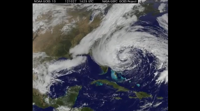
hurricane-sandy-timelapse-videos-goes-13-satellite-view

Image credit: TW

A complete timelapse animation of Hurricane Sandy from October 23-31, as seen by GOES-13 (a geosynchronous satellite that is in orbit nearly 36,000 km (23,000 miles) above Earth).

Another timelapse animation from GOES-EAST (GOES-13) shows the full disk and the development of Hurricane Sandy as it begins over Central America on October 18 and begins its path up through the Caribbean and the east coast of the U.S. and ends on October 28.

Share:

Commenting rules and guidelines

We value the thoughts and opinions of our readers and welcome healthy discussions on our website. In order to maintain a respectful and positive community, we ask that all commenters follow these rules.

Leave a reply

Your email address will not be published. Required fields are marked *