
Tropical Storm Ivo forecast to bring heavy rains across Mexico
Tropical Storm Ivo formed on August 6, 2025, off the Pacific coast of Mexico, bringing the threat of flash flooding to the Mexican states of Guerrero, Michoacán, and Colima. While the system is not expected to make landfall, it could strengthen into a hurricane later in the week.
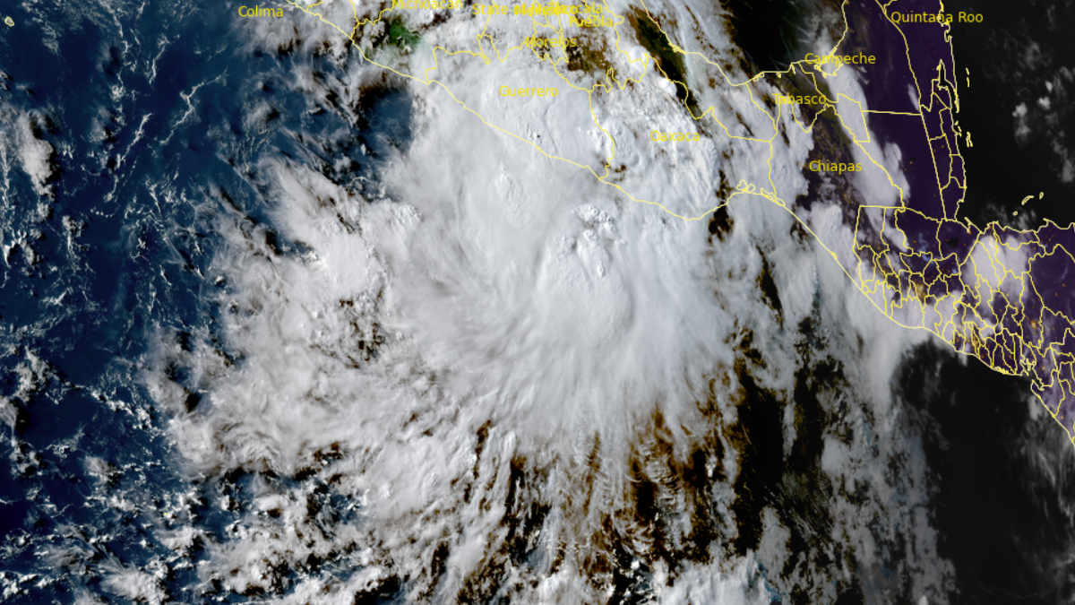
Satellite image of Tropical Storm Ivo acquired at 00:10 UTC on August 7, 2025. Credit: Goes-18, RAMMB/CIRA, The Watchers.
Tropical Storm Ivo formed south of Mexico on August 6 and is forecast to bring heavy rainfall across parts of Mexico as it passes near the country’s coast.
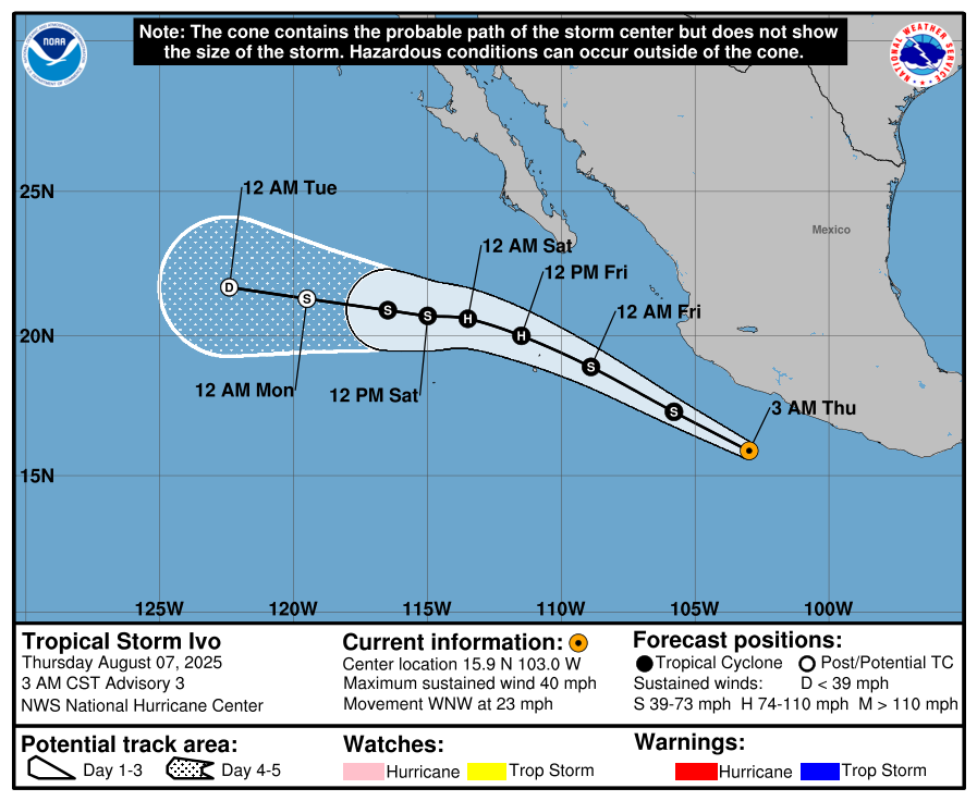
As of 03:00 CST (09:00 UTC) on August 7, Ivo was located 346 km (215 miles) west-southwest of Acapulco, Mexico, moving west-northwest at 37 km/h (23 mph). Maximum sustained winds reached 64 km/h (40 mph), with higher gusts.
Estimated minimum central pressure was 1 008 hPa, with tropical storm-force winds extending outward up to 56 km (35 miles) from the center.
The system is forecast to move generally parallel to, but offshore of, the coast of Mexico from August 7 to 8, and then turn westward away from Mexico.
Ivo is expected to continue strengthening, possibly reaching hurricane strength by the end of the week. It is forecast to bring 50–100 mm (2–4 inches) of rainfall across the Mexican states of Guerrero, Michoacán de Ocampo, and Colima through August 8. Isolated totals could reach 150 mm (6 inches). These areas are likely to experience significant flash floods due to the storm.
Swells generated by Ivo will affect the southwestern coast of Mexico over the next couple of days, causing life-threatening surf and rip currents.
Meanwhile, Tropical Storm Henriette, which formed on August 4, continues to maintain strength far off the coast of Hawaii.
As of 23:00 HST on August 6 (09:00 UTC on August 7), Henriette was located 2 229 km (1 385 miles) east of Hilo, Hawaii. Maximum sustained winds reached 72 km/h (45 mph), with higher gusts. The storm had an estimated minimum central pressure of 1 004 hPa and was moving west at 26 km/h (16 mph).
Henriette is the eighth named storm of the 2025 eastern Pacific hurricane season, while Ivo is the ninth. If Ivo reaches hurricane strength, it would be the fifth hurricane of the season.

I am an Assistant Editor and Severe Weather & Science Journalist at The Watchers, specializing in real-time severe weather coverage, geophysical event reporting, and research-driven scientific analysis. You can reach me at rishav(at)watchers(.)news.
Commenting rules and guidelines
We value the thoughts and opinions of our readers and welcome healthy discussions on our website. In order to maintain a respectful and positive community, we ask that all commenters follow these rules.