
Tropical Cyclone “Uesi” hits New Caledonia, on track to bring strong winds and heavy rain to Lord Howe Island and Australian east coast
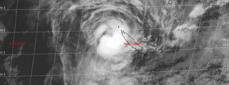
Image credit: JTWC
Tropical Cyclone "Uesi" has dumped heavy rains to northern New Caledonia as the storm passed west of the islands on Wednesday, February 12, 2020. The storm is on course to bring severe storms to Australia's east coast in the following days, while New Zealand's South Island will see heavy rain from the storm's remnants during the weekend.
Damage has been reported in the northern area of New Caledonia as the storm brought heavy rain and strong winds. According to the media, 16 people were evacuated to shelters on Belep.
Up to 300 mm (11.8 inches) of rain fell in 48 hours to Wednesday, inundating roads which left several communities isolated. Furthermore, power outages occurred in parts of the north of the main island Grand Terre where a maximum cyclone alert remains in place.
.png)
According to the Bureau of Meteorology's bulletin issued at 12:45 UTC on February 12, the storm remains at Category 2 intensity with sustained winds near the center of 110 km/h (70 mph) with wind gusts to 155 km/h (95 mph). At 22:00 LT (12:00 UTC), the storm was approximately 870 km (540 miles) north-northeast of Lord Howe Island, moving south-southwest at 17 km/h (11 mph).
"Convection has significantly weakened around Uesi in the last 24 hours and it is apparent there is increasing northwesterly shear across the system due to a negatively tilted upper trough over eastern Australia," BOM wrote.
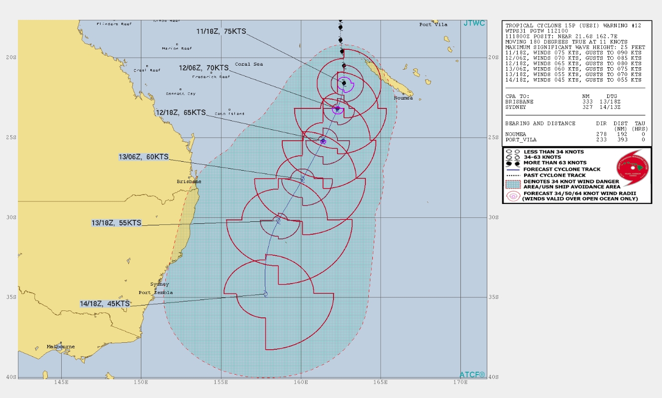
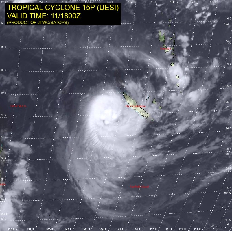
Image credit: JTWC
Tropical Cyclone "Uesi" at 14:30 UTC on February 12, 2020. Credit: JMA/Himawari-8, RAMMB/CIRA
The storm is expected to lose its tropical characteristics on Thursday, February 13, but is still expected to maintain intensity equivalent to a category 2 tropical cyclone and likely cause destructive winds at Lord Howe Island late on Thursday (LT).
Gales with gusts in excess of 100 km/h (62 mph) are expected to develop about Lord Howe Island on Thursday afternoon or early evening (LT).
Destructive winds with gusts in excess of 125 km/h (78 mph) should start to occur about Lord Howe Island during Thursday evening and continue into early Friday (LT) as the Uesi's center passes close to or just to the west of the island.
Heavy rain, which may lead to flash flooding, is expected to develop about Lord Howe Island on Thursday evening and continue overnight.
Damaging surf conditions, with waves exceeding 5 m (16 feet) in the surf zone, are likely to produce significant beach erosion. The sea water level may exceed the highest tide of the year. People living in coastal areas likely to be affected by this flooding should take measures to protect their property as much as possible.
Strong and gusty winds are likely to persist through till Saturday, in the wake of the system moving through on Friday.
Huge swells, gale-force winds, and rains are forecast off New South Wales, with thunderstorms likely to further soak Queensland as well.
A severe weather warning has been issued for severe storms in the Gold Coast and Brisbane, with up to 250 mm (9.8 inches) of rain possible in some areas. Melbourne, Canberra, and Hobart may also experience downpours.
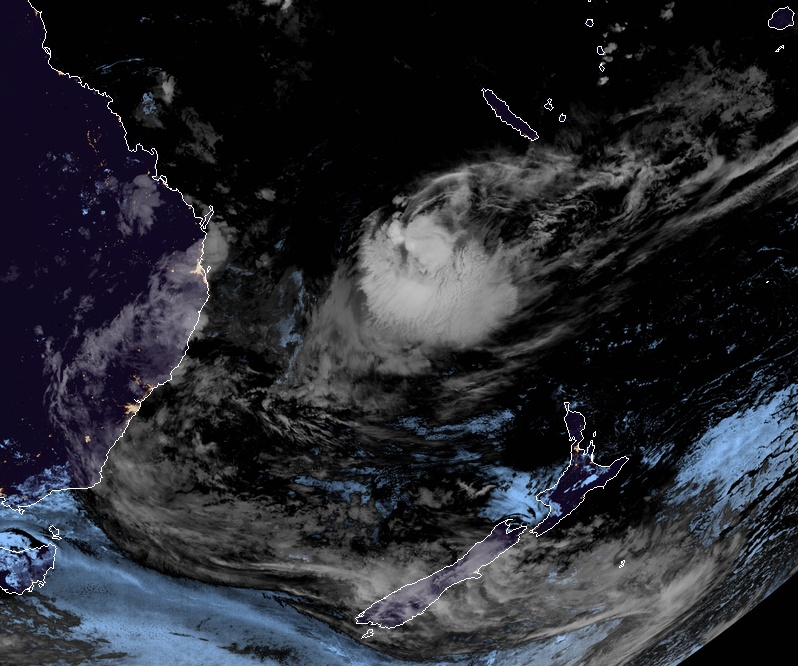
On the weekend, Uesi will lose its cyclone status as it heads towards New Zealand, becoming a deep low by the time it arrives on Saturday, February 15. According to the Met Service, the storm's remnants will deliver heavy rain to parts of the South Island.
Throughout the following week, further heavy rainfall with a chance for showers or thunderstorms are forecast in other parts of the country, said NIWA.
Severe Weather Update: Tropical #Cyclone Uesi west of New Caledonia. Video current at 1 pm AEST 12 Feb 2020. Uesi is currently approx. 1000 km offshore; large & powerful swells will develop along parts of the east coast as it moves towards the southwest. https://t.co/cSGjMI8FQM pic.twitter.com/GrEf8mjTVX
— Bureau of Meteorology, Australia (@BOM_au) February 12, 2020
View of Cyclone #Uesi on Wednesday evening via @zoom_earth #CycloneUesi pic.twitter.com/ZDCHGWKWIT
— Zoom Earth (@zoom_earth) February 12, 2020
#CycloneUesi may approach the South Island on Sunday-Monday
Some heavy rainfall could occur in the western & lower South Island with an increased chance for showers/thunderstorms in other parts of the country throughout next week. pic.twitter.com/2g64HR8U39
— NIWA Weather (@NiwaWeather) February 11, 2020
Latest models show Uesi heading towards NZ. Although it won't be Tropical Cyclone by then, severe weather is still expected, particularly for southern South Island, still recovering from recent storms. https://t.co/k44wyVOt1p ^RK pic.twitter.com/gOG8qjReLF
— MetService (@MetService) February 11, 2020
Commenting rules and guidelines
We value the thoughts and opinions of our readers and welcome healthy discussions on our website. In order to maintain a respectful and positive community, we ask that all commenters follow these rules.