
Cyclone Vaianu brings destructive winds, heavy rain and widespread disruption to New Zealand’s North Island
Cyclone Vaianu crossed New Zealand’s North Island on Sunday, April 12, 2026, bringing damaging winds, torrential rain, and large swells that caused flooding, evacuations, power outages, and transport disruption across several districts. The storm made landfall near the Māketū Peninsula in Bay of Plenty shortly after 14:00 LT on Sunday before tracking southeast and moving offshore later that evening. Cleanup continued on Monday as authorities assessed slips, flood damage, and coastal impacts.
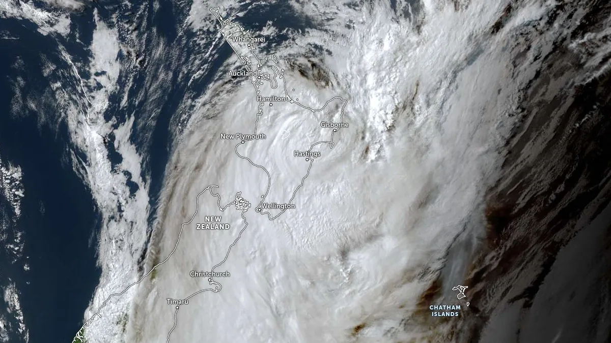
Satellite image of Cyclone Vaianu making landfall in North Island, New Zealand on April 12, 2026. Credit: JMA/Himawari-9, Zoom Earth, The Watchers. Acquired at 04:10 UTC on April 12, 2026
Cyclone Vaianu crossed New Zealand’s North Island on Sunday, April 12, 2026, bringing damaging winds, heavy rain, and large swells that caused flooding, evacuations, coastal inundation concerns, road closures, and power disruption across several districts.
Bay of Plenty was among the hardest-hit regions, with Whakatāne, Ōhope, Thornton, and nearby coastal communities facing the highest coastal hazard.
The cyclone made landfall near the Māketū Peninsula in Bay of Plenty shortly after 14:00 LT on Sunday, with a central pressure of about 978 hPa, before tracking southeast across the island and moving offshore near Hawke’s Bay around 18:00 LT later that day.
The most severe conditions were recorded in exposed coastal and elevated areas as the Vaianu approached and crossed the island. Great Mercury Island recorded a peak wind gust of 133 km/h (83 mph), Māhia reached 126 km/h (78 mph), and Gisborne Airport recorded 102 km/h (63 mph). Whakatāne recorded gusts of 94 km/h (58 mph) before the local station went offline for several hours.
The Pinnacles weather station in Coromandel Forest Park recorded 332 mm (13.1 inches) of rain in the 24 hours ending 16:00 LT on Sunday, while areas toward the Bay of Plenty experienced up to 150 mm (5.9 inches).
Radio New Zealand reported 270 households in Ōhope and Thornton were placed on evacuation orders, but it’s not known how many of them decided to evacuate. All of those who did evacuate were allowed to return home, as long as it’s safe, later on Sunday.
Flooding and storm impacts also affected Coromandel, Waikato, and parts of Auckland, where surface flooding, hazardous road conditions, and localized landslides were reported. The rain there fell on already saturated ground, increasing the risk of slope instability.
Power outages affected thousands of customers in parts of the Bay of Plenty, Coromandel, and surrounding districts during the height of the storm. Local reporting also indicated that wastewater systems in some eastern coastal communities were placed under strain by heavy inflows and storm conditions, prompting close monitoring by authorities.
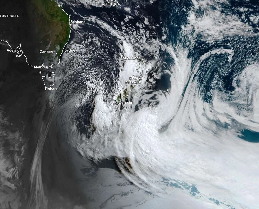
The cyclone has now moved away from New Zealand, and MetService has lifted cyclone-related Watches and Warnings, but residual hazards remain. A Heavy Rain Watch remains in place on Monday for northern Taranaki, Waitomo, Taumarunui, and areas west of Lake Taupō as a series of fronts moves in from the Tasman Sea.
Additional showers and isolated thunderstorms could slow cleanup efforts and prolong localized flood and landslide risks through midweek.
References:
1 As it happened: Cyclone Vaianu moves away, clean-up begins – Radio New Zealand – April 13, 2026
2 Vaianu moves away but showery westerlies remain – MetService New Zealand – April 13, 2026
3 Cyclone Vaianu leaves North Island cleanup underway in New Zealand – Reuters – April 13, 2026
I'm a dedicated researcher, journalist, and editor at The Watchers. With over 20 years of experience in the media industry, I specialize in hard science news, focusing on extreme weather, seismic and volcanic activity, space weather, and astronomy, including near-Earth objects and planetary defense strategies. You can reach me at teo /at/ watchers.news.
Ex-cyclone.
A breezy, wetter Sunday, with a little impact on the expected places. No fuss.
Watching the post-event ambient-field breakdown stress off to the west. Rebalancing.
Kind regards to our scribe and my fellow Watchers.