
Vanuatu issues Red alert for Tafea Province as Tropical Cyclone Urmil intensifies
Tropical Cyclone Urmil formed on February 27, 2026, south of Vanuatu, prompting a Red Alert for Tafea Province as the system began strengthening over the region. At 09:00 UTC, Urmil had intensified to 102 km/h (63 mph) and was moving southeast at about 15 km/h (9 mph). The cyclone is forecast to strengthen further over open waters between Vanuatu and Fiji, potentially reaching Category 2 intensity.
Urmil is the first named storm of the 2025–26 South Pacific cyclone season. It set a new record as the latest-ever first named cyclone in the basin, surpassing Cyclone Bart, which was named on February 21, 2017.
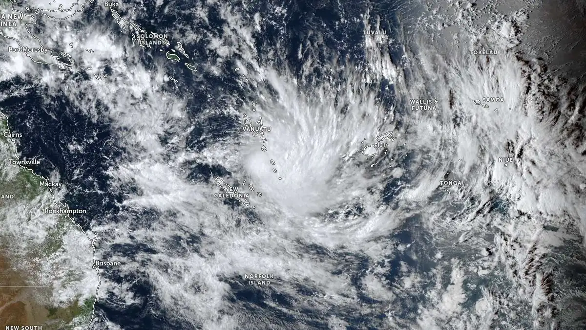
Tropical Cyclone Urmil at 04:30 UTC on February 27, 2026. Credit: JMA/Himawari-9, Zoom Earth, The Watchers
RSMC Nadi reported that the system reached Category 1 intensity early Friday before strengthening further based on multi-agency satellite estimates. Forecast guidance indicates continued southeastward movement through February 28, with peak intensity near 148 km/h (92 mph), within 36 hours before gradual weakening and subtropical transition.
Gale-force winds exceeding 61 km/h (38 mph) extend outward from the centre, primarily within the eastern semicircle. Significant wave heights near the centre are estimated at around 6 m (20 feet).
Marine conditions across southern Vanuatu and adjacent waters are expected to remain hazardous as the cyclone strengthens and accelerates.
Damaging winds are affecting Vanuatu’s Tafea Province and will continue to do so tonight and tomorrow, February 28, according to the Vanuatu Meteorology & Geo-hazards Department TC Warning Number 1.
Heavy rainfalls with flash flooding are expected over low-lying areas and areas close to river banks, including coastal flooding over Tafea today and continuing tomorrow. Very rough seas with heavy to phenomenal swells are expected over the area mentioned above.
Marine strong wind warning is current for the Central and southern waters of Vanuatu. High Seas wind warning is also current for all open waters of Vanuatu.
People, including seagoing vessels, are advised to take extra precautions.
The Vanuatu National Disaster Management Office said that Red Alert is now in effect for Tafea. For actions regarding these colour alerts, contact NDMO on 22699.
People over Tafea Province are urged to listen to all Radio Outlets to get the latest information on this system.
The National Weather Forecasting Centre in Nadi, Fiji, issued a Special Weather Bulletin for Heavy Rain at 10:30 local time (LT) on February 27. A Heavy Rain Alert remains in force for the Western Division, Yasawa and Mamanuca groups, Kadavu, and nearby smaller islands.
Occasional showers with isolated heavy falls are forecast to increase to frequent and heavy rain with thunderstorms, potentially leading to flash flooding in low-lying and flood-prone areas.
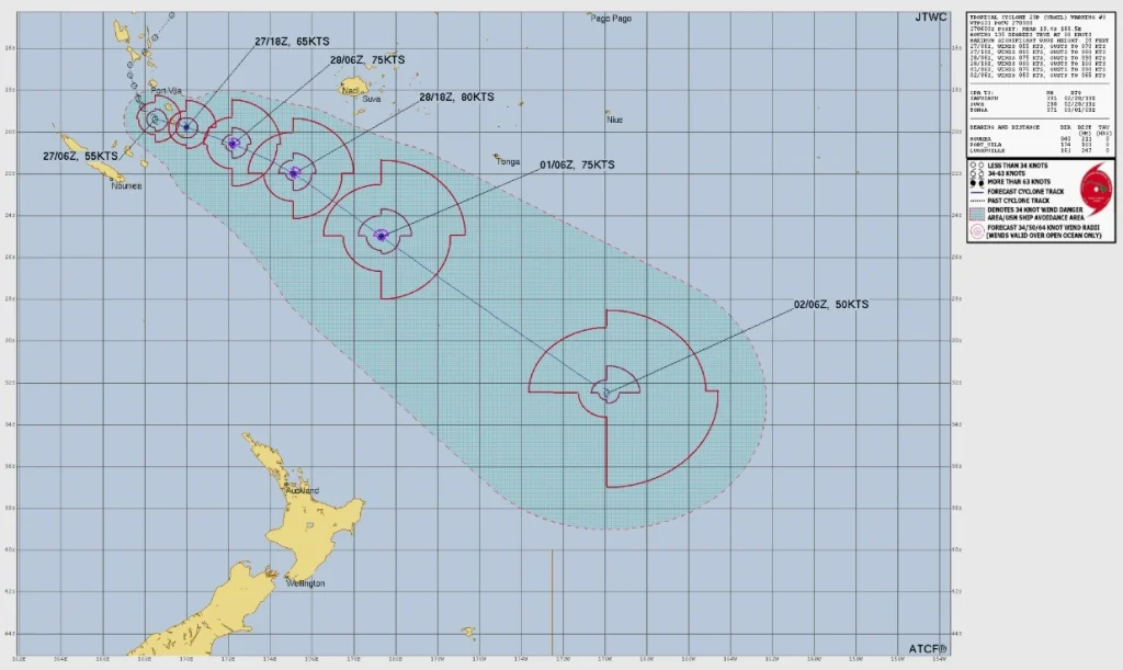
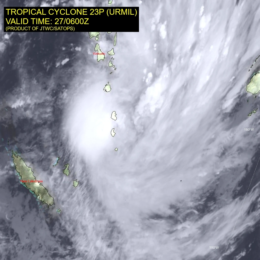
According to the analysis provided by the Joint Typhoon Warning Centre (JTWC) at 09:00 UTC on February 27, Urmil is a very compact tropical cyclone positioned just west of Tanna Island, Vanuatu.
At the time, the center of Urmil was located about 190 km (118 miles) south of Port Vila, Vanuatu. The system had maximum sustained winds of 102 km/h (63 mph) and was moving southeastward at 15 km/h (9 mph).
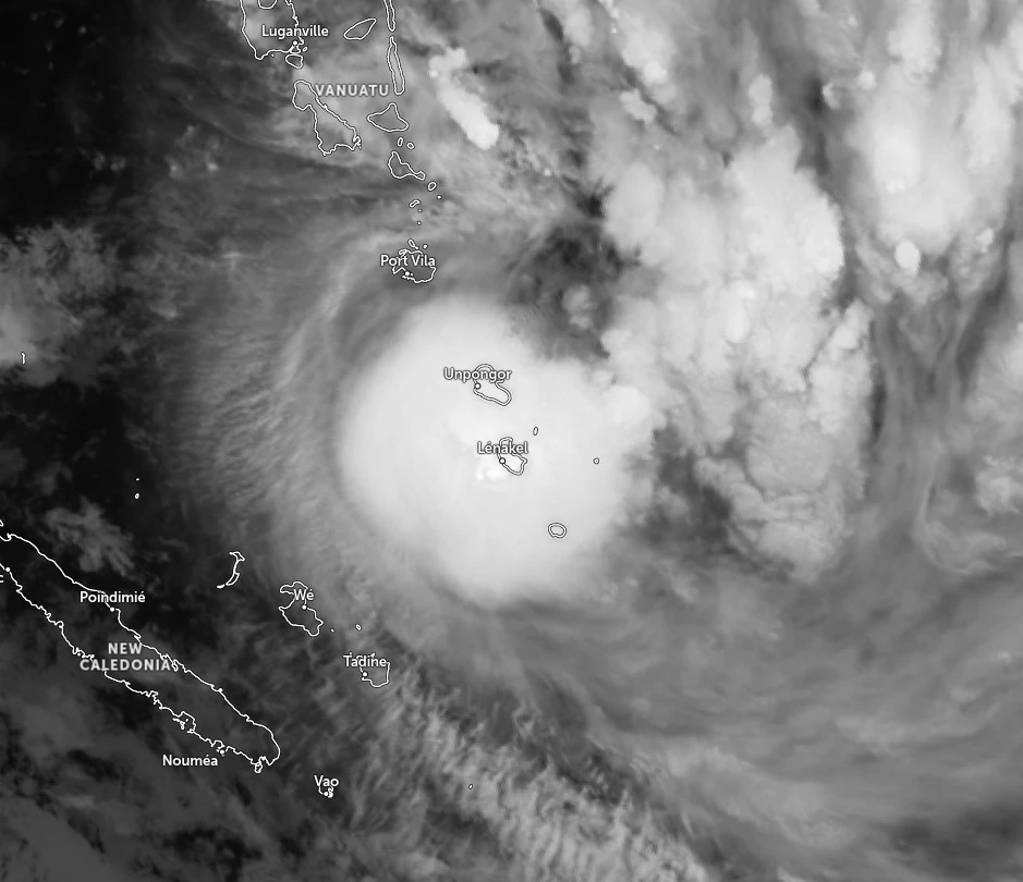
Enhanced infrared (EIR) satellite imagery shows a small inner core of deep, cold convection, with isolated overshooting tops along the southern and eastern periphery of the low-level circulation center (LLCC).
The upper-level vortex is situated on the margins of radar range from New Caledonia, and corresponding reflectivity data indicate an intermittent eye feature with convective bursts along the southern periphery of the inner core.
The system has turned east-southeastward over the past hours based on radar analysis and is now tracking toward Tanna Island.
Environmental conditions are conducive for development, with low deep-layer vertical wind shear (VWS), robust poleward outflow, and warm sea surface temperatures of 28–29°C (82–84°F), partially tempered by moderate mid-level shear.
In the near term, Urmil is forecast to transit over or in the immediate vicinity of Tanna Island. After crossing the island, it will curve southeastward along the southwestern gradient of a deep-layer subtropical ridge (STR) positioned northwest of Fiji.
From 09:00 UTC on February 28 through March 3, the STR will propagate southeastward, remaining in phase with Urmil, maintaining a vigorous steering gradient and accelerating the cyclone southeastward.
Orographic interaction with Tanna Island may briefly attenuate intensification. However, upon re-emergence over open water, the system is expected to achieve vertical coherence and commence a more rapid intensification phase.
VWS is forecast to remain low, while upper-level outflow steadily augments through 00:00 UTC on March 1, facilitating a peak intensity of 148 km/h (92 mph). Thereafter, shear magnitude is forecast to increase rapidly as the system interacts with the subtropical jet streak.
By 09:00 UTC on March 1, the system will be engulfed by mid-level dry air entrainment as it transits poleward of the 26°C (79°F) sea surface temperature isotherm, initiating subtropical transition (STT) concurrent with rapid weakening.
Urmil is the first named storm of the 2025–26 South Pacific cyclone season and sets a new record as the latest-ever first named cyclone in the basin, surpassing Cyclone Bart, which was named on February 21, 2017.
RSMC Nadi’s seasonal outlook had predicted below-average tropical cyclone activity (4–5 systems) for the 2025–26 season, making Urmil, arriving this late in February, consistent with that forecast.
References:
1 TC Warning Number 1 on Tropical Cyclone URMIL – VMGD – February 27, 2026
2 Tropical Cyclone 23P (Urmil) Warning #03 – JTWC – Issued at 09:00 UTC on February 27, 2026
3 Fiji Heavy Rain Alerts/Warning – Fiji Meteorological Service – February 27, 2026

I am an Assistant Editor and Severe Weather & Science Journalist at The Watchers, specializing in real-time severe weather coverage, geophysical event reporting, and research-driven scientific analysis. You can reach me at rishav(at)watchers(.)news.
Commenting rules and guidelines
We value the thoughts and opinions of our readers and welcome healthy discussions on our website. In order to maintain a respectful and positive community, we ask that all commenters follow these rules.