
Polar vortex split to impact Northern Hemisphere weather in March 2026
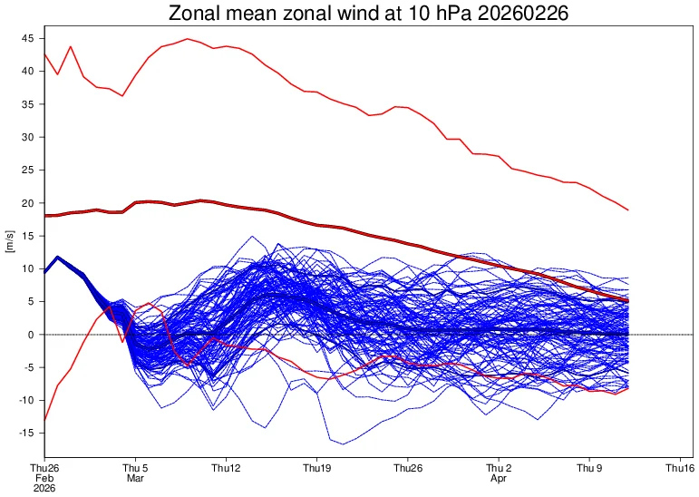
Another warming of the Arctic stratosphere is now underway, with the polar vortex forecast to undergo a final split in March 2026. The zonal mean wind reversal around 60°N and 10 hPa is expected between February 28 and March 1, with its impacts propagating into the troposphere, likely shifting weather patterns over Europe and North America.
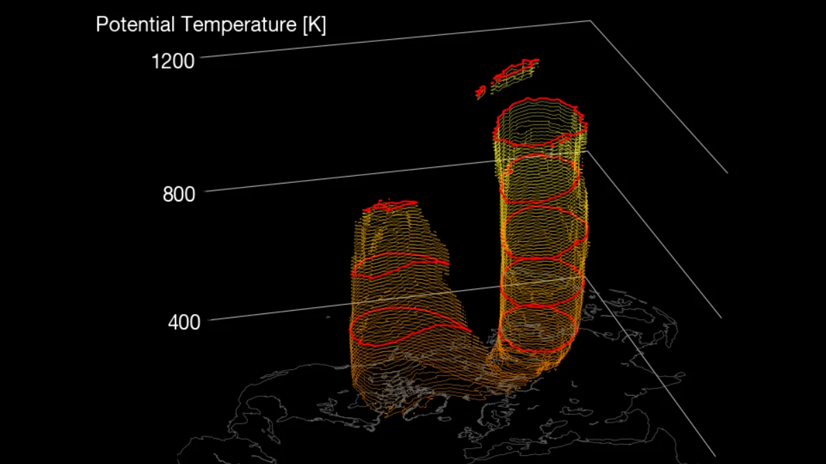
Image credit: Stratobserve
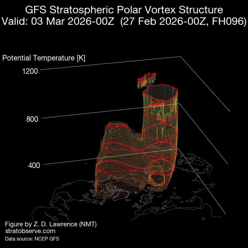
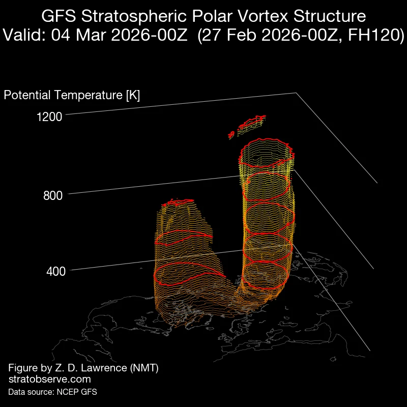
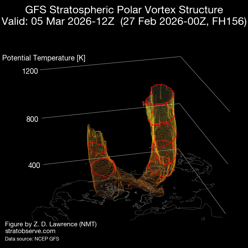
High-pressure areas compressing the polar vortex have begun disrupting it, with forecast models showing that the final split will begin sometime around March 3 and be complete by March 5. One of the cores will then move over Canada into the United States, while the other will move over to Siberia.
The stratospheric wind reversal is forecast to start in the first days of March. There is some tendency to recover later in the month, but this likely marks the end of the stratospheric Polar Vortex, collapsing from the top down, according to forecast analysis by Andrej Flis of Severe Weather Europe (SWE).
The late February forecasts show that the polar vortex is elongated with a continuous warming wave around it. The main cold core is weak and displaced, with a high-pressure area pushing in from the North Pacific.
Once the stratospheric circulation reverses, easterly anomalies typically propagate downward through the troposphere over a period of 10 to 20 days.
During this coupling phase, the altered momentum can reshape surface-level pressure fields, leading to a negative Arctic Oscillation (AO) and North Atlantic Oscillation (NAO) pattern.
As a result, high-latitude blocking tends to strengthen over Greenland and the Arctic Ocean, while the mid-latitude westerly flow weakens and meanders southward. The jet stream will become more curved, sucking in the Arctic air, bringing cold spells across Canada and the U.S.
Current forecasts show that the impacts of the split will begin early to mid-March 2026. The configuration favors a ridge near Greenland and troughing across central and eastern sectors of Europe, increasing the likelihood of cold air intrusions and late-winter snow events. Western Europe may experience transient warming episodes on the periphery of the ridge.
The disrupted core over Canada could bring cold anomalies over the Prairie Provinces, the Great Lakes region, and parts of the northern United States, while the western states remain under warmer and drier conditions. Eastern Canada could see below-average temperatures and intermittent snow as the jet stream shifts southward.
The downward propagation phase typically lasts one to three weeks, meaning the strongest tropospheric response should be observable by March 10–20.

I am an Assistant Editor and Severe Weather & Science Journalist at The Watchers, specializing in real-time severe weather coverage, geophysical event reporting, and research-driven scientific analysis. You can reach me at rishav(at)watchers(.)news.
Commenting rules and guidelines
We value the thoughts and opinions of our readers and welcome healthy discussions on our website. In order to maintain a respectful and positive community, we ask that all commenters follow these rules.