
Strong and shallow M6.1 earthquake hits Vanuatu
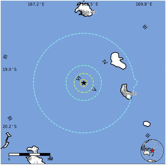
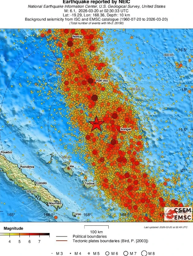
A strong and shallow earthquake registered by the USGS as M6.1 hit 100 km (62.5 miles) WNW of Isangel, Vanuatu, at 02:30 UTC on March 20, 2026. The earthquake occurred at a depth of 10 km (6.2 miles). This is the second M6+ earthquake of the day, following M6.6 in the South Shetland Islands at 00:22 UTC.
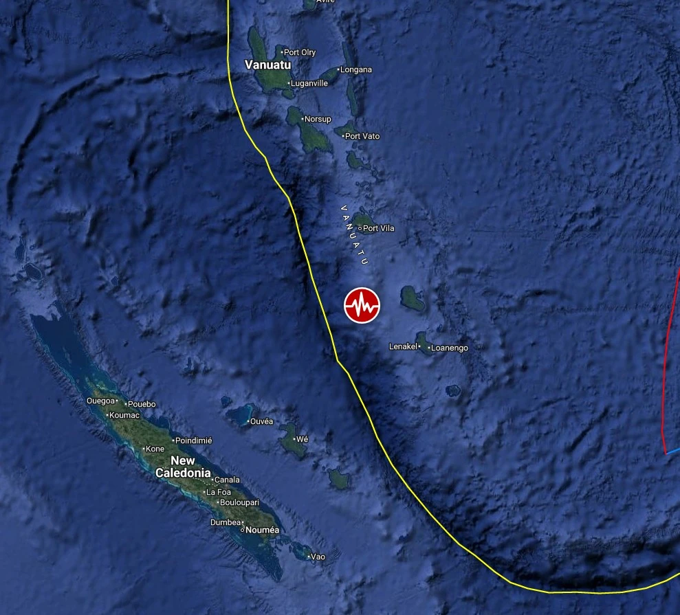
Epicenter of M6.1 earthquake in Vanuatu on March 20, 2026. Credit: TW/SAM, Google
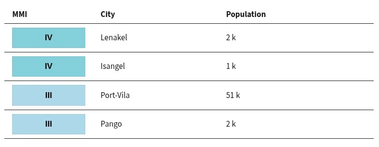
The epicenter was located 100 km (62 miles) WNW of Isangel (population 1 437), 173 km (107 miles) S of Port-Vila (population 35 901), Vanuatu and 214 km (133 miles) NNE of Wé (population 10 375), New Caledonia.
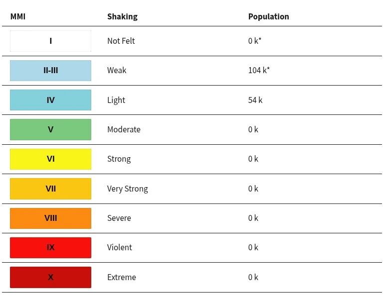
According to the USGS PAGER, 54 000 people are estimated to have felt light shaking, and 104 000 weak.
There is no tsunami expected.
The USGS issued a Green alert for shaking-related fatalities and economic losses. There is a low likelihood of casualties and damage.
Overall, the population in this region resides in structures that are highly vulnerable to earthquake shaking, though some resistant structures exist. The predominant vulnerable building types are unknown/miscellaneous types and wood construction.
Recent earthquakes in this area have caused secondary hazards such as landslides that might have contributed to losses.
This is the second M6+ earthquake recorded today, following an M6.6 event in the South Shetland Islands at 00:22 UTC.
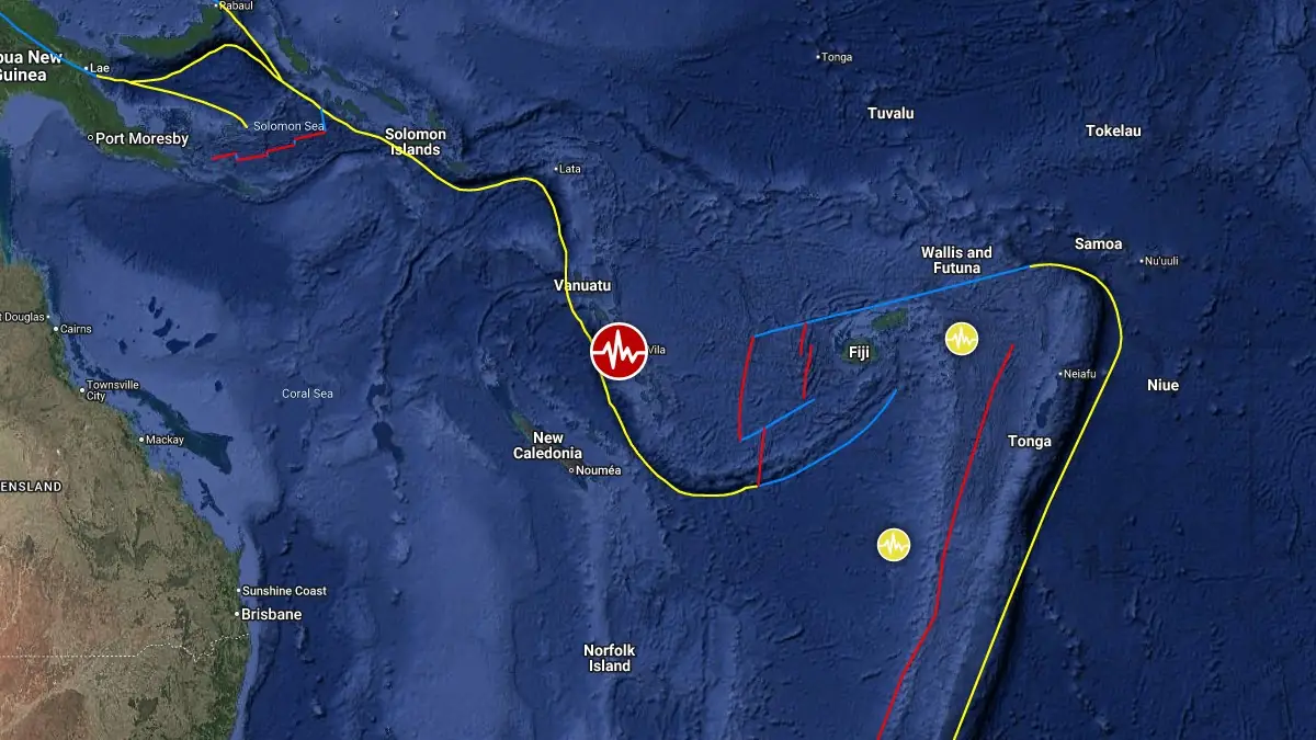
Vanuatu lies along the eastern margin of the Australia Plate, where the Australia Plate subducts eastward beneath the Pacific Plate along the North New Hebrides trench. This is one of the most seismically active plate-boundary systems in the world and regularly generates strong earthquakes associated with active subduction west of the Vanuatu Islands.
According to the USGS, convergence along the trench increases northward from about 80 to 90 mm/year (3.1 to 3.5 inches/year), while back-arc extension in the North Fiji Basin increases the overall rate of plate consumption.
The tectonic setting is further complicated by the D’Entrecasteaux ridge, which intersects the trench near central Vanuatu and locally disrupts the subduction process. Large earthquakes are common in this region, with 34 M7.5+ events recorded since 1900 along the North New Hebrides subduction zone.
Estimated population exposure to earthquake shaking
Selected cities exposed
Regional seismicity
References:
1 M6.1 earthquake Vanuatu – USGS – March 20, 2026
2 M6.1 earthquake Vanuatu – EMSC – March 20, 2026
I'm a dedicated researcher, journalist, and editor at The Watchers. With over 20 years of experience in the media industry, I specialize in hard science news, focusing on extreme weather, seismic and volcanic activity, space weather, and astronomy, including near-Earth objects and planetary defense strategies. You can reach me at teo /at/ watchers.news.
Commenting rules and guidelines
We value the thoughts and opinions of our readers and welcome healthy discussions on our website. In order to maintain a respectful and positive community, we ask that all commenters follow these rules.