
Bombing low brings destructive winds, heavy rain, and coastal hazards to southwest Western Australia
A rapidly deepening low-pressure system southwest of Western Australia is bringing damaging to destructive winds, severe thunderstorms, heavy rainfall, and coastal hazards to broad areas of the state’s southwest on Sunday, May 31, 2026. Wind gusts of up to 130 km/h (81 mph) are possible southwest of a line from Lancelin to Albany, including the Perth metropolitan area, while dangerous surf, coastal erosion, and inundation affect exposed sections of the coast.
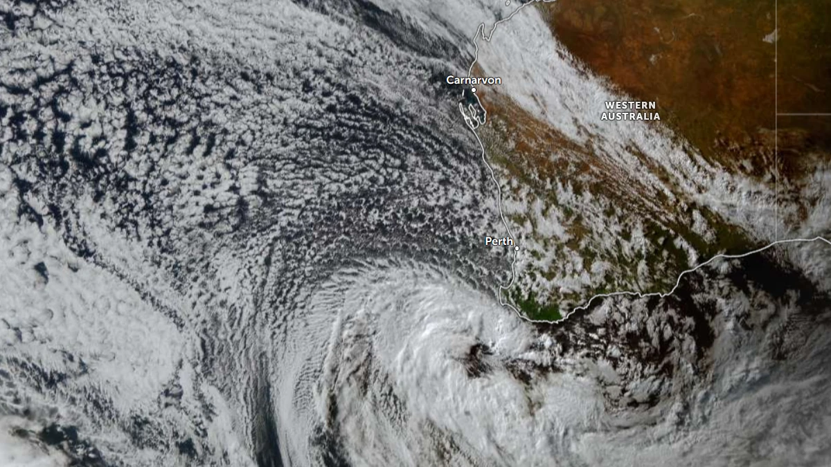
Satellite image of Western Australia at 07:40 UTC on May 31, 2026. Credit: JMA/Himawari-9, Zoom Earth, The Watchers
The severe weather is being generated by a deep low-pressure system associated with a cold front and secondary trough moving through southwestern Australia. According to the Bureau of Meteorology (BOM), the low has a central pressure near 980 hPa, a depth reached only every few years on average in the region.
Weatherzone reported that the system underwent explosive cyclogenesis, with the central pressure falling by about 25 hPa during the 24 hours leading into the morning of May 31.
Rainfall has also been significant across southwest Western Australia, with widespread totals of 15 to 50 mm (0.6 to 2 inches) and locally higher amounts recorded between 09:00 AWST on May 30 and early May 31.
Busselton Airport measured 50.6 mm (1.99 inches) by 05:30 AWST on May 31, its highest May daily rainfall total in eight years.
Manjimup recorded 43.6 mm (1.72 inches), its highest May daily total in 21 years, while North Island received 31.2 mm (1.23 inches), its highest May daily total in 25 years.
Bridgetown recorded 27 mm (1.06 inches) – its highest May daily total in six years, Geraldton Airport measured 26.6 mm (1.05 inches) – its highest May daily total in five years, and Cunderdin Airport recorded 23.4 mm (0.92 inches) – its highest May daily total in 27 years.
Perth Stadium measured 12 mm (0.47 inches) in 10 minutes at 01:00 AWST on May 31 after recording 7 mm (0.28 inches) in 10 minutes at 00:50 AWST.
Busselton recorded 6.2 mm (0.24 inches) in 10 minutes at 21:50 AWST on May 30, 6 mm (0.24 inches) at 22:20 AWST, and 5.2 mm (0.20 inches) at 22:00 AWST, while Manjimup Shire measured 5.6 mm (0.22 inches) in 10 minutes at 23:30 AWST on May 30.
BOM meteorologists warned a second and stronger pulse of damaging to destructive winds would move into the southwestern parts of the state during the afternoon of May 31, continuing through the evening of May 31 and into the early hours of June 1.
Destructive wind gusts up to 130 km/h (81 mph) remain possible southwest of a line from Lancelin to Albany, including Perth and surrounding districts.
Severe thunderstorms are possible across the far southwest, with risks including damaging to destructive winds and isolated tornadoes south of Bunbury. Severe thunderstorms capable of producing damaging winds may persist south of Perth into June 1.
The Bureau reported offshore wave heights above 8 m (26 feet), while abnormally high tides and dangerous surf continue to affect parts of the coast. Coastal hazard warnings remain in effect, with coastal erosion and inundation of low-lying coastal areas possible along vulnerable stretches of the Western Australian coastline.
Weatherzone said the system developed in an environment containing a strong upper-level jet, relatively warm waters offshore, and a cold pool aloft, factors that enhanced temperature contrasts and supported rapid intensification of the low-pressure system.
The low is forecast to move east into the Great Australian Bight on June 1. As conditions gradually ease across Western Australia, damaging winds, showers, and thunderstorms are expected to spread into South Australia, Victoria, New South Wales, and Tasmania through June 1 and 2.
References:
1 Bombing low hammers southwest WA as fierce winds worsen – Weatherzone – May 31, 2026

I am an Assistant Editor and Severe Weather & Science Journalist at The Watchers, specializing in real-time severe weather coverage, geophysical event reporting, and research-driven scientific analysis. You can reach me at rishav(at)watchers(.)news.
Commenting rules and guidelines
We value the thoughts and opinions of our readers and welcome healthy discussions on our website. In order to maintain a respectful and positive community, we ask that all commenters follow these rules.