
Major late-season winter storm forecast to bring up to 50 cm (20 inches) of snow and freezing rain to northern Manitoba, Canada
A major late-season winter storm is forecast to impact northern Manitoba, Canada, beginning Wednesday evening, April 22, 2026, bringing 30–50 cm (12–20 inches) of snow, freezing rain, and strong winds. The system will produce rain or freezing rain across central regions before transitioning to heavy snow through Saturday, creating hazardous travel conditions and increasing the risk of power outages.
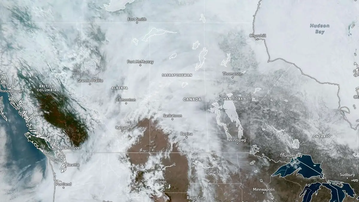
Satellite image acquired at 18:30 UTC on April 22, 2026. Credit: NOAA/GOES-East, Zoom Earth, The Watchers
A major late-season winter storm is forecast to affect northern Manitoba beginning Wednesday evening, April 22, bringing a period of mixed precipitation followed by heavy snowfall across the region.
Precipitation will begin across central Manitoba as rain or freezing rain before transitioning to snow as colder conditions spread into the region. Areas from The Pas eastward to the Ontario border are expected to experience freezing rain during the initial phase, with ice buildup possible on exposed surfaces.
Snowfall will intensify on Thursday, April 23, and continue through Saturday, April 25, with total accumulations reaching 30-50 cm (12-20 inches) across northern areas, including Cranberry Portage and Flin Flon. The snowfall is expected to expand across much of the northern region while remaining south of the Hudson Bay coast.
Northeasterly winds gusting up to 70 km/h (43 mph) will produce blowing snow and reduced visibility. Combined with ongoing snowfall, these conditions are expected to create hazardous travel conditions, with some routes becoming impassable.
Officials warned that the combination of freezing rain followed by heavy snowfall increases the risk of infrastructure impacts, potential prolonged outages, and difficult travel conditions.
Environment Canada has issued snowfall warnings, freezing rain warnings, and winter storm watches across much of northern Manitoba. Forecast guidance notes that freezing rain warnings may be upgraded to winter storm warnings if heavier snow develops following the initial precipitation phase.
Conditions differ sharply across the province, with southern Manitoba remaining under warm air. Temperatures in Winnipeg and Brandon are expected to reach 17-22°C (63-72°F) on April 22 and April 23, accompanied by high ultraviolet radiation levels, while northern regions experience winter storm conditions.
Mixed precipitation events are common during seasonal transition periods in April across central Canada, when temperature variations support both rain and snow within the same system.
References:
1 Weather Alerts for Manitoba – Environment Canada – April 22, 2026
I'm a dedicated researcher, journalist, and editor at The Watchers. With over 20 years of experience in the media industry, I specialize in hard science news, focusing on extreme weather, seismic and volcanic activity, space weather, and astronomy, including near-Earth objects and planetary defense strategies. You can reach me at teo /at/ watchers.news.
Commenting rules and guidelines
We value the thoughts and opinions of our readers and welcome healthy discussions on our website. In order to maintain a respectful and positive community, we ask that all commenters follow these rules.