
Strong Alberta Clipper to bring up to 40 cm (16 inches) of snow and flash freeze across northern Ontario, Canada
A strong Alberta Clipper storm will move through northern Ontario on Thursday and Friday, December 18 and 19, 2025, dropping 20–30 cm (8–12 inches) of snow, gusts up to 80 km/h (50 mph), and a sharp temperature drop. The system will create blowing snow and flash-freeze conditions on major highways, including routes between Kenora and Thunder Bay.
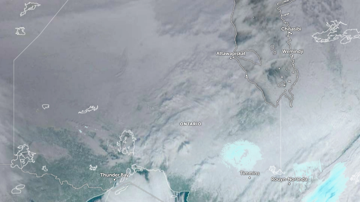
Satellite image of Ontario as of 16:00 UTC on December 17, 2025. Credit: NOAA/GOES-19, Zoom Earth, The Watchers
A strengthening Alberta Clipper is forecast to sweep through northwestern and northern Ontario on Thursday and Friday, producing heavy snowfall, strong winds, and sharply colder air.
According to Environment and Climate Change Canada (ECCC), snowfall totals will range from 10–30 cm (4–12 inches), with localized amounts possibly reaching 40 cm (16 inches) in areas under persistent snow bands.
The heaviest accumulations are forecast along and north of the Trans-Canada Highway corridor, including Kenora, Dryden, Thunder Bay, and Geraldton. Wind gusts of 60–80 km/h (37–50 mph) will create periods of whiteout conditions and drifting snow, making travel hazardous at times.
The Alberta Clipper will be interacting with Arctic air and a developing upper trough across central Canada. The steep temperature gradient and upper-level jet will enhance frontogenesis and produce sustained snowfall rates through Wednesday night into Thursday.
As the low passes, a sharp cold front will cause temperatures to fall rapidly from near 0°C to below −15°C (5°F), triggering flash-freeze conditions and turning wet surfaces to ice.
Behind the storm, Arctic high pressure will settle over the region, with overnight lows dropping into the −20°C (−4°F) range. A second low pressure system is expected to approach by Friday night into Saturday, maintaining an active winter pattern into the Christmas period.
ECCC advises residents and travelers to monitor updated bulletins through the WeatherCAN platform and local forecast pages for warnings related to snowfall, blowing snow, and extreme cold. Motorists are urged to postpone non-essential travel during the height of the storm due to rapidly deteriorating visibility and icy road surfaces.
References:
1 High-impact snowstorm to cause winter travel chaos in NW/northern Ontario – The Weather Network – December 16 2025.
2 Updated forecasts for Northern Ontario – ECCC – Accessed December 17, 2025.
3 Sioux Lookout Weather Update: Major Winter Storm on the Way – Net News Ledger – December 16, 2025.

Rishav Kothari is Editor-in-Chief of The Watchers, where he runs the newsroom and covers earthquakes, volcanoes, severe weather and space weather.
Published in the last 24 hours
- In September 1859, a solar storm lit up the night sky so brightly that gold miners in the Rocky Mountains woke up after midnight and started cooking breakfast, convinced the aurora glowing over their camp was the sunrise Epicenter
- A patch of warm Pacific water that could become the strongest El Niño in more than 70 years sits thousands of miles from any American town, yet it is already the main reason NOAA expects a wetter winter across the South and a milder one across the North
- A 19-year-old Nebraska teacher reportedly tied her pupils together with twine and led them to safety through a blizzard in January 1888 Epicenter
- NASA built the Opportunity rover to last 90 days on Mars, and Martian winds helped keep it alive for nearly 15 years by blowing dust off its solar panels, until a planet-wide dust storm in 2018 blocked sunlight and silenced the rover Epicenter
