
Atmospheric river brings heavy rain to Bay of Plenty, New Zealand
Heavy rain caused by an atmospheric river hit parts of the Bay of Plenty on November 18, 2025, with MetService reporting localized downpours of 25–40 mm (1 to 1.5 inches) per hour and an Orange heavy-rain warning in effect
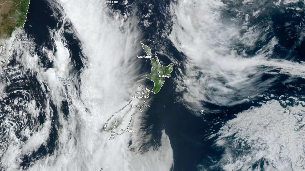
Satellite image of New Zealand at 01:50 UTC on November 17, 2025. Credit: JMA/Himawari-9, Zoom Earth, The Watchers
Heavy rain affected parts of the Bay of Plenty on November 18, with MetService reporting localized downpours of 25–40 mm (1–1.5 inches) per hour and placing the region under an Orange heavy-rain warning.
Rainfall rates of 20 to 40 mm (0.8 to 1.6 inches) per hour were reported in the Bay of Plenty, and 150–200 mm (6–8 inches) of rain in parts of the region in the 24-hour warning period ending 20:00 LT on November 19.
The highest accumulations were expected west of Whakatāne, and authorities stated that the warning could be upgraded to Red if rainfall bands intensify.
A severe thunderstorm watch was in place for parts of the Bay of Plenty on November 18, with some watches valid into the mid-afternoon.
The same weather system was forecast to reach other parts of the upper North Island. MetService issued heavy-rain watches and warnings for Auckland, the Coromandel, Waikato and Taupō for November 18–19, with humid northeasterlies expected to add to persistent rainfall.
NZTA advised motorists to check conditions before travelling and warned of potential surface flooding, reduced visibility, and hazardous driving conditions.
NZ Transport Agency Waka Kotahi (NZTA) Journey Manager for the Waikato Andrew Brosnan says people should take extra care on the roads today and tomorrow as weather conditions are set to intensify across the Waikato and Bay of Plenty regions.
Heavy rain can increase the risk of flooding in low-lying areas and coastal zones — conditions like these can change rapidly and make driving hazardous.
“Please slow down, increase following distances and drive to the conditions. Watch for surface flooding, slips and debris and avoid driving through floodwaters,” Brosnan said.
People can check road conditions before heading out via the NZTA Journey Planner.
“Our crews are on standby to respond to any incidents, and any updates will be provided via official channels.”
Forecasts also indicated significant accumulations elsewhere in the upper North Island, including up to 120 mm (4.72 inches) in parts of Gisborne/Tairāwhiti and up to 180 mm (7.08 inches) in Coromandel during this event. Regional councils advised property owners to clear drainage systems and prepare for rapid changes in water levels.
References:
1 Severe Weather Warnings – MetService – November 18, 2025
2 Heavy rain set for Waikato and Bay of Plenty: drive with caution – NZTA – November 18, 2025

I am an Assistant Editor and Severe Weather & Science Journalist at The Watchers, specializing in real-time severe weather coverage, geophysical event reporting, and research-driven scientific analysis. You can reach me at rishav(at)watchers(.)news.
Commenting rules and guidelines
We value the thoughts and opinions of our readers and welcome healthy discussions on our website. In order to maintain a respectful and positive community, we ask that all commenters follow these rules.