
Arctic air outbreak forecast to impact much of Europe this week
A cold Arctic air mass is forecast to move into much of Europe between November 17 and 21, 2025, lowering temperatures several degrees below normal and producing a mix of hill snow and overnight ice.
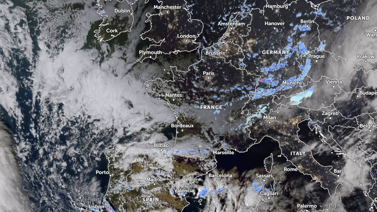
Satellite image of Europe at 15:30 UTC on November 17, 2025. Credit: EUMESAT/Meteosat, Zoom Earth, The Watchers
An Arctic air outbreak is forecast to affect parts of Western Europe from November 17 to 21, with colder-than-normal conditions expected across portions of the United Kingdom, Germany, and Spain.
The event is associated with a Greenland–North Atlantic blocking pattern that allows cold polar air to move southeastward over the region, increasing the possibility of overnight frost and locally disruptive snow at higher elevations.
ECMWF ensemble forecasts show a pronounced negative 2 m temperature anomaly across parts of Western Europe during the period, consistent with the observed blocking pattern.
By November 22, most of Europe and northern Africa will experience very cold temperatures.
The UK Met Office has issued Yellow warnings for snow and ice covering parts of northern Scotland, with timing centered on November 17–19. Expected snow accumulations remain elevation-dependent, with around 20–50 mm (1–2 inches) possible above 150 m (500 feet) and 50–100 mm (2–4 inches) above 400 m (1 300 feet) in the most exposed terrain.
The UK Health Security Agency (UKHSA) has issued amber cold-health alerts for North East England, North West England, and Yorkshire and the Humber, with yellow alerts for several additional regions.
The Deutscher Wetterdienst (DWD) lists snow, snow-drift, and ice hazards in affected federal states, with the highest risks in Alpine and pre-Alpine areas where frontal moisture overlaps the incoming cold air mass.
DWD’s hazard documentation describes the potential for heavy snowfall where uplift and moisture are sufficient, though impacts in lowlands will depend on frontal placement and the availability of precipitation. The main impacts are expected between November 18 and 20, when the cold pool interacts with Atlantic systems.
The Spanish meteorological agency AEMET reported that a very cold, high-latitude air mass will enter the Iberian Peninsula from November 18, producing generalized frost (heladas) through November 19–21.
Snow levels are forecast to descend into mountain and sub-mountain zones, with the snow line often near or below 700–800 m (2 300–2 600 feet) in some interior regions, depending on moisture.
Snow over high terrain in Scotland and Alpine regions, combined with widespread overnight ice, is likely to cause localized travel disruption on road, rail, and mountain routes. Delays are possible in the early morning when surfaces remain below freezing.

I am an Assistant Editor and Severe Weather & Science Journalist at The Watchers, specializing in real-time severe weather coverage, geophysical event reporting, and research-driven scientific analysis. You can reach me at rishav(at)watchers(.)news.
Commenting rules and guidelines
We value the thoughts and opinions of our readers and welcome healthy discussions on our website. In order to maintain a respectful and positive community, we ask that all commenters follow these rules.