
Large submarine landslide discovered northwest of 1957 M8.6 Andreanof Islands earthquake epicenter
A massive submarine landslide structure was discovered along the southern slope of the Aleutian Shelf, about 16 km (10 miles) northwest of the 1957 M8.6 Andreanof Islands earthquake epicenter.
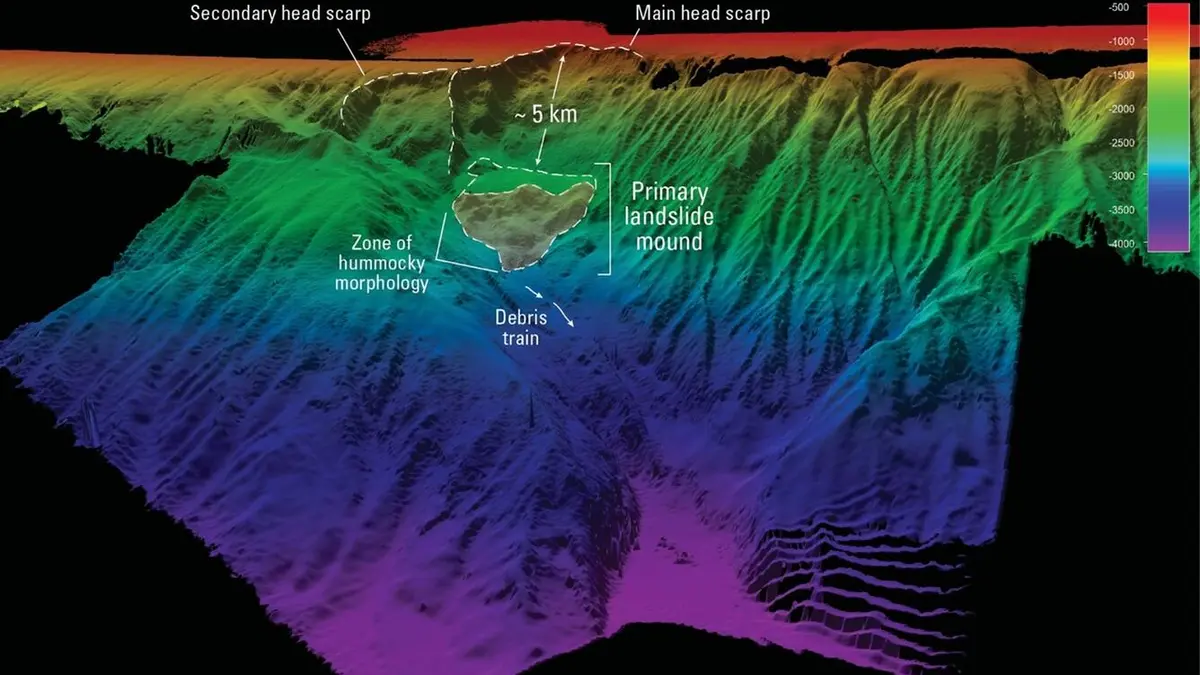
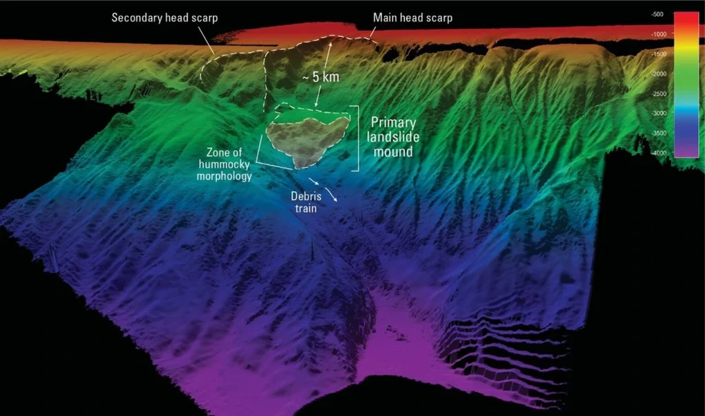
3D perspective map of the seafloor on the southern Aleutian Shelf. Credit: Volcano Science Center
A June 2025 multi-agency expedition mapped more than 6 400 km2 (2 500 square miles) of previously uncharted seafloor along the Aleutian margin aboard the Office of Naval Research’s Research Vessel (R/V) Atlantis.
The mission, led by the United States Geological Survey’s (USGS) Volcano Science Center with participation from the Bureau of Ocean Energy Management (BOEM), the National Oceanic and Atmospheric Administration (NOAA), the Smithsonian Institution, and Woods Hole Oceanographic Institution (WHOI), focused on investigating submarine geohazards and their role in shaping tsunami risk across the Pacific.
The newly identified landslide spans over 16 km (10 miles) across the southern slope of the Aleutian Shelf and displays features typical of rapid slope failure, including a scalloped headwall, a chaotic debris zone, and long runout lobes extending into a deeper basin.
It lies approximately 16 km (10 miles) northwest of the epicenter of the M8.6 earthquake that struck the Andreanof Islands on March 9, 1957.
The 1957 earthquake generated a Pacific-wide tsunami that produced run-up heights of up to 16 m (53 feet) at Hāʻena on Kauaʻi, 3.7 m (12 feet) in Hilo Bay, and caused millions of dollars in damage in Hawaiʻi.
Previous seismic and tsunami models have struggled to fully explain the unusually high run-ups observed in some locations, prompting hypotheses that a submarine landslide might have acted as a secondary tsunami source, amplifying wave energy.
If the newly discovered landslide was triggered by the 1957 earthquake, it could help resolve these discrepancies, similar to the 1946 Aleutian tsunami event in which a massive slope failure off Unimak Island generated devastating waves that killed 159 people in Hawaiʻi and destroyed the Scotch Cap Lighthouse in Alaska.
The exact age of the landslide remains unknown, and upcoming studies aim to determine whether it coincided with the 1957 earthquake.
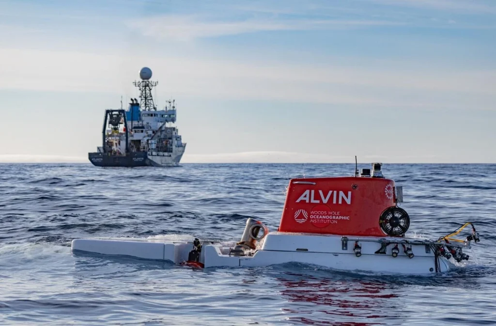
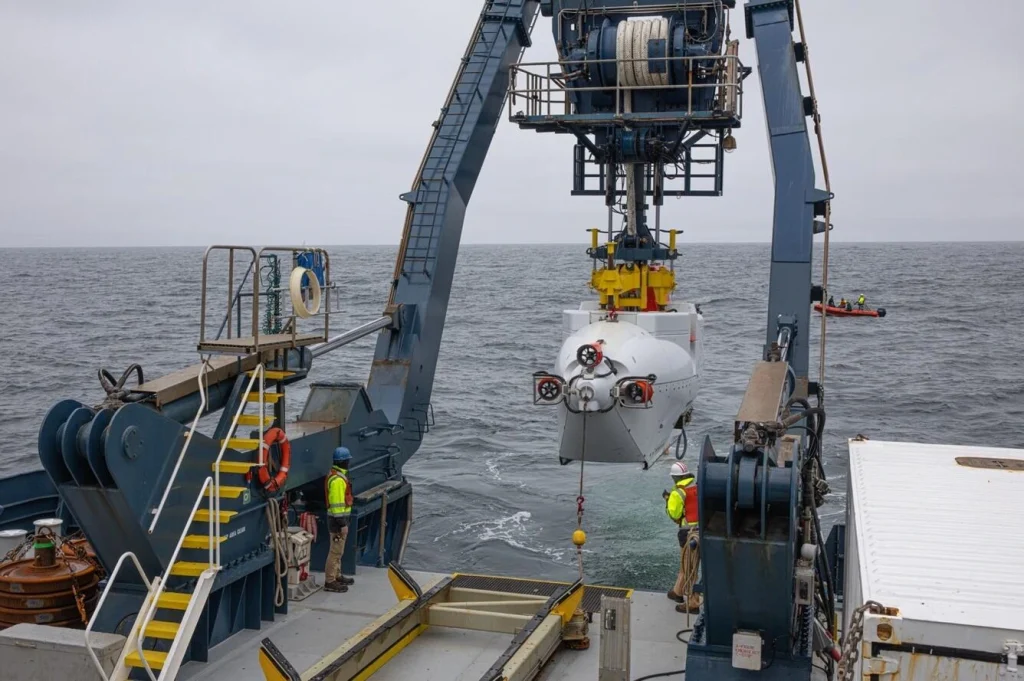
The expedition deployed the U.S. Navy’s human-occupied vehicle (HOV) Alvin, a deep-diving submersible capable of reaching depths over 6 000 m (20 000 feet) to investigate volcanic flanks, earthquake rupture zones, and deep-sea habitats.
The team collected 884 scientific samples, including biological, geological, and seawater specimens, and mapped over 3 540 km (2 200 miles) of the Aleutian margin.
Further studies led by the USGS Alaska Volcano Observatory will aim to determine the slide’s precise age, volume, and potential tsunami-generating capacity, as well as to examine other newly mapped volcanic landslides in the Aleutian Arc.
Researchers note that such work highlights the importance of modern seafloor mapping technologies, such as multibeam and backscatter sonar in revealing hidden geologic hazards and refining tsunami risk assessments for Alaska, Hawaiʻi, and the broader Pacific region.

I’m a science journalist and researcher at The Watchers, contributing to the Epicenter edition, where I cover peer-reviewed scientific research and emerging discoveries across Earth and space sciences. With a background in astronomy and a passion for environmental science, I’ve worked in shark and coral conservation in Fiji, conducting reef and shark-behavior research, contributing to mangrove restoration, and earning PADI Open Water and Coral Reef Certifications. I bring a blend of scientific rigor and storytelling to illuminate the discoveries shaping our planet and beyond.
Commenting rules and guidelines
We value the thoughts and opinions of our readers and welcome healthy discussions on our website. In order to maintain a respectful and positive community, we ask that all commenters follow these rules.