
Tropical Cyclone “Haliba” affecting portions of the Mascarene Islands
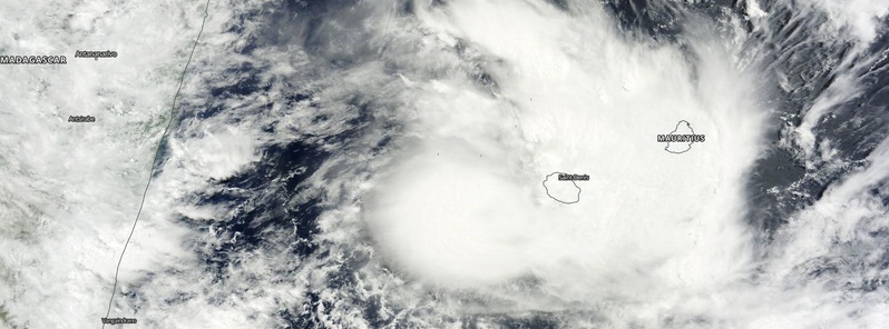
Image credit: NASA Terra/MODIS
Tropical Cyclone "Haliba" formed in the southern Indian Ocean and is affecting portions of the Mascarene Islands (mainly Reunion Island). Inhabitants of this area should monitor the progress of this system, RSMC La Reunion said.
Haliba is currently a Moderate tropical storm with central pressure of 994 hPa. Its maximum average (10 minute) wind speed at 06:00 UTC today was 74 km/h (46 mph).
At 09:00 UTC today, Haliba was located approximately 157 km (97 miles) west of La Reunion.
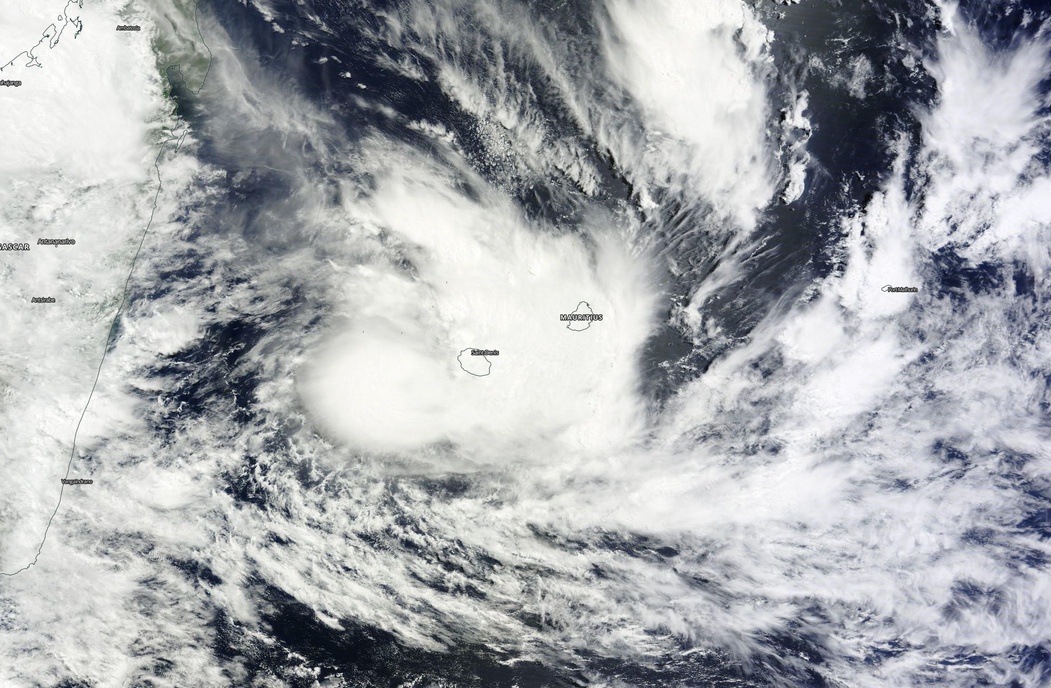
Tropical Cyclone "Haliba" on March 9, 2015. Image credit: NASA Terra/MODIS
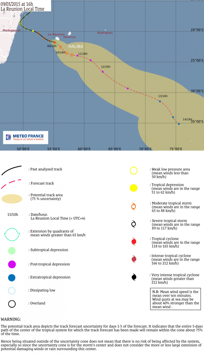
According to RSMC La Reunion, the system is expected to continue to track south-eastwards. It should slow down on Wednesday when the remnants of ex-tropical depression 11 are expected to merge with the circulation.
The system should resume its southeastwards track with an ongoing extra-tropical process on Thursday.
Satellite animations
- Storm-Centered Infrared (Meteosat 7; CIMSS)
- Storm-Centered Enhanced Infrared (Meteosat 7; CIMSS)
- Storm-Centered Water Vapor (Meteosat 7; CIMSS)
- Storm-Centered Visible (Meteosat 7; CIMSS)
- Meteosat 7 Infrared (Meteosat 7; CIMSS)
- Meteosat 7 Infrared (Color Background) (Meteosat 7; CIMSS)
- Meteosat 7 Infrared (NHC Color Enhancement) (Meteosat 7; CIMSS)
- Meteosat 7 Water Vapor (Meteosat 7; CIMSS)
- Meteosat 7 Water Vapor (Color Background) (Meteosat 7; CIMSS)
I'm a dedicated researcher, journalist, and editor at The Watchers. With over 20 years of experience in the media industry, I specialize in hard science news, focusing on extreme weather, seismic and volcanic activity, space weather, and astronomy, including near-Earth objects and planetary defense strategies. You can reach me at teo /at/ watchers.news.
Commenting rules and guidelines
We value the thoughts and opinions of our readers and welcome healthy discussions on our website. In order to maintain a respectful and positive community, we ask that all commenters follow these rules.