• Category 5 Severe Tropical Cyclone Narelle forecast to cross Far North Queensland on March 20

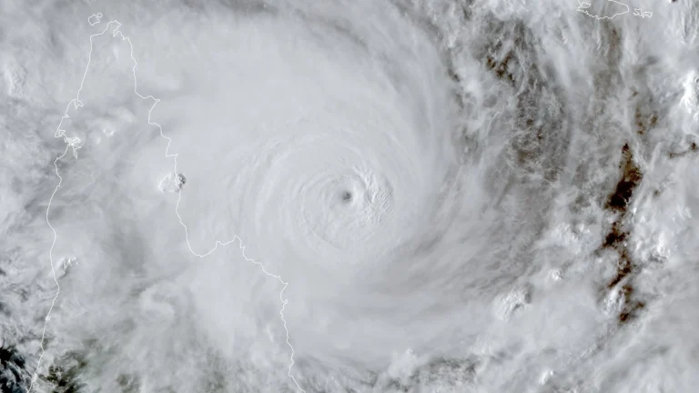
    Severe Tropical Cyclone Narelle intensified into a Category 5 system on March 19, 2026, and is forecast to cross the Cape York Peninsula between Lockhart River and Cape Melville, Queensland, on the morning of March 20. Very destructive wind gusts of more than 250 km/h (155 mph), heavy rainfall of 100 to 350 mm (4 to 14 inches), and dangerous coastal conditions including abnormally high tides and large waves are forecast near and south of the landfall area, although slight weakening to a high-end Category 4 before crossing remains possible.
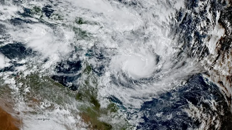
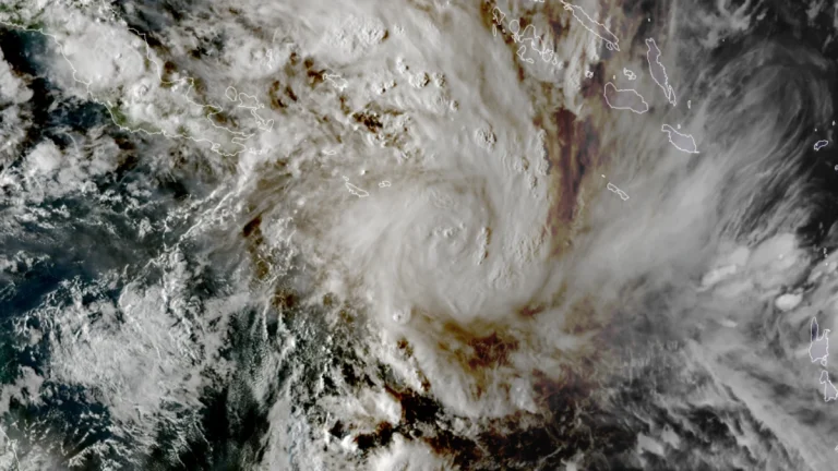
  • Severe Tropical Cyclone Narelle forecast to briefly reach Category 5 before Queensland landfall, Australia

    Severe Tropical Cyclone Narelle is forecast to intensify to Category 5 peak intensity over the Coral Sea before approaching the Far North Queensland coast between Lockhart River and Cooktown on March 20, 2026. Destructive winds of over 250 km/h (155 mph), along with rainfall totals over 350 mm (14 inches), are expected to triggere flash flooding, significant storm surges, and coastal flooding.

  • Tropical Cyclone Narelle forms in Coral Sea, forecast to intensify before Queensland impact, Australia

    ropical Cyclone Narelle developed in the northern Coral Sea on Tuesday, March 17, 2026, with sustained winds of 85 km/h (53 mph) and gusts to 120 km/h (75 mph). The system is moving west-southwest toward Far North Queensland and is forecast to intensify to severe tropical cyclone strength before approaching the coast later this week, with damaging winds, heavy rainfall, and coastal flooding being forecast.

  • Two subtropical systems active simultaneously in South Atlantic, first such overlap documented in modern monitoring era

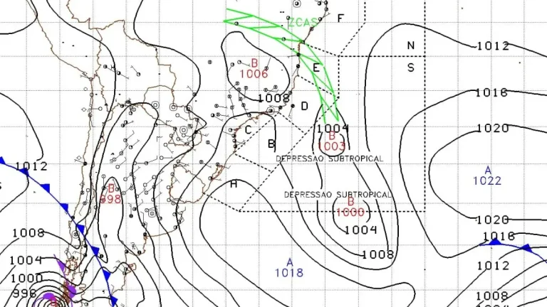
    Subtropical Storm Caiobá formed off southern Brazil on March 2, 2026, after two subtropical depressions developed simultaneously in the South Atlantic. According to Metsul Meteorologia and available South Atlantic cyclone records, no previous instance of simultaneous subtropical depressions has been documented since formal monitoring and classification began. Caiobá moved away from the coast of Brazil without any major impacts.

  • Vanuatu issues Red alert for Tafea Province as Tropical Cyclone Urmil intensifies

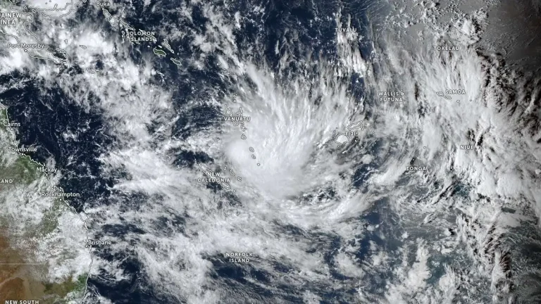
    Tropical Cyclone Urmil formed on February 27, 2026, south of Vanuatu, prompting a Red Alert for Tafea Province as the system began strengthening over the region. At 09:00 UTC, Urmil had intensified to 102 km/h (63 mph) and was moving southeast at about 15 km/h (9 mph). The cyclone is forecast to strengthen further over open waters between Vanuatu and Fiji, potentially reaching Category 2 intensity.

    Urmil is the first named storm of the 2025–26 South Pacific cyclone season. It set a new record as the latest-ever first named cyclone in the basin, surpassing Cyclone Bart, which was named on February 21, 2017.

  • Post-season NHC report finds Melissa tied for strongest Atlantic hurricane by maximum sustained wind

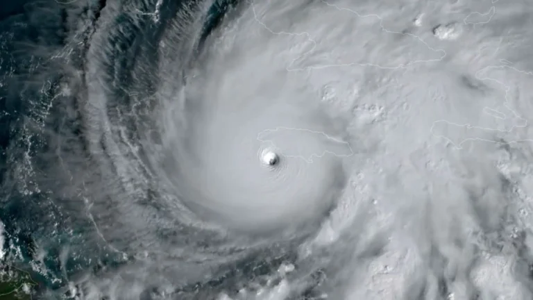
    NOAA’s final Tropical Cyclone Report confirms that Hurricane Melissa reached Category 5 intensity with peak 1-minute sustained winds of 306 km/h (190 mph), tying for the highest maximum sustained wind speed on record in the Atlantic basin, and a minimum central pressure of 892 hPa. The hurricane made landfall near New Hope, Jamaica, at 17:25 UTC (13:25 LT) on October 28, 2025, resulting in 45 fatalities in Jamaica and 95 across the region, with economic losses in Jamaica estimated at USD 8.8 billion.

  • Tropical Cyclone Horacio becomes strongest storm of 2026 east of Mauritius

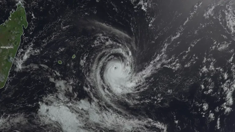
    Tropical Cyclone Horacio intensified to a Category 5-equivalent system over the central Southwest Indian Ocean east of Mauritius on February 22, 2026, becoming the strongest tropical cyclone recorded globally this year. The storm reached sustained winds near 260 km/h (160 mph) before moving southward over open waters.

  • Tropical Cyclone Gezani leaves at least 63 dead across Madagascar and Mozambique

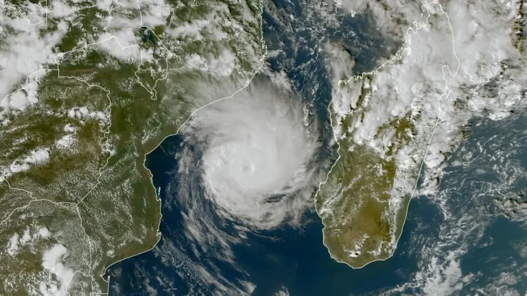
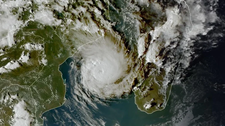
    Tropical Cyclone Gezani has left at least 63 people dead across Madagascar and Mozambique after striking eastern Madagascar on February 10, 2026, and later passing 15 km (9 miles) offshore from Mozambique’s Inhambane coast before weakening over the Mozambique Channel. Madagascar’s disaster management authority reports 59 fatalities, 15 missing persons, and 804 injured, with 423 986 people affected nationwide, while Mozambique officials confirmed four deaths and continued infrastructure disruption. Heavy rain and coastal hazards persisted into February 17 as the system looped west of southern Madagascar.

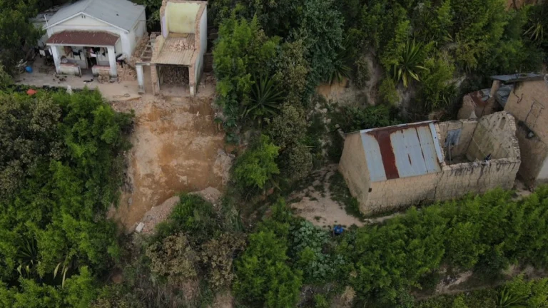
  • Gezani destroys 18 800 homes, claims 40 lives in Madagascar

    At least 40 fatalities have been confirmed, and over 18 800 homes have been destroyed as of February 13, 2026, since Tropical Cyclone Gezani made landfall over Madagascar. The storm remains active and is forecast to continue intensifying through February 13 while remaining in open waters.

  • Gezani forecast to reach intense tropical cyclone strength near Mozambique coast, more than 1 million at risk

    Tropical Cyclone Gezani was located in the Mozambique Channel at 12:00 UTC on February 12, 2026, with maximum sustained winds of 120 km/h (75 mph) and is forecast to intensify to 165 km/h (105 mph) near the Mozambique coast by February 14. Gale- to hurricane-force winds, rainfall totals locally reaching 200 mm (8 inches), and high seas of 7–10 m (23–33 feet) are possible in Inhambane Province, while Sofala and Gaza provinces remain saturated from prolonged flooding that has already displaced hundreds of thousands.