• Hurricane Polo brings heavy rain to Mexico, NHC forecasts Baja California approach

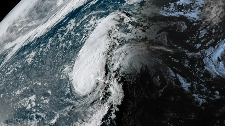
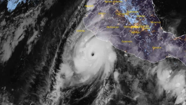
    Hurricane Polo’s outer rainbands brought heavy rain to southwestern Mexico on September 24, 2026, with a Tropical Storm Warning in effect from Tecpan de Galeana to Manzanillo. Mexico had extended the warning westward overnight as the Category 5 hurricane remained offshore, bringing a risk of flooding, mudslides and dangerous coastal conditions.Polo is forecast to approach the Baja California Peninsula as a hurricane early in the week beginning September 28.
  • Hurricane Polo intensifies to Category 5, heavy rainfall threatens southwestern Mexico

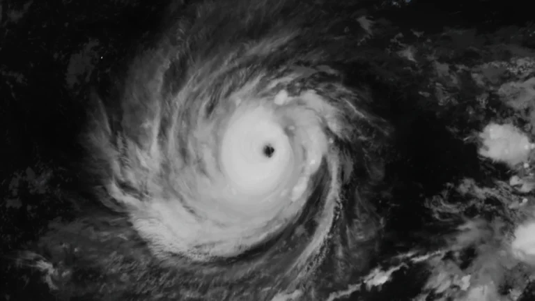
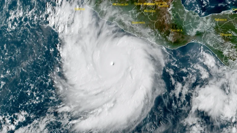
    Hurricane Polo intensified to Category 5 south of southwestern Mexico on September 22, 2026, reaching maximum sustained winds of 260 km/h (160 mph) at 12:00 UTC before strengthening further to 270 km/h (165 mph) by 15:00 UTC, according to the US National Hurricane Center (NHC). A Tropical Storm Warning was in effect for part of the southwestern Mexican coast, while heavy rainfall through September 24 threatened life-threatening flooding and mudslides in Guerrero and Michoacán.

  • Rapidly intensifying Tropical Storm Polo forecast to become major hurricane near southwestern Mexico

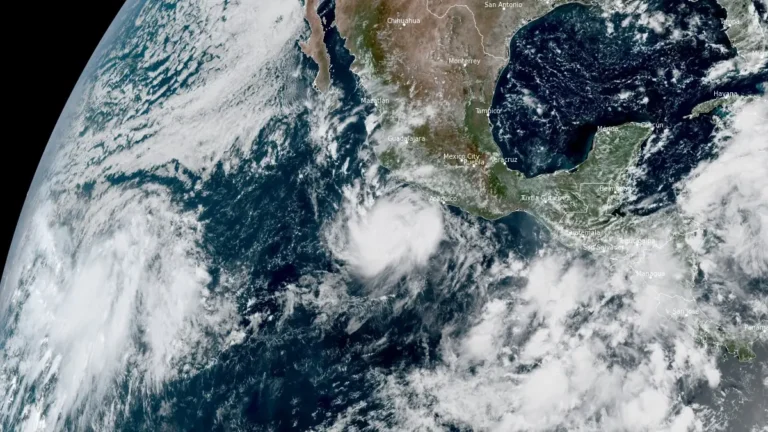
    Tropical Storm Polo was rapidly intensifying off southwestern Mexico on September 21, 2026, with maximum sustained winds reaching 100 km/h (65 mph) at 09:00 CST (15:00 UTC), according to the National Hurricane Center (NHC). NHC forecasts Polo to become a hurricane later Monday and a major hurricane on Tuesday while moving near the southwestern Mexican coast, where a Tropical Storm Watch is already in effect.

  • Typhoon Dujuan brings record rainfall to eastern Japan, JMA issues Level 5 landslide warning for Oshima

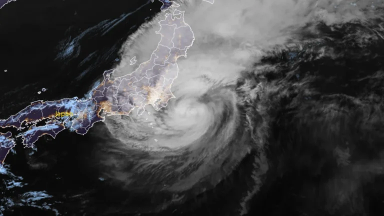
    Rainfall on Oshima reached 600 mm (23.6 inches) in the 24 hours ending at 14:00 LT (05:00 UTC) on September 21, 2026, as Typhoon Dujuan passed the Izu Islands and approached eastern Japan. The record September rainfall prompted a Level 5 landslide special warning, while flooding, landslides and transport disruption affected parts of the Kanto region.

  • Tropical Depression Six forms over the North Atlantic, forecast to strengthen into Tropical Storm Fay

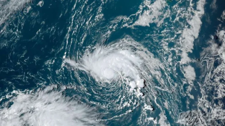
    Tropical Depression Six formed southwest of the Azores on September 19, 2026, with initial maximum sustained winds of 55 km/h (35 mph). The NHC forecast the depression to reach tropical-storm intensity by 00:00 UTC on September 20 and strengthen further to 75 km/h (45 mph) by 00:00 UTC on September 21. The system would receive the name Fay if upgraded to a tropical storm.

  • 1 dead as Hurricane Lowell passes west of Niʻihau, knocks out power to 90% of Kauaʻi, Hawaii

    One person died on Oʻahu as Hurricane Lowell passed the Hawaiian Islands late on September 7, 2026 (local time), while the storm’s core passed near Niʻihau with maximum sustained winds of 175 km/h (110 mph). Approximately 90% of Kauaʻi Island Utility Cooperative customers were without power the following morning, while numerous roads and Port Allen Small-Boat Harbor sustained severe damage. Preliminary National Weather Service (NWS) observations included a gust of approximately 150 km/h (92 mph) at Puʻu Lua and a 72-hour rainfall total of 536.2 mm (21.11 inches) at Kilohana.

  • Hurricane Lowell approaches Kauaʻi County with destructive winds, flooding, storm surge and tornado threat, Hawaii

    Flooding and transportation disruptions were already affecting Kauaʻi late September 7, 2026, as Hurricane Lowell moved toward the island with maximum sustained winds of 175 km/h (110 mph). The hurricane was about 215 km (135 miles) southwest of Līhuʻe at 20:00 HST (06:00 UTC on September 8), with its core forecast to pass near or just west of Niʻihau overnight.

  • Hurricane Lowell weakens to Category 4 after briefly regaining Category 5, Hawaii under State of Emergency

    Hurricane Lowell reached Category 5 strength with winds of 260 km/h (160 mph) before weakening slightly to Category 4 south of Hawaii late on September 4. Heavy rainfall, life-threatening surf and possible wind and storm-surge impacts remained forecast for portions of the state through early next week, particularly around Kauaʻi County.

  • Multiple people missing, more than 100 houses collapse in Putian as Typhoon Saudel floods Fujian, China

    Multiple people were missing, and more than 100 houses had collapsed in Huating Town, Putian, after Typhoon Saudel brought heavy rain and severe flooding across Fujian on September 3, 2026. Authorities had evacuated 83 700 people from risk areas, while NMC recorded local rainfall totals reaching 565.5 mm (22.26 inches) in some areas. Fifty rivers in Fujian exceeded warning levels at 74 hydrological stations between September 3 and 4.

  • Atmospheric river targets Pacific Northwest as Tropical Storm Marie boosts California rainfall risk

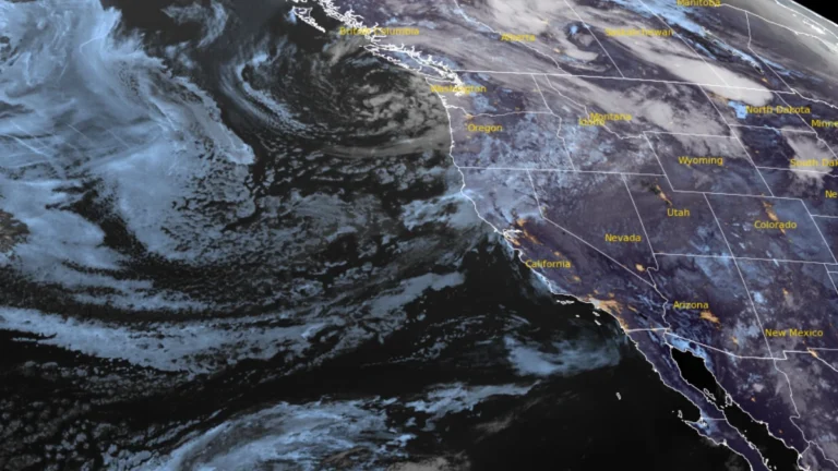
    An early-season atmospheric river associated with a potent upper-level closed low is forecast to bring 25–75 mm (1–3 inches) of precipitation to parts of the western United States through 05:00 PT (12:00 UTC) on September 5, 2026. The Weather Prediction Center (WPC) placed interior northern California, eastern Oregon, and western Idaho under a Marginal Risk of excessive rainfall for September 3–4, while Marie-related moisture raised a separate, more uncertain California rainfall risk later in the forecast period.