
Arctic stratospheric polar vortex forecast to weaken sharply in early November
NASA Ozone Watch’s current Arctic wind product forecasts the 60°N zonal-mean wind at 10 hPa falling from 22.12 m/s (49.5 mph) on October 25, 2026, to 4.15 m/s (9.3 mph) by November 3, compared with a climatological mean of 25.97 m/s (58.1 mph) for November 3. A few European forecast models go further and reverse the winds, but said that outcome remains unlikely and Canadian surface impacts are not established.
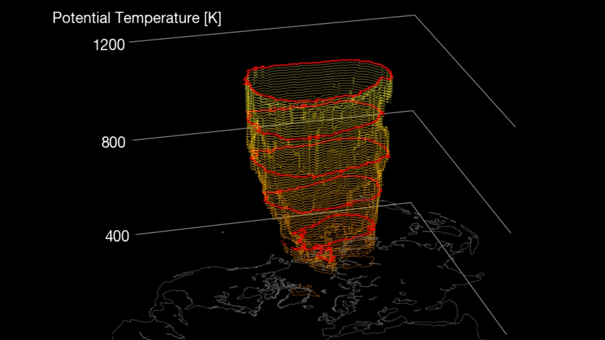
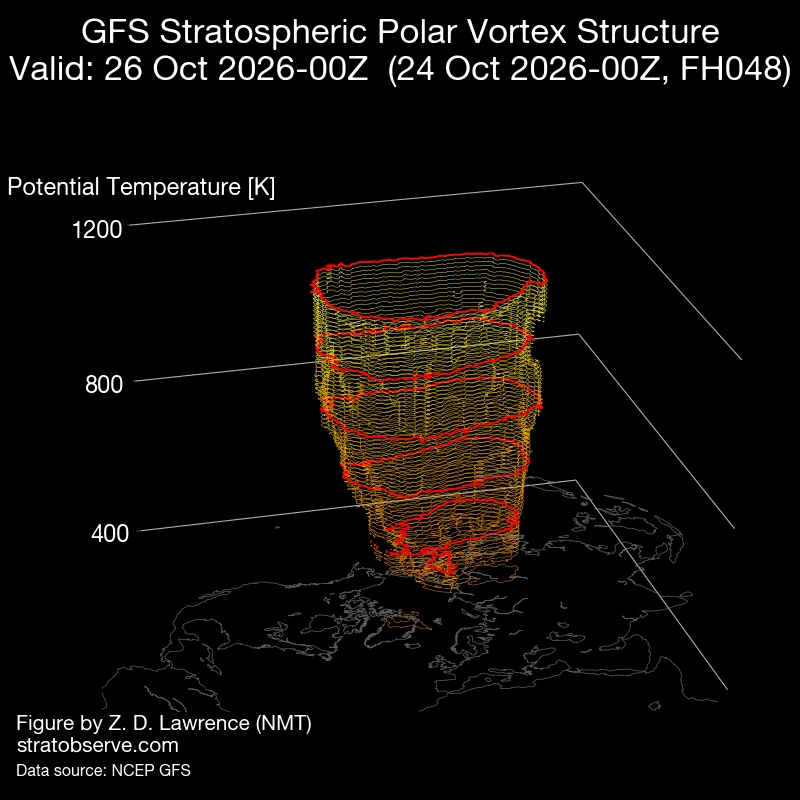
Image credit: Stratobserve
NASA Ozone Watch’s 2026/2027 Arctic product shows the 10-hPa circulation weakening through the forecast period. The wind falls to 12.04 m/s (26.9 mph) on October 31, 9.15 m/s (20.5 mph) on November 1, and 4.15 m/s (9.3 mph) on November 3.
This forecast lies well below the climatological distribution shown by NASA. The 1978/79–2025/26 climatology gives a November 3 mean of 25.97 m/s (58.1 mph) and a minimum of 14.35 m/s (32.1 mph), compared with the current forecast of 4.15 m/s (9.3 mph).
European forecast models also showed strong early-November weakening and that a few solutions reached complete wind reversal, The Weather Network reported on October 25. The outlet said reversal remained unlikely and that the guidance had not settled on the final outcome.
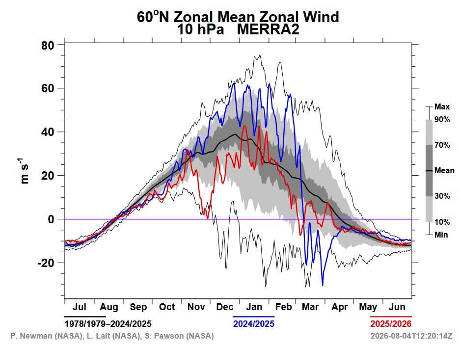
NASA’s available 60°N, 10-hPa forecast remains above zero through November 3. The product consequently shows sharp weakening of the westerly circulation during that period, rather than a wind reversal.
Environment and Climate Change Canada describes the Arctic polar vortex as a band of strong west-to-east stratospheric winds that forms every fall as declining sunlight cools the polar region.
ECCC’s 2026 climate assessment notes substantial variability in vortex behavior and says tropospheric circulation following sudden stratospheric warming events often resembles the negative phase of the North Atlantic Oscillation, a pattern associated with warmer-than-normal conditions in eastern Canada.
The Weather Network also warned that colder Canadian weather is not guaranteed and that the surface response depends on the later evolution of the lower-atmospheric circulation and jet stream.
The timing of the modeled weakening is the main anomaly. NASA’s climatology shows the mean 60°N, 10-hPa wind increasing from 21.53 m/s (48.2 mph) on October 25 to 25.97 m/s (58.1 mph) on November 3 as the seasonal vortex strengthens, while the current forecast falls sharply over the same period.
References:
1 2026/2027 Arctic MERRA-2 Wind – NASA Ozone Watch – accessed on October 26, 2026
2 Canada’s polar vortex wild card is waking up much earlier than expected – The Weather Network – October 25, 2026

Rishav Kothari is Editor-in-Chief of The Watchers, where he runs the newsroom and covers earthquakes, volcanoes, severe weather and space weather.
Published in the last 24 hours
- Weather radar tracked meteorites falling into Cape Cod Bay after a 1.1-kiloton fireball over Massachusetts on 30 May 2026; researchers have now traced its orbit almost out to Jupiter. Epicenter
- 10 named storms, one hurricane for the first time since 1925: Why has the Atlantic been so quiet in 2026 Epicenter
- Amazon fire hotspots rise 82.6% in October 2026 as El Niño intensifies Epicenter
- In 2005, a driver near Russia's Chulyshman River picked up a stone to wedge under his car wheel and kept it for 20 years; the Meteoritical Bulletin has now approved it as the Altai Republic's first meteorite. Epicenter
