
Typhoon Dolphin approaches landfall south of Taizhou, Zhejiang and Fujian raise emergency responses, China
Typhoon Dolphin is forecast to make landfall south of Taizhou along the southeastern Chinese coast on August 9, 2026. Zhejiang was put under a Level 1 typhoon emergency response, Fujian had raised its response to Level 2, and China’s National Meteorological Center maintained a red typhoon warning as the cyclone approached the coast. Fujian also reported 98 900 people relocated from risk areas, while ferry, rail and aviation restrictions are in effect in affected areas.
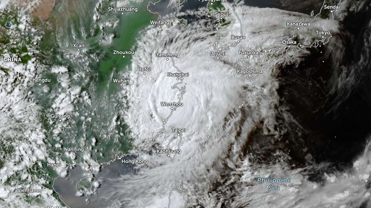
Satellite image of Typhoon Dolphin at 09:00 UTC on August 9, 2026. Credit: JMA/Himawari-9, Zoom Earth, The Watchers
At 14:00 LT (06:00 UTC) on August 9, the center of Typhoon Dolphin was located 335 km (208 miles) north of Taipei, Taiwan, according to the Joint Typhoon Warning Center (JTWC).
The system had 1-minute maximum sustained winds of approximately 140 km/h (85 mph). The cyclone is forecast to make landfall along the southeastern Chinese coast south of Taizhou sometime on August 9.
The western eyewall remained well defined and was brushing the coastline near Shitangzhen. Surface observations from Dachen Dao at 14:00 LT (06:00 UTC) recorded east-northeast winds of 83 km/h (52 mph) and an estimated minimum central pressure of 965 hPa.
Dolphin had moved west-northwest during the previous six hours at 22 km/h (14 mph), with a significant wave height of about 9 m (30 feet).
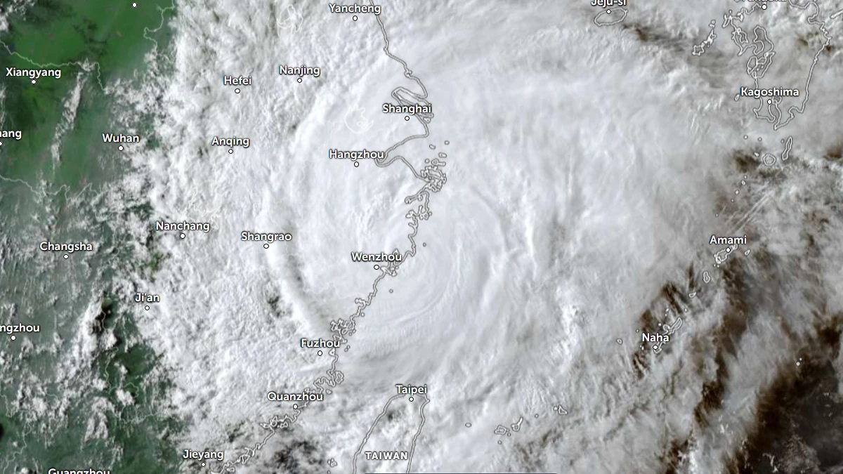
Satellite imagery showed a large cyclone with outer rainbands extending from Taiwan to Shanghai and a much smaller inner core surrounding a compact, cloud-filled eye. Radar imagery showed the eye becoming more ragged and less defined as Dolphin approached Zhejiang.
China’s National Meteorological Center placed Dolphin about 130 km (81 miles) east of Wenzhou at 14:00 LT (06:00 UTC), with 10-minute maximum winds of 162 km/h (101 mph) and a central pressure of 950 hPa.
The agency issued a red typhoon warning at 10:00 LT (02:00 UTC) and forecast landfall between Zhoushan in Zhejiang and Fuding in Fujian from the evening of August 9 into early August 10.
The environment remains favorable, but the imminent landfall means the system won’t have enough time to take advantage of the conditions.
The cyclone was being steered along the southern side of an extension of the subtropical ridge. JTWC placed the center of the ridge over southern Japan, with the ridge extending northwest toward the Shandong Peninsula.
No significant change is expected in Dolphin’s intensity during the short period before landfall. The cyclone was forecast to continue generally westward along the southern side of the ridge for about 12 hours before turning northwestward as the ridge moved slightly eastward.
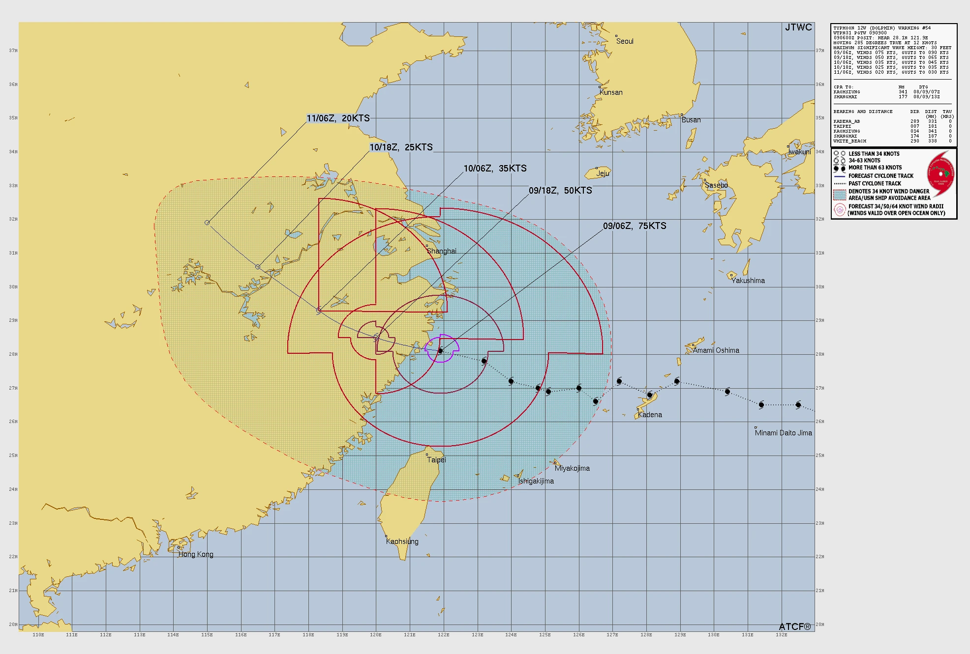
The landfall-stage analysis came while Chinese authorities maintained extensive emergency measures across the affected region.
Zhejiang’s provincial flood-control headquarters raised the province’s typhoon emergency response to Level I at 20:00 LT (12:00 UTC) on August 8. Fujian raised its provincial typhoon emergency response to Level II at 09:00 LT (01:00 UTC) on August 9.
The Fujian provincial government reported that 98 900 people had been relocated from risk areas by 18:00 LT (10:00 UTC) on August 8. It also reported that 17 800 flood-control responsibility personnel had been deployed to frontline duties.
Fujian authorities suspended 55 passenger and ferry routes, stopped work at 115 water engineering projects and moved 290 construction vessels to safe waters.

The Shanghai municipal government reported that all city ferry services were suspended. Above-ground sections of several metro lines were operating under speed restrictions, and some Yangtze River Delta rail services were temporarily suspended.
Nearly 60% of inbound and outbound flights at Shanghai Pudong and Hongqiao airports were adjusted or canceled.
Heavy rainfall remained a major secondary hazard. NMC forecast 250–500 mm (10–20 inches) of rain in parts of central and eastern Zhejiang during the 24 hours beginning at 14:00 LT (06:00 UTC) on August 9. Additional heavy rainfall was forecast across other parts of eastern China.
China’s National Flood Control Headquarters maintained a Level III flood- and typhoon-response for Zhejiang and Fujian. The Ministry of Emergency Management also activated a national Level IV geological-disaster emergency response for the two provinces.
National work teams had been sent to Zhejiang and Fujian. Authorities were also instructed to pre-position rescue forces and prepare emergency materials and equipment for possible heavy rainfall, mountain torrents and geological hazards.
Dolphin is occurring during the active western Pacific typhoon season. August is normally one of the active months for tropical cyclones affecting East and Southeast Asia.
References:
1 Prognostic Reasoning for Typhoon 12W (Dolphin), Warning No. 054 – JTWC – August 9, 2026
2 Typhoon Red Warning – NMC – August 9, 2026
3 The provincial flood control and drought relief headquarters maintains a level-three emergency response for typhoon prevention – Fujian Provincial Government – August 9, 2026

Rishav Kothari is Editor-in-Chief of The Watchers, where he runs the newsroom and covers earthquakes, volcanoes, severe weather and space weather.
