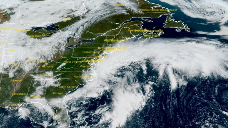
• High Wind and Coastal flood alerts issued as nor’easter brings coastal flooding to Virginia

    A strengthening nor’easter was producing coastal flooding in southeastern Virginia on September 25, 2026, while high winds, heavy rain, high surf and additional tidal flooding were forecast from New York to New England through the weekend. High Wind Warnings covered coastal Massachusetts and most of Rhode Island, with gusts of 70–95 km/h (45–60 mph) expected.E
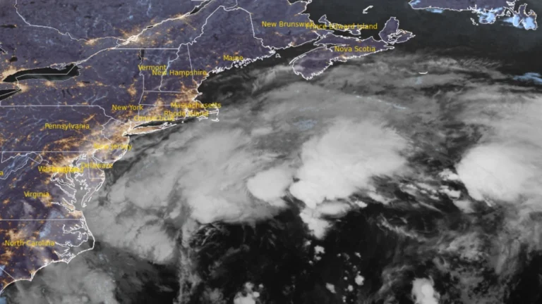
  • Long-duration nor’easter brings coastal flooding to Virginia, threatens Northeast US with damaging winds and heavy rain

    A long-duration nor’easter is forecast to bring coastal gusts of 70–95 km/h (45–60 mph) and periods of heavy rain to southern New England from September 25, 2026 through the weekend. High Wind Warnings are in effect for coastal and southeastern Massachusetts and most of Rhode Island. Coastal Flood Warnings remain in effect across southeastern Virginia, where the National Weather Service (NWS) forecasts 0.6–0.9 m (2–3 feet) of inundation.

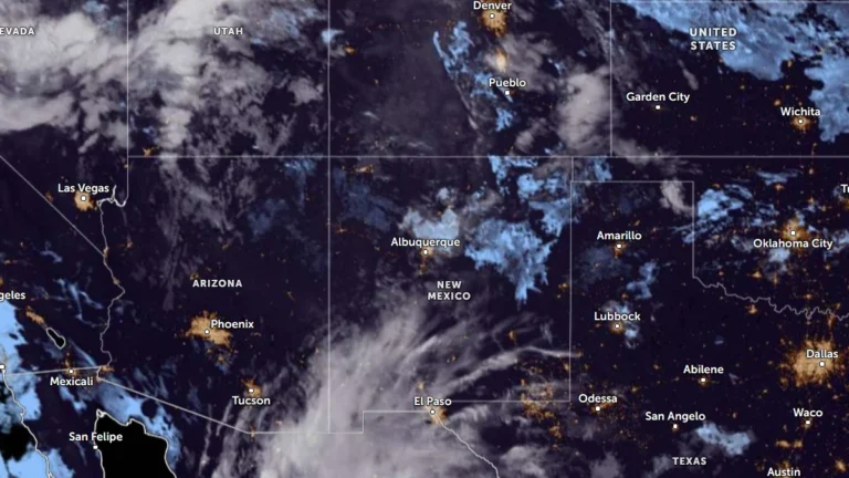
  • Flood watches cover much of New Mexico as multi-day heavy rainfall event begins

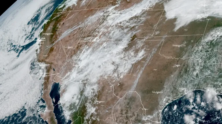
    Flood Watches cover much of New Mexico on September 22, 2026, as a multi-day surge of tropical and monsoon moisture is forecast to produce repeated rounds of heavy rain and thunderstorms through at least September 24. The Weather Prediction Center (WPC) placed portions of southern New Mexico under a Moderate Risk of excessive rainfall, level 3 of 4, for the first 24-hour period, with the Moderate Risk shifting into parts of eastern New Mexico during the following period. Flash flooding, river flooding and debris flows near recent burn scars are possible.

  • Heavy rain raises flash-flood risk across Arizona burn scars, slot canyons and saturated ground

    Heavy rainfall and repeated thunderstorms are raising the flash-flood threat across Arizona on September 16, 2026, with the Weather Prediction Center (WPC) placing parts of southern and central Arizona under a Moderate Risk of excessive rainfall. Flood Watches cover much of the state, while National Weather Service (NWS) offices warn that burn scars, slot canyons, and already saturated ground require particular attention during periods of heavy rainfall.

  • Moderate Risk of excessive rainfall issued for northeastern Kansas and northwestern Missouri

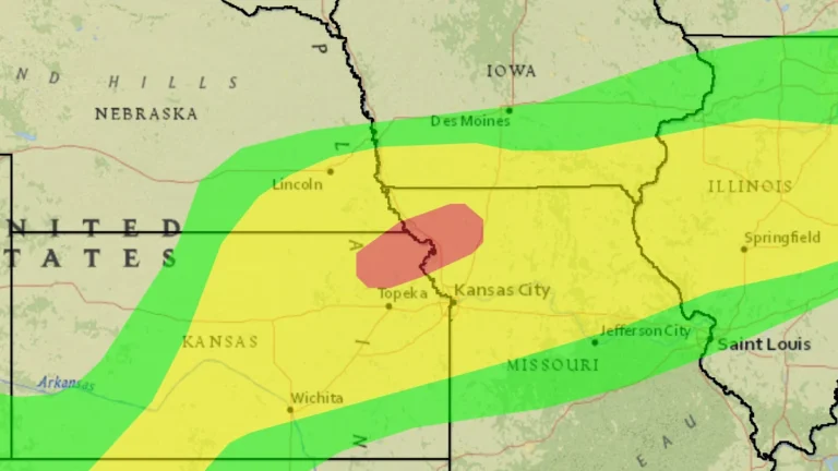
    The Weather Prediction Center (WPC) placed parts of northeastern Kansas and northwestern Missouri under a Moderate Risk of excessive rainfall from 07:00 CDT (12:00 UTC) on September 15 through 07:00 CDT (12:00 UTC) on September 16, 2026, as repeated thunderstorms threaten flash flooding. The Moderate Risk extends into far southeastern Nebraska, while parts of the northern Kansas City/Pleasant Hill forecast area have already received more than 127 mm (5 inches) of rain and could receive another 25–76 mm (1–3 inches).

  • Two tornadoes confirmed in Paraná, extratropical cyclone forecast to form near southern Brazil

    Two tornadoes were confirmed in Paraná between September 9 and 10, 2026, as severe weather affected southern Brazil, while three people were killed when a landslide struck a home during heavy rain in Ponta Grossa. The National Institute of Meteorology (INMET) warned of another period of intense instability on September 11, with an extratropical cyclone forecast to form Friday night between northeastern Rio Grande do Sul and the Atlantic Ocean.

  • Severe storms leave 2 dead, trigger flooding and evacuations across Italy, Slovenia and Croatia

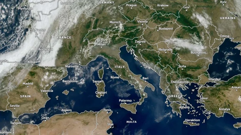
    Severe storms and torrential rainfall struck parts of Italy, Slovenia and Croatia on September 9 and 10, 2026, causing flooding, evacuations, transport disruption and localized infrastructure damage. Two women died in Italy during the event, one after becoming trapped in a flooded underpass at Latisana and another after being struck by broken window glass at Sinalunga.

  • Record rainfall floods roads and disrupts rail services in Nagoya, Japan

    Nagoya recorded 104.5 mm (4.1 inches) of rain in one hour on September 8, 2026, setting an all-time station record as flooding disrupted roads and rail services. Nagoya City issued Level 5 Emergency Safety Measures for communities along the Kanare, Yada and Ueda rivers, while the Japan Meteorological Agency and the Ministry of Land, Infrastructure, Transport and Tourism issued a Level 5 flood special warning for the Shonai River system at 18:20 LT (09:20 UTC). The municipal Level 5 measures were downgraded at 22:25 LT (13:25 UTC), while local media reported four injuries across Aichi Prefecture.

  • Thunderstorms, heavy rainfall and flash flood risk forecast across northern Italy, Slovenia and Croatia, ending late-summer heat

    Widespread thunderstorms and locally heavy rainfall are forecast across northern Italy, Slovenia and Croatia on September 9, 2026, with intense rainfall posing a risk of rapid rises in torrential watercourses and localized flash flooding. A marked temperature drop is also forecast behind the system, bringing substantially cooler conditions to northern Italy and parts of the Alpine and northern Adriatic region after the recent late-summer heat.