
Tropical Cyclone Narelle crosses Gascoyne coast with destructive winds and flooding, Western Australia
Severe Tropical Cyclone Narelle made landfall just south of Coral Bay, Western Australia, at approximately 09:30 AWST (01:30 UTC) on March 27, 2026, as a Category 3 system. It brought wind gusts up to 195 km/h (121 mph), intense rainfall, and a dangerous storm tide along the Gascoyne coast. Severe weather conditions are continuing inland through the day and are forecast to persist into March 28.
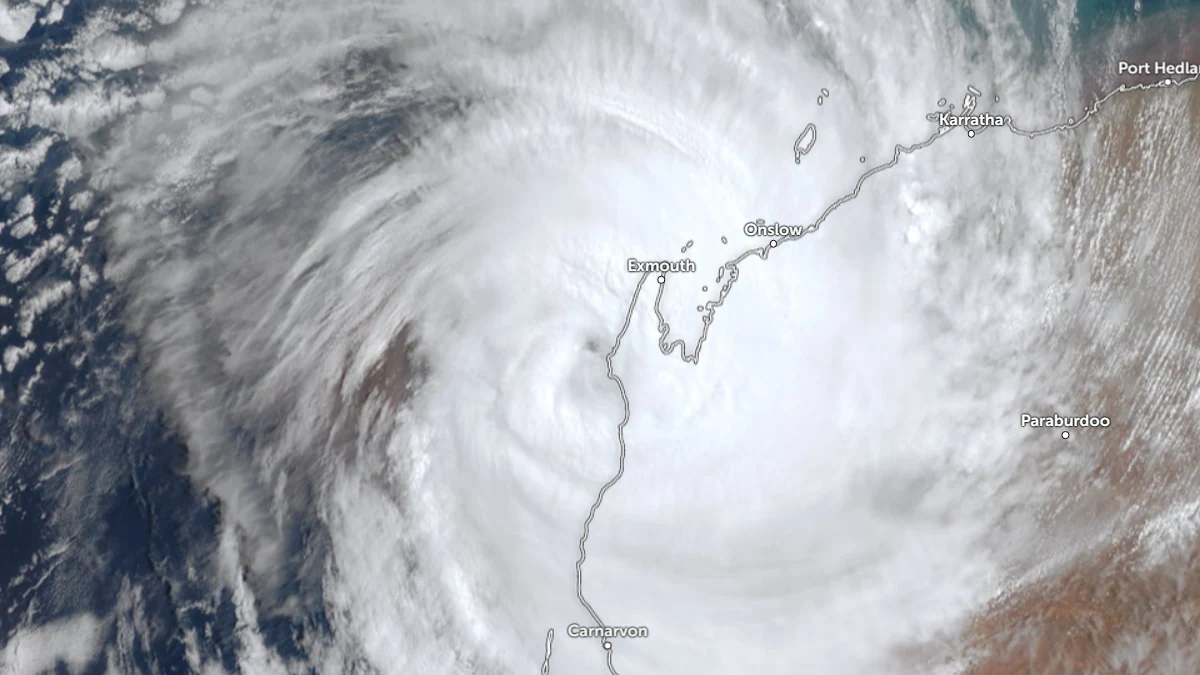
Satellite image of Tropical Cyclone Narelle making landfall over the coast of Western Australia at 01:30 UTC on March 27, 2026. Credit: JMA/Himawari-9, Zoom Earth, The Watchers
Severe Tropical Cyclone Narelle made landfall just south of Coral Bay along the Gascoyne coast of Western Australia at approximately 09:30 AWST (01:30 UTC) on March 27 as a Category 3 cyclone.
At landfall, the system had 10-minute sustained winds of approximately 140 km/h (87 mph), with maximum wind gusts reaching up to 195 km/h (121 mph), producing destructive conditions along the coast and adjacent inland areas.
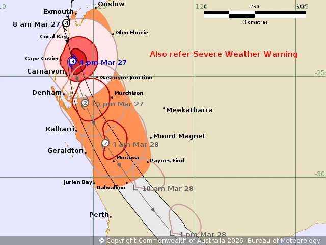
Narelle tracked south to south-southeast at approximately 28 km/h (17 mph), moving inland over the Gascoyne while gradually weakening due to land interaction and increasing wind shear.
By 14:00 AWST (06:00 UTC) on March 27, the system had 10-minute maximum sustained winds of 150 km/h (93 mph) with 3-second gusts of 205 km/h (127 mph), and an estimated minimum central pressure of 956 hPa. It was moving south at 23 km/h (14 mph).
The very destructive core crossed the coastline south of Coral Bay, bringing extreme wind gusts up to 195 km/h (121 mph). Carnarvon was expected to experience wind gusts up to 170 km/h (106 mph) as the system passed to the east.
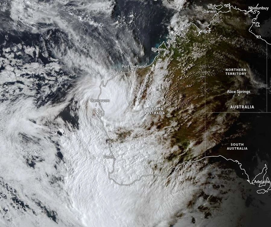
Destructive wind gusts exceeding 125 km/h (78 mph) extended south from the west Pilbara through Ningaloo toward Carnarvon and were forecast to reach Denham and inland parts of the Central West.
Damaging wind gusts of up to 120 km/h (75 mph) affected a broader area from west of Onslow to south of Carnarvon and extended inland toward Murchison.
Heavy to intense rainfall accompanied the system, with 6-hour totals of 30–50 mm (1.2–2 inches) and locally higher amounts. Severe flash flooding was observed in parts of the western Pilbara and was forecast to extend southward into the Gascoyne and Central West as the system progressed inland.

A dangerous storm tide developed along coastal areas between Onslow and Denham, with sea levels rising significantly above normal high tide, resulting in coastal flooding and damaging wave action along exposed sections of the Gascoyne coastline.
As the system moves inland, the strongest winds are expected to shift to the eastern side due to increasing wind shear and forward motion, enhancing wind impacts across inland regions as the cyclone accelerates toward the south-southeast.
Forecast guidance indicates rapid weakening through March 28 as the system moves across the Central West into the South West Land Division, transitioning into a tropical low. Despite weakening, heavy rainfall and damaging winds are expected to persist across a broad area, including regions east of Perth and toward the south coast.
Flood watches have been issued across western parts of Western Australia, including the Gascoyne, western Pilbara, and Wheatbelt, with river and creek rises possible as rainfall continues.
Severe weather warnings remain in effect for damaging to locally destructive winds and heavy rainfall across much of southwestern Western Australia, with hazardous conditions expected to continue through March 28.
References:
1 Tropical Cyclone Advice – BoM – March 27, 2026
2 Tropical Cyclone Forecast Track Map – BoM – March 27, 2026
3 Tropical Cyclone Technical Bulletin – BoM – March 27, 2026

I am an Assistant Editor and Severe Weather & Science Journalist at The Watchers, specializing in real-time severe weather coverage, geophysical event reporting, and research-driven scientific analysis. You can reach me at rishav(at)watchers(.)news.
Commenting rules and guidelines
We value the thoughts and opinions of our readers and welcome healthy discussions on our website. In order to maintain a respectful and positive community, we ask that all commenters follow these rules.