
June 10 derecho produces widespread wind damage, tornadoes, and large hail across Midwest and Great Lakes
The Storm Prediction Center (SPC) said a fast-moving convective system that crossed parts of the Midwest and Great Lakes on June 10, 2026, has been preliminarily classified as a derecho after producing widespread wind damage, downed power lines, and measured gusts exceeding 145 km/h (90 mph).
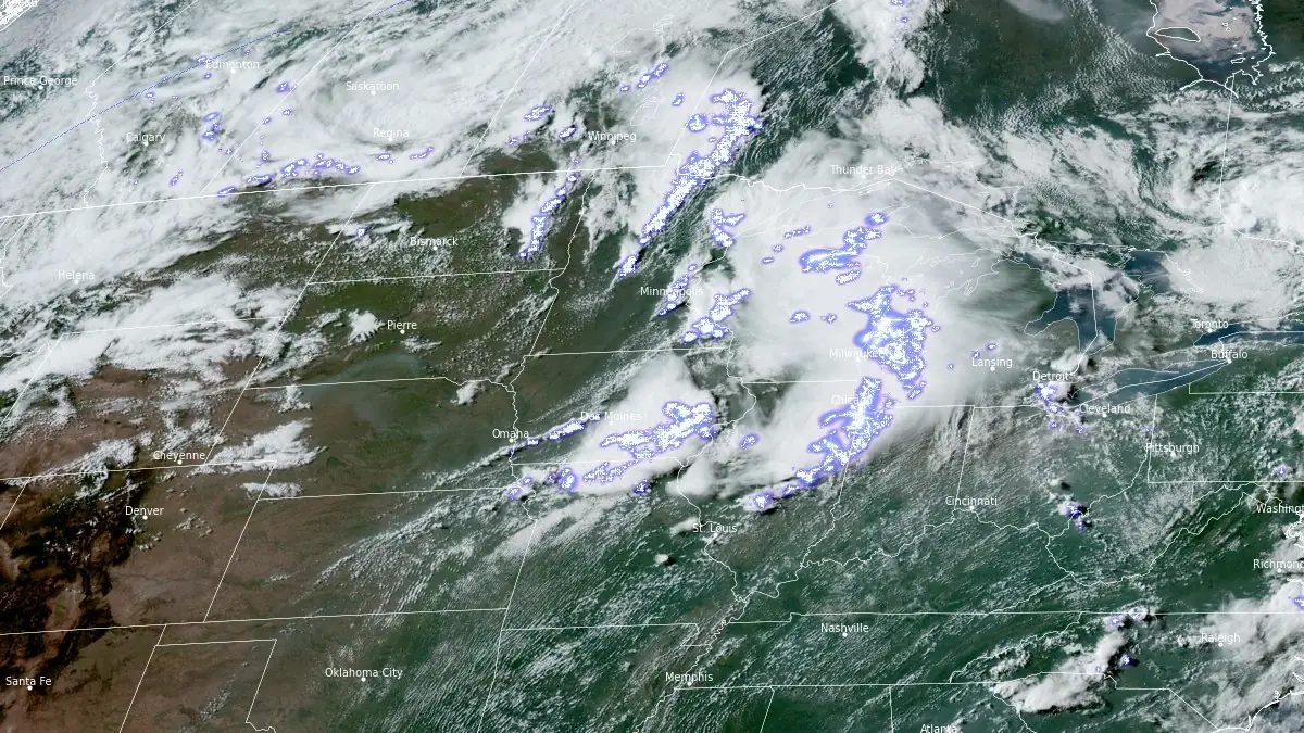
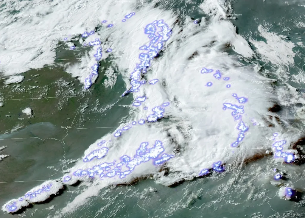
GOES-East GeoColor satellite image at 22:20 UTC on June 10, 2026, showing the organized mesoscale convective system associated with the SPC-confirmed derecho as it intensified across the Midwest toward the Great Lakes. Credit: NOAA/GOES-EAST, RAMMB/CIRA, The Watchers
The storm system produced a damaging wind swath exceeding 644 km (400 miles), meeting the SPC’s spatial threshold for derecho classification as severe thunderstorms moved from the Midwest into the Great Lakes region. The most impactful storms occurred during the afternoon, when a line of thunderstorms produced widespread wind damage across much of northern Illinois.
The strongest verified wind report was a gust of 151 km/h (94 mph), measured at 20:17 UTC on June 10 at KOSH / Oshkosh Airport in Wisconsin. Earlier in the event, a trained spotter reported a 142 km/h (88 mph) gust near Darlington, Wisconsin, at 18:28 UTC. Additional severe gusts exceeding 93 km/h (58 mph) were documented across Iowa, Illinois, Wisconsin, and Michigan.
The National Weather Service (NWS) office in Chicago said the storm line was formally classified as a derecho and produced gusts of up to around 130 km/h (80 mph) across parts of northern Illinois. Preliminary reports included trees uprooted onto homes, roof and outbuilding damage, downed power lines, damaged utility poles, and roads blocked by debris.
According to PowerOutage.us data and regional reporting, more than 500 000 customers lost electricity at the height of the disruption, with Illinois accounting for more than 300 000 outages, including nearly 200 000 in Cook County, while large outages were also reported in Indiana, Wisconsin, and Michigan. Restoration efforts continued into June 13 as utility crews worked to clear debris and repair damaged infrastructure.
As of 04:50 CDT (09:50 UTC) on June 13, 85 000 customers were still without power in Illinois and 57 000 in Indiana.
SPC preliminary reports show the convective line intensified across portions of eastern Iowa and southern Wisconsin before moving through northern Illinois and into western Michigan during the evening hours.
Wind-related damage reports in Illinois included trees down on homes near Crystal Lake, damaged roofs and outbuildings near Morris and Lisbon, utility poles down along Illinois Route 47, and damaged interstate signage near Interstate 55.
Trees and power lines were downed, and homes were damaged in Allegan County as the system entered western Michigan.
The severe weather event produced multiple tornadoes and dropped large hail along portions of the convective corridor. Tornado sightings were reported in parts of Iowa, Illinois, Wisconsin, and Indiana, including reports near Streator, Illinois, Dwight, Illinois, and Somers, Wisconsin.
In total, SPC received 23 tornado reports — 14 from Illinois, 6 from Indiana, 2 from Wisconsin, and one each from Iowa and Texas.
As of 23:00 CDT on June 12 (04:00 UTC on June 13), NWS Chicago identified at least 7 tornadoes, led by EF3 at Kouts, IN, and Streator, IL, followed by an EF2 tornado at Merrillville, IN, EF1 tornadoes at Wenona/Osage Township, IL, Graymont to Dwight, IL, and Bartlett, IL, and an EF0 tornado at St. John, IN.
SPC reports included hail up to 6.35 cm (2.5 inches) near Wenona, Illinois, with multiple reports of hail measuring around 4.5 to 5 cm (1.75 to 2 inches) elsewhere in the storm environment.
At least one storm-related fatality was reported during the severe weather outbreak. Authorities in Polk County, Iowa, said a man in Des Moines died after a tree fell on him during severe storms on June 11, while damage assessments and injury reports continued across parts of the Midwest and Great Lakes region.
Derecho is a widespread, long-lived windstorm associated with a fast-moving band of severe thunderstorms that produces a concentrated corridor of damaging winds extending at least 400 km (250 miles), with several measured gusts of 121 km/h (75 mph) or greater along the path.
References:
1 June 10, 2026: Derecho Produces Widespread Wind Damage Across Northern Illinois – NWS Chicago – June 13, 2026
2 One dead, hundreds of thousands without power after tornadoes and severe storms hit Midwest and Northeast – The Watchers – June 12, 2026
I'm a dedicated researcher, journalist, and editor at The Watchers. With over 20 years of experience in the media industry, I specialize in hard science news, focusing on extreme weather, seismic and volcanic activity, space weather, and astronomy, including near-Earth objects and planetary defense strategies. You can reach me at teo /at/ watchers.news.
Commenting rules and guidelines
We value the thoughts and opinions of our readers and welcome healthy discussions on our website. In order to maintain a respectful and positive community, we ask that all commenters follow these rules.