
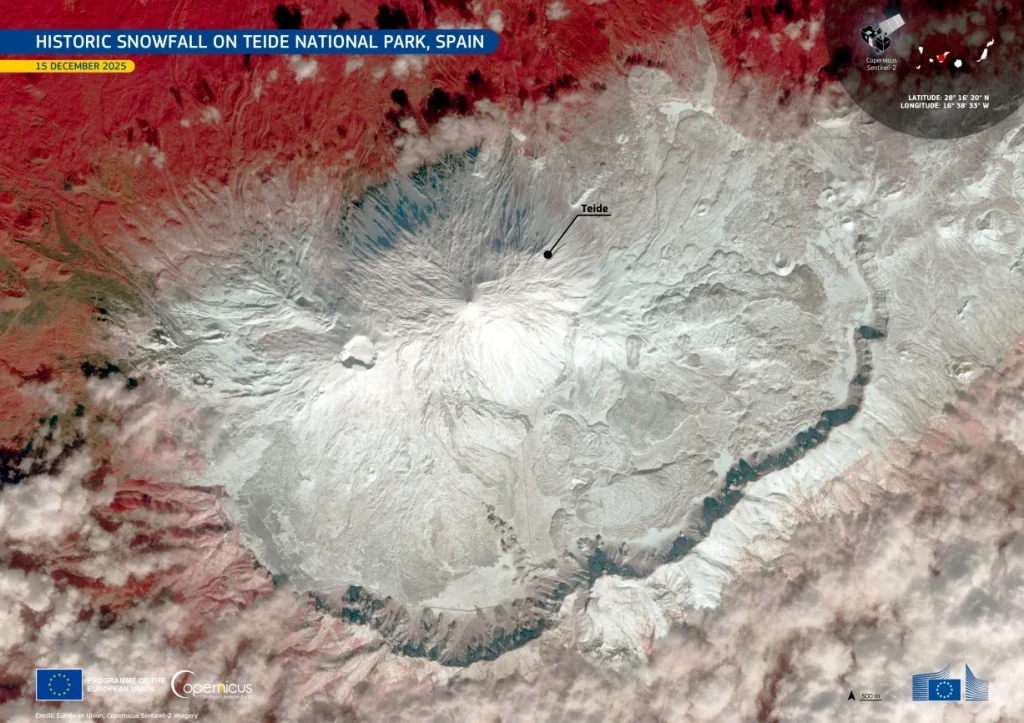
Storm Emilia drops historic snowfall over Mount Teide, Tenerife
A significant snowfall covered Mount Teide and the surrounding high-altitude terrain in Teide National Park on Tenerife, Canary Islands, during mid-December 2025, following the passage of Storm Emilia. Snow accumulation locally reached around 1.5 m (5 feet), marking the most substantial snowfall at the summit area since 2016. The event temporarily affected access and operations within the park.
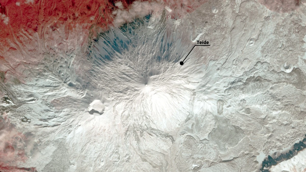
Historic snowfall over Teide volcano, Canary Islands, Spain captured on December 15, 2025. Credit: CopernicusEU/Sentinel-2
A mid-December winter storm produced an unusually extensive snow cover across Mount Teide, a high-altitude volcano located near 28°N latitude in the subtropical eastern Atlantic.
False-color satellite imagery acquired on December 15, 2025, shows snow spread widely across summit slopes and interior plateaus of Teide National Park following the passage of Storm Emilia, a rare outcome for this region and time of year.
Snow accumulation reached up to approximately 1.5 m (5 feet) in exposed highland areas, marking the most significant snowfall observed at the site since 2016. Local authorities temporarily restricted access to sections of the park as snow covered roads, trails, and volcanic terrain not typically affected by deep winter conditions.
Such events remain infrequent in the Canary Islands, where snowfall is generally limited to brief, shallow episodes confined to the highest elevations.
The spatial extent of snow visible in satellite data shows the scale of the event, with coverage extending beyond the summit cone into surrounding calderas and lava plains. Multispectral observations allow snow to be clearly distinguished from dark volcanic rock, providing accurate mapping of snow extent and persistence in a landscape where surface conditions can change rapidly following storms.
Mount Teide rises to 3 715 m (12 188 feet) above sea level and is the highest point in Spain. It dominates Teide National Park, a UNESCO World Heritage Site recognized for its well-preserved volcanic landforms, including lava flows, crater walls, and erosion-shaped structures formed over successive eruptive phases.
The park hosts a range of endemic plant species adapted to dry, high-elevation environments. Snowfall plays a limited but important role in local hydrology and ecological processes, particularly when accumulation is deep enough to persist for several days. Monitoring such events helps assess potential impacts on vegetation, soil stability, and visitor safety.
Copernicus Sentinel-2 satellite data are routinely used to monitor snow extent, surface conditions, and environmental changes in protected mountainous regions. In volcanic landscapes like Teide, satellite observations provide a consistent method for tracking rare extreme weather events and supporting operational decision-making during and after severe storms.
I'm a dedicated researcher, journalist, and editor at The Watchers. With over 20 years of experience in the media industry, I specialize in hard science news, focusing on extreme weather, seismic and volcanic activity, space weather, and astronomy, including near-Earth objects and planetary defense strategies. You can reach me at teo /at/ watchers.news.
Commenting rules and guidelines
We value the thoughts and opinions of our readers and welcome healthy discussions on our website. In order to maintain a respectful and positive community, we ask that all commenters follow these rules.