
Satellite data show continued expansion of Home Reef volcano in Tonga
Satellite monitoring confirms that Home Reef volcano in Tonga remains active nearly two months after its latest eruption began on December 17, 2025. The eruption has expanded the island’s surface area by nearly 8 ha (20 acres) as lava flows extended its margins east, south, northwest, and north.
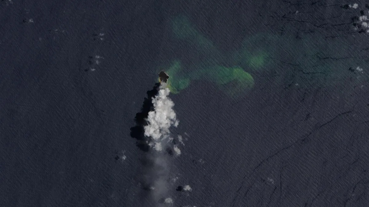
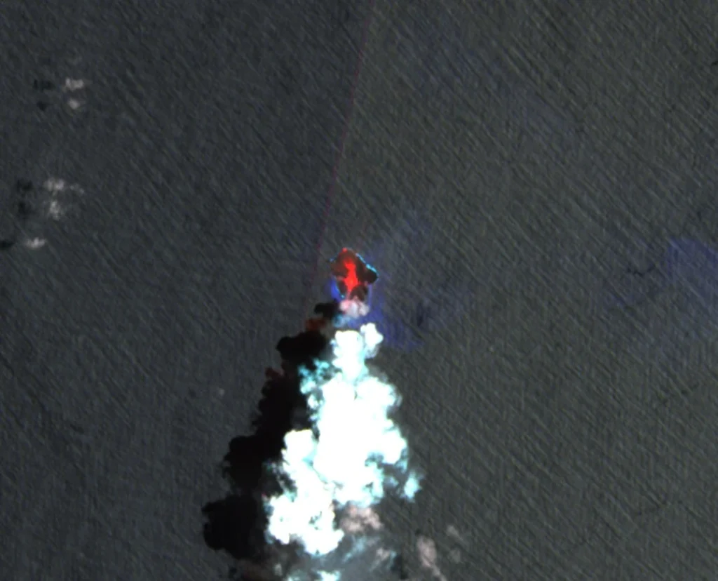
Satellite image of Home Reef volcano, Tonga on February 15, 2026. Credit: Copernicus EU/Sentinel-2, The Watchers
Home Reef, a submarine volcano located between Metis Shoal and Late Island in the central Tonga archipelago, remains active as of mid-February 2026 following renewed eruptive activity that began on December 17, 2025.
Data from the Operational Land Imager (OLI) aboard Landsat 8 and Landsat 9, together with synthetic aperture radar observations from the German Aerospace Center’s TerraSAR-X satellite, show that the eruption has added nearly 8 ha (20 acres) of new land over the past two months.
As of February 15, the volcanic island covered approximately 0.26 km2 (0.10 mi2), equivalent to about 26 ha (64 acres).
Thermal anomalies detected by the Moderate Resolution Imaging Spectroradiometer (MODIS) and the Visible Infrared Imaging Radiometer Suite (VIIRS) confirm persistent heat emission and active lava effusion.
During the initial phase of the eruption, lava flows extended the island east and south before advancing toward the northwest and north. Radar data show progressive shoreline expansion and the formation of new lava platforms. Volcanic gases and steam continue to rise from a central vent approximately 100 m (330 feet) in diameter, with intermittent ash emission reported in late January 2026.
Observations of increased plume heights during late January led Tonga Geological Services to raise the Aviation Color Code to Orange. Authorities stated that the eruption posed no direct threat to populated islands such as Vavaʻu and Haʻapai, located tens of kilometers from the vent.
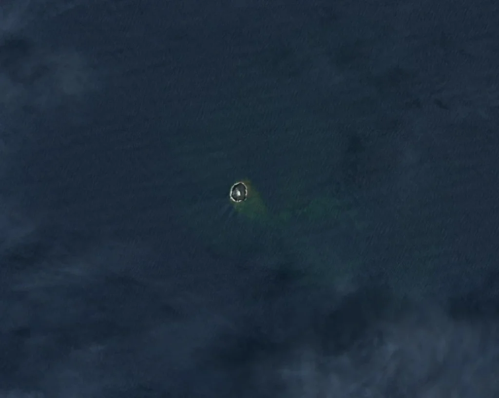
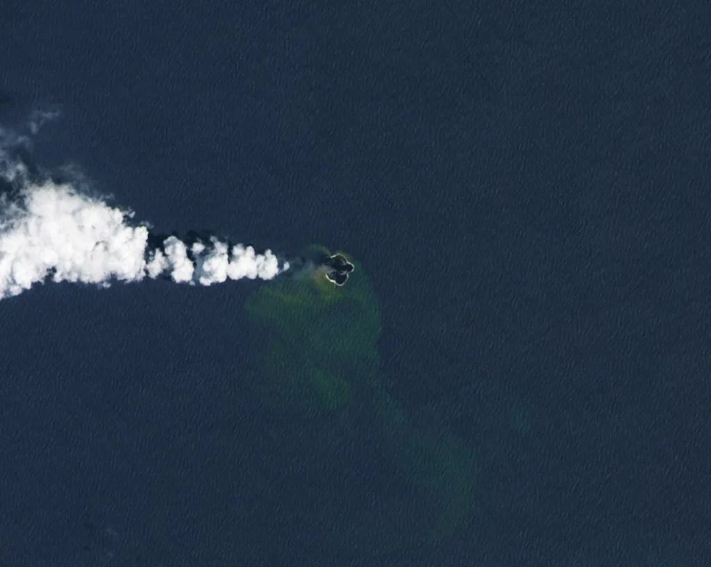
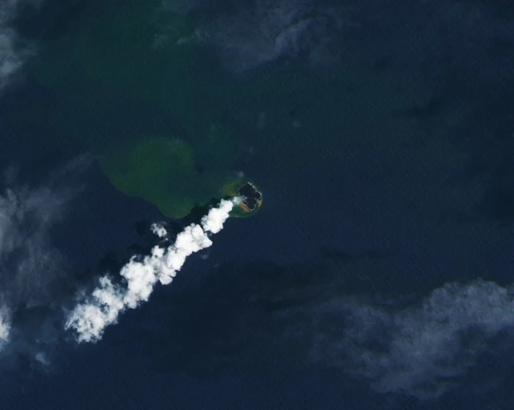
Greenish discoloration of seawater surrounding the island is produced by magmatic fluids, volcanic gases, and fine rock fragments mixing with ocean water.
Such plumes can contain sulfur and iron compounds released during submarine eruptions. Elevated temperatures and localized acidity occur near the vent but typically diminish as seawater mixing restores ambient conditions.
Home Reef forms part of the Tonga Volcanic Arc, a segment of the Tonga–Kermadec subduction zone where the Pacific Plate descends beneath the Indo-Australian Plate.
The volcano has a history of episodic island formation followed by erosion; documented emergence events occurred in 1852, 1857, 1984, 2006, and 2022. The present eruption represents another phase of short-term island construction that may later be reshaped by wave action and marine erosion.
High-resolution optical and radar satellite systems provide continuous measurement of surface change, thermal output, and plume dispersion in this remote region. Integration of Landsat, TerraSAR-X, MODIS, and VIIRS datasets enables near-real-time assessment of volcanic growth and supports aviation and marine hazard monitoring across the central South Pacific.
Home Reef’s activity continues to be monitored by Tonga Geological Services and the Smithsonian Institution’s Global Volcanism Program. As of mid-February 2026, no large explosive phase has been reported, and the eruption remains classified as low risk to inhabited areas.
I'm a dedicated researcher, journalist, and editor at The Watchers. With over 20 years of experience in the media industry, I specialize in hard science news, focusing on extreme weather, seismic and volcanic activity, space weather, and astronomy, including near-Earth objects and planetary defense strategies. You can reach me at teo /at/ watchers.news.
Commenting rules and guidelines
We value the thoughts and opinions of our readers and welcome healthy discussions on our website. In order to maintain a respectful and positive community, we ask that all commenters follow these rules.