
60 000 evacuated as Tropical Storm Tapah makes landfall near Taishan, China
Over 60 000 people were evacuated as Tropical Storm Tapah made landfall near China’s Taishan (Jiangmen), Guangdong Province, at about 00:50 UTC on September 8, 2025. The storm brought severe weather across the province, causing traffic disruption and leaving at least 12 people injured.
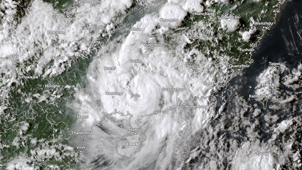
Satellite image of Tropical Storm Tapah over Chinese mainland at 04:50 UTC on September 8, 2025. Credit: JMA/Himawari-9, Zoom Earth, The Watchers
Tropical Storm Tapah, also designated Typhoon No. 16, made landfall near Taishan, a county-level city under Jiangmen, Guangdong Province, at 08:50 LT (00:50 UTC) on September 8, with maximum sustained winds near 110 km/h (68 mph), according to the Hong Kong Observatory (HKO).
Authorities in Guangdong evacuated about 60 000 residents ahead of the storm as heavy rain and strong winds spread across the province. Initial reports confirmed at least 12 people injured, more than 160 cases of fallen trees and three flooding incidents, while emergency response teams were deployed to reinforce reservoirs, power facilities and other vulnerable infrastructure.
Hundreds of people used temporary shelters while public-transport services, including buses, ferries and trams, were widely suspended and the Mass Transit Railway (MTR) operated on reduced schedules. Court hearings were also suspended during the warning period.
A runway at Hong Kong International Airport was temporarily closed after an HK Express flight from Beijing veered onto the grass during landing, with smoke briefly observed from its landing gear. No injuries were reported, and the incident remains under investigation to determine whether it was weather-related.
HKO raised the Typhoon Signal No. 8 late on September 7; the warning remained in force into the morning of September 8 while heavy rain bands and gale-force winds affected the territory.
Macau reported localized flooding in low-lying districts but no major structural damage in the initial reports. Macau authorities issued contingency notices and weather advisories as the system passed nearby.
Following landfall, Tapah tracked inland and was forecast to move northwest toward parts of Guangxi, including near Wuzhou.
Provincial flood control offices and the National Meteorological Center warned of continued heavy rain and a heightened risk of flash flooding and landslides; some provincial forecasts cited possible cumulative rainfall totals of 250–400 mm (10–16 inches) in affected areas.

I am an Assistant Editor and Severe Weather & Science Journalist at The Watchers, specializing in real-time severe weather coverage, geophysical event reporting, and research-driven scientific analysis. You can reach me at rishav(at)watchers(.)news.
Commenting rules and guidelines
We value the thoughts and opinions of our readers and welcome healthy discussions on our website. In order to maintain a respectful and positive community, we ask that all commenters follow these rules.