
Arctic blast forecast to bring extreme cold across the Northeast and Mid-Atlantic through February 11
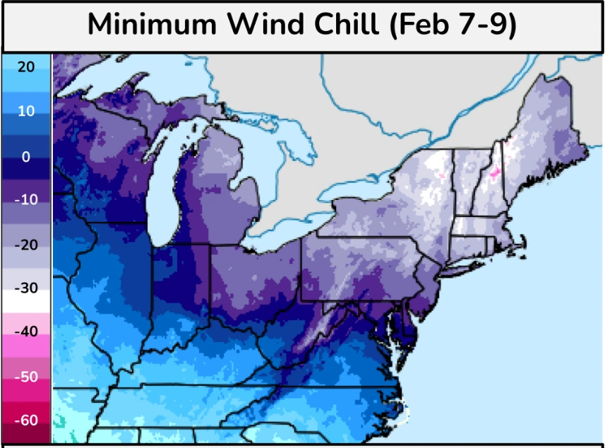
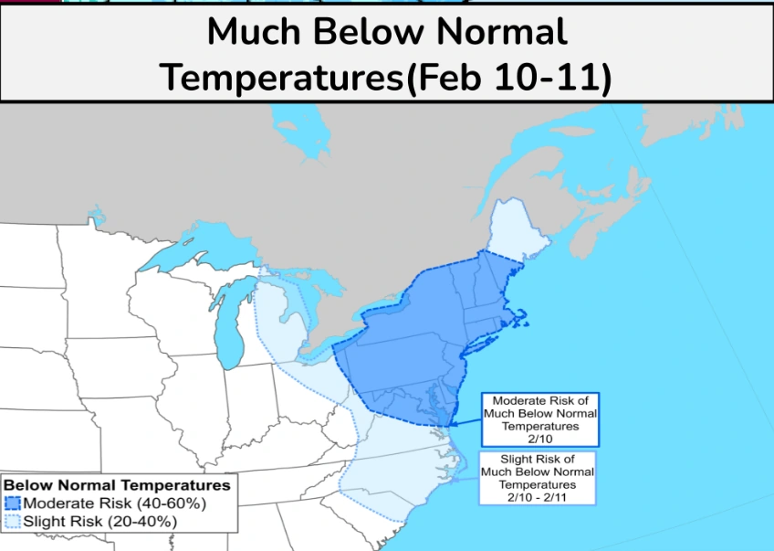
A powerful Arctic blast is forecast to bring extreme cold and dangerous wind chills across the Northeast and Mid-Atlantic from the weekend into the second week of February. Below-normal temperatures and record lows are expected in some areas, with the cold forecast to persist until February 11, 2026.
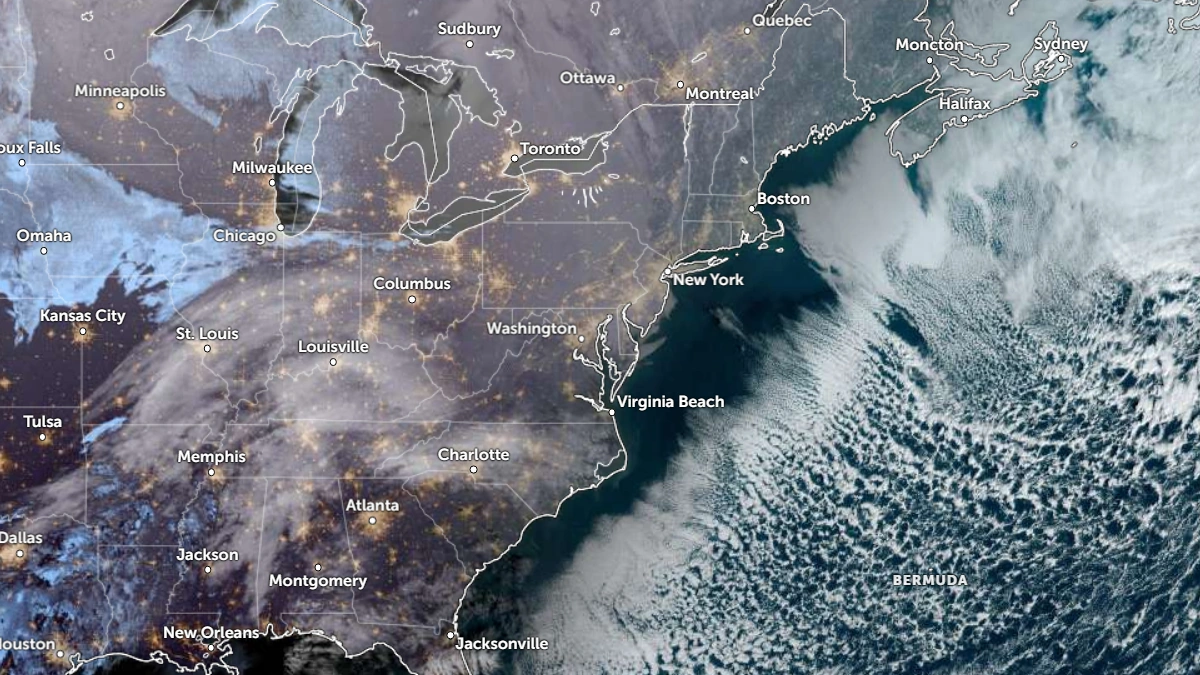
Satellite image of the U.S. Northeast and Mid-Atlantic at 13:10 UTC on February 3, 2026. Credit: NOAA/GOES-19, Zoom Earth, The Watchers
A powerful Arctic Blast is forecast to bring extreme cold and dangerous wind chills across the Northeast and Mid-Atlantic over the weekend into the second week of February.
Below-normal temperatures, along with record lows, are expected in some areas. Gusty winds and sub-zero wind chills will worsen the conditions across the region starting this week.
The extreme cold is forecast to linger across parts of the Mid-Atlantic and the Northeast until February 11, according to the Weather Prediction Center (WPC).
Forecast uncertainty remains about the exact time and impacts of the Arctic outbreak, with a more detailed forecast expected in the coming days.
Currently, a low-pressure system is forecast to bring rain and thunderstorms from Texas across the South and Southeast, reaching the Gulf Coast and Southeast by February 3. Showers and thunderstorms will then move into Florida on February 4.
Light wintry precipitation is forecast from the upper Ohio Valley to the Mid-Atlantic, starting on February 3 and will begin to taper off by February 5. Showers and some thunderstorms are forecast to move through the Southeast on the night of February 4, before reaching into the Florida Peninsula by the morning of February 5, ahead of a cold front trailing from the low-pressure wave.
An Alberta clipper is forecast to bring light snow flurries to the Great Lakes, as anomalous warmth spreads across the Northern High Plains by February 5.
This comes just after a powerful nor’easter brought historic snow to the Carolinas and deep winter cold across much of the eastern United States over the past weekend. The storm disrupted travel, caused power outages, and extended freezing conditions into Georgia and Alabama.
Read more:

Rishav Kothari is Editor-in-Chief of The Watchers, where he runs the newsroom and covers earthquakes, volcanoes, severe weather and space weather.
Published in the last 24 hours
- Strong El Niño reinforces above-normal winter precipitation outlook across southern and eastern U.S.
- Scientists directly observe how submarine landslides unfold in western Canada Epicenter
- Odisha evacuated 983,642 people before Phailin crossed near Gopalpur on 12 October 2013 with winds of 200-210 km/h gusting to 220, and 44 died, against 9,885 in the 1999 super cyclone. Cyclone Akvan crossed the same coast on 20 November 2026. Epicenter
- Lava fountains reached 1,900 feet (580 m) at Kīlauea Iki in 1959, the highest ever recorded at Kīlauea, as USGS forecasts episode 57 fountaining at Halemaʻumaʻu for November 22-26. Epicenter
