
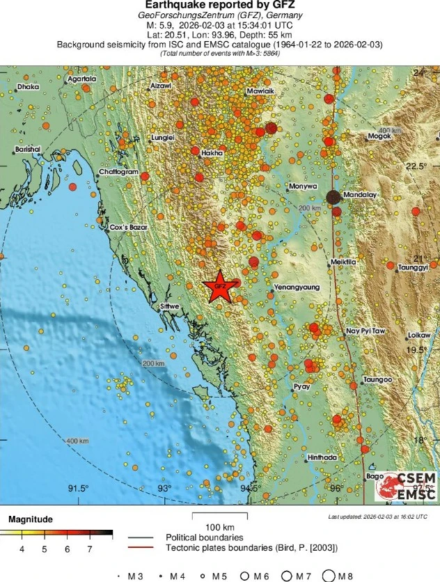
M5.9 earthquake hits Rakhine-Magway border region, Myanmar
A strong earthquake registered by the USGS as M5.9 struck Myanmar at 15:34 UTC (22:04 LT) on February 3, 2026. The agency is reporting a depth of 62.7 km (39 miles). EMSC is reporting M5.9 at a depth of 55 km (34 miles). The USGS issued a Green alert for shaking-related fatalities and economic losses.

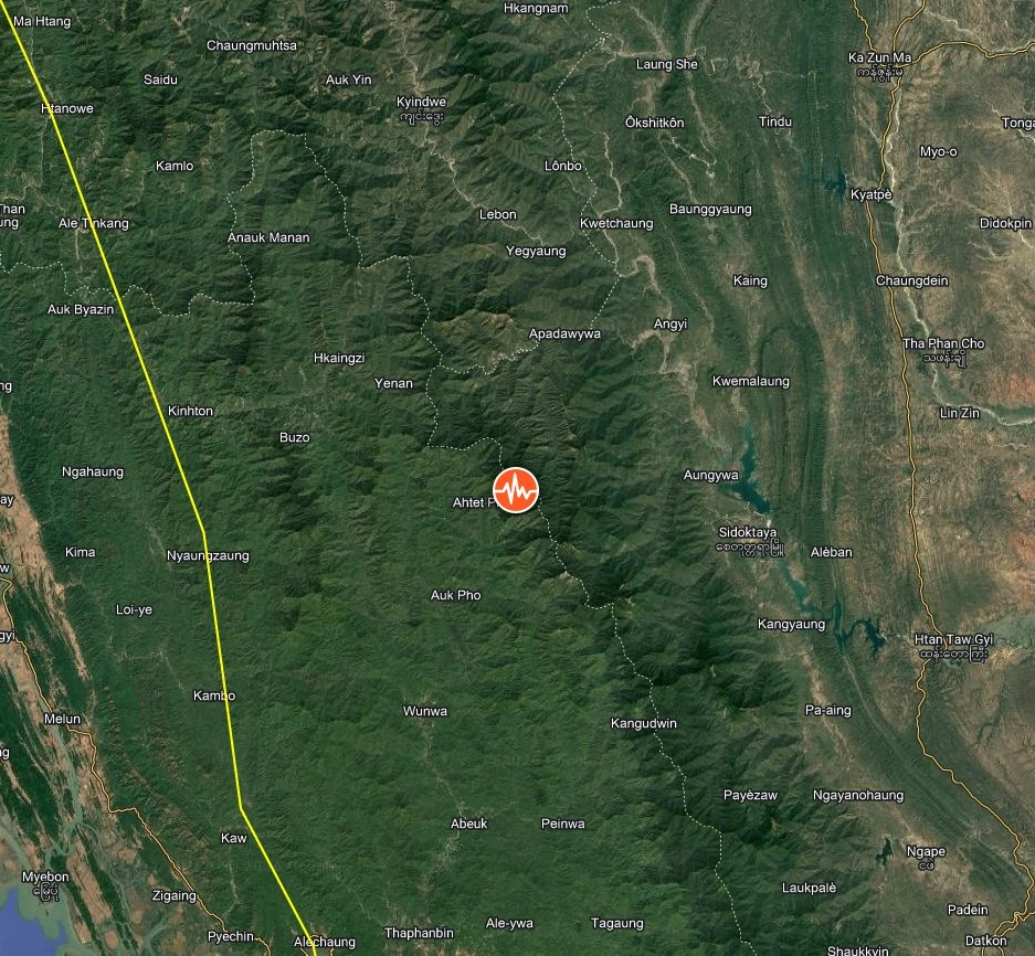
Epicenter of M5.9 earthquake in Myanmar on February 3, 2026. Credit: TW/SAM, Google
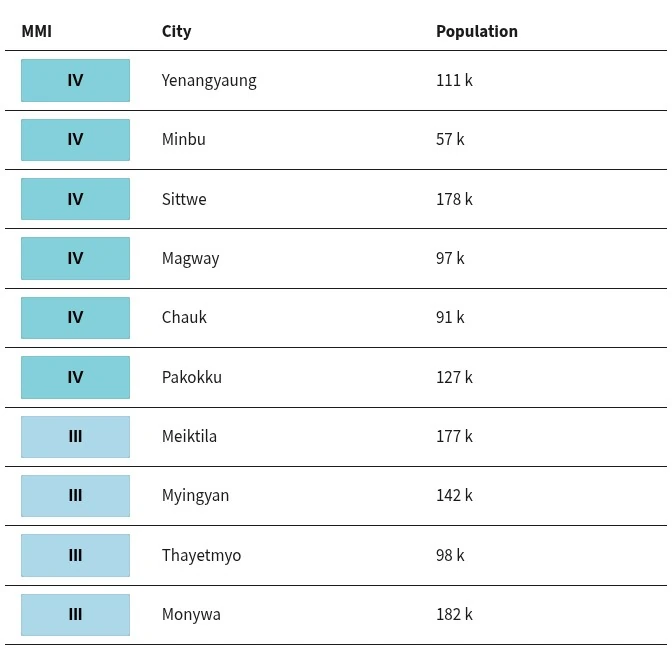
The epicenter was located 95 km (59 miles) W of Yenangyaung (population 110 553), 101 km (63 miles) WNW of Minbu (population 57 342), 102 km (63 miles) WSW of Chauk (population 90 870), 108 km (67 miles) WNW of Magway (population 96 954), and 116 km (72 miles) ENE of Sittwe (population 177 743), Myanmar.
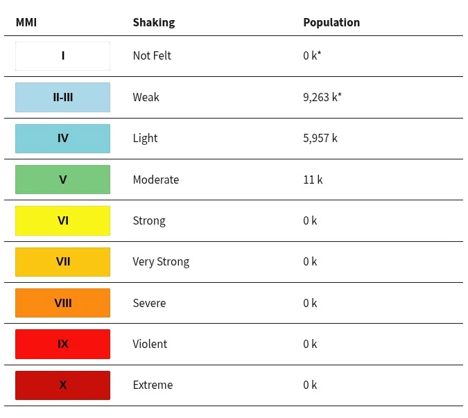
9 263 000 people are estimated to have felt weak shaking, 5 957 000 light and 11 000 moderate.
The USGS issued a Green alert for shaking-related fatalities and economic losses. There is a low likelihood of casualties and damage. Overall, the population in this region resides in structures that are vulnerable to earthquake shaking, though resistant structures exist.
The predominant vulnerable building types are adobe block with wood and rubble/field stone masonry. Recent earthquakes in this area have caused secondary hazards such as landslides that might have contributed to losses.
Liquefaction triggered by this earthquake is considered unlikely. No significant landsliding is expected.
Estimated population exposure to earthquake shaking
Selected cities exposed
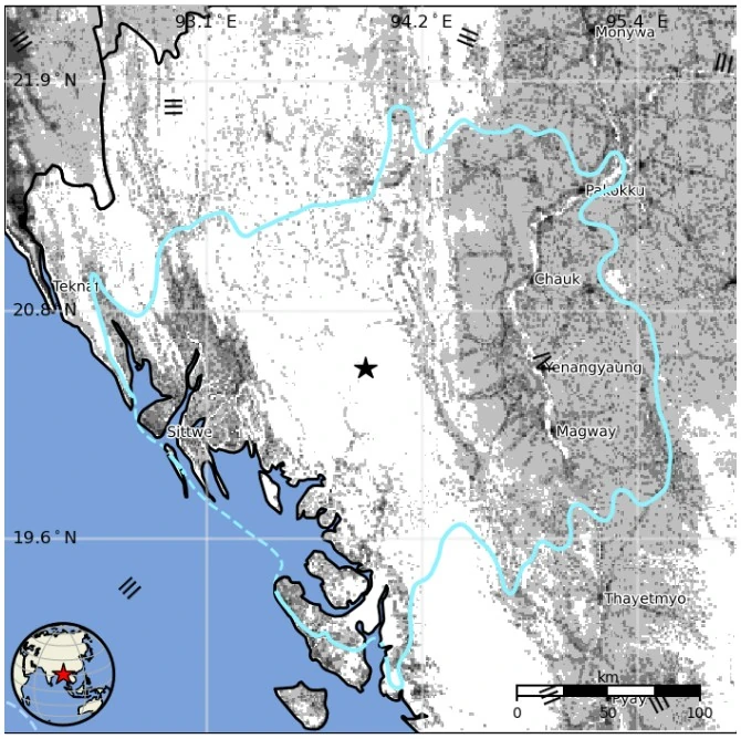
Regional seismicity
References:
1 M5.9 earthquake Rakhine-Magway border region, Myanmar – USGS – February 3, 2026
2 M5.9 earthquake Rakhine-Magway border region, Myanmar – EMSC – February 3, 2026
I'm a dedicated researcher, journalist, and editor at The Watchers. With over 20 years of experience in the media industry, I specialize in hard science news, focusing on extreme weather, seismic and volcanic activity, space weather, and astronomy, including near-Earth objects and planetary defense strategies. You can reach me at teo /at/ watchers.news.
Commenting rules and guidelines
We value the thoughts and opinions of our readers and welcome healthy discussions on our website. In order to maintain a respectful and positive community, we ask that all commenters follow these rules.