
Heavy rainfall and flash flooding threaten Florida and Gulf Coast as Invest 93L moves westward
A low-pressure system designated Invest 93L is moving westward across the Florida Peninsula on July 15, 2025, with a medium chance of tropical cyclone development in the northeastern Gulf by mid-week. The system could become a tropical depression or Tropical Storm Dexter later this week, potentially affecting the northern Gulf Coast with heavy rain and localized flooding.
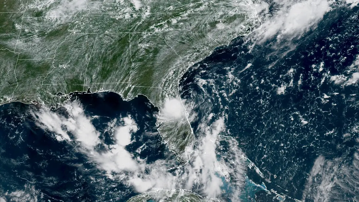
Image credit: NOAA/GOES-East, RAMMB/CIRA, The Watchers. Acquired at 17:10 UTC on July 15, 2025
A developing tropical disturbance labeled Invest 93L is currently tracking westward across the Florida Peninsula and is forecast to emerge over the northeastern Gulf of Mexico by July 16.
The system, currently centered just offshore of Florida’s east-central coast near Cape Canaveral, with a surface pressure of 1 014 hPa, is gradually becoming better organized but remains hindered by upper-level northerly wind shear that is disrupting convection.
According to the National Hurricane Center (NHC), Invest 93L has a medium (40%) chance of forming into a tropical depression or tropical storm within the next 48 hours and again over the next 7 days. If named, it would become Tropical Storm Dexter.
Regardless of development, the system is already producing widespread rainfall across Florida, with some central and western regions experiencing flash flooding. Local rainfall totals have exceeded 250 mm (10 inches) near Tampa.
The National Weather Service (NWS) has issued flood advisories and warns that additional heavy rainfall through July 16 may lead to more localized flash flooding.

Once Invest 93L reaches the Gulf, environmental conditions are expected to become more favorable for tropical development, including higher sea surface temperatures near 32°C (90°F) and reduced wind shear. Forecast models indicate that the disturbance may slowly intensify over the northeastern and north-central Gulf by July 17–18.
The primary hazard from this system remains heavy rainfall. The northern Gulf Coast, including parts of Louisiana, Mississippi, Alabama, and the Florida Panhandle, could see significant rainfall and flash flooding beginning mid-week. The NWS currently classifies the flash flood risk for these areas as moderate to high.
Texas, particularly its eastern region, may experience some impacts later in the week. However, current model trends suggest the heaviest rainfall and potential landfall zone may remain east of the Texas coastline.
I'm a dedicated researcher, journalist, and editor at The Watchers. With over 20 years of experience in the media industry, I specialize in hard science news, focusing on extreme weather, seismic and volcanic activity, space weather, and astronomy, including near-Earth objects and planetary defense strategies. You can reach me at teo /at/ watchers.news.
Gulf of American, not gulf of mexico