
Tropical Storm “Max” forms, about to hit Mexican state of Guerrero
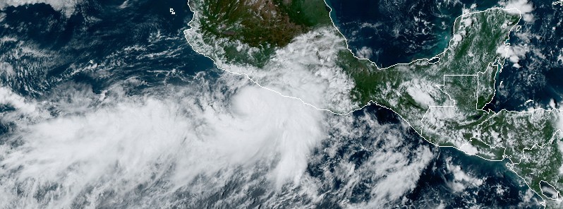
Featured image: Tropical Storm "Max" at 20:35 UTC on September 13, 2017. Credit: NOAA/GOES-16 (preliminary and non-operational)
Tropical Storm "Max" formed near the southwest coast of Mexico on September 13, 2017 as the 13th named storm of the 2017 Pacific hurricane season. Max is expected to make landfall on the southern coast of the Mexican state of Guerrero on September 14 and move into Oaxaca. The system will bring heavy rains to both Guerrero and Oaxaca and may produce life-threatening flash floods and landslides.
At 21:00 UTC on September 13, the center of Tropical Storm "Max" was located 185 km (115 miles) WSW of Acapulco, Mexico. The system is moving ENE at 6 km/h (3 mph) with maximum sustained winds of 65 km/h (40 mph). Its minimum estimated central pressure is 1 005 hPa.
The government of Mexico has issued a Tropical Storm Warning from Zihuatanejo to Punda Maldonado. Tropical storm conditions are expected in the area within the next 6 to 12 hours. Tropical-storm-force winds extend up to 55 km (35 miles) from the center.
No significant change in strength is anticipated before Max makes landfall within the warning area on Thursday, September 14.
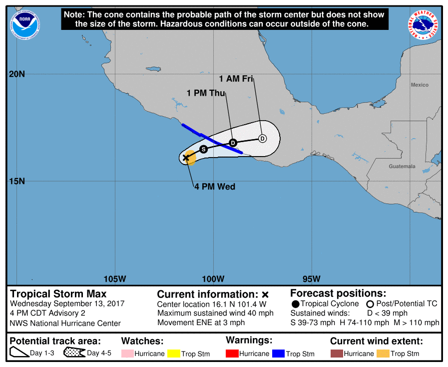
Max is expected to produce total rainfall accumulations of 127 to 254 mm (5 to 10 inches) with maximum totals of 381 mm (15 inches) across southern portions of Mexican state of Guerrero and western portions of the state of Oaxaca.
These rainfall amounts may produce life-threatening flash floods and landslides.
I'm a dedicated researcher, journalist, and editor at The Watchers. With over 20 years of experience in the media industry, I specialize in hard science news, focusing on extreme weather, seismic and volcanic activity, space weather, and astronomy, including near-Earth objects and planetary defense strategies. You can reach me at teo /at/ watchers.news.
Commenting rules and guidelines
We value the thoughts and opinions of our readers and welcome healthy discussions on our website. In order to maintain a respectful and positive community, we ask that all commenters follow these rules.