
Chantal weakened into a tropical depression

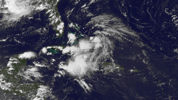
Featured image: GOES-13 satellite image taken at 20:15 UTC on July 11, 2013 (Credit: NOAA/GOES)
Tropical Storm Chantal in Caribbean has lost its tropical characteristics while approaching Haiti.
However, Chantal brought heavy rainfall in Central Haiti and the central and south coastal Dominican Republic. The low pressure system extends northeastward from the northwestern Caribbean Sea, across central Cuba into the Bahamas. The remains of Tropical Storm Chantal are bringing heavy rains and gusty winds to the Southeast Bahamas and Turks and Caicos Islands.
GOES East satellite image taken at 20:15 UTC on July 11, 2013. (Credit: NOAA/GOES)
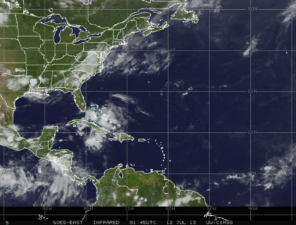
GOES-East Infrared satellite image taken at 01:45 UTC on July 12, 2013 (Credit: NOAA/GOES/CIMSS)
The remains of Chantal will spread into the Northwest Bahamas and to the Southeast U.S.in the coming days. Upper-level winds are forecast to become more favorable for development during the next day or two as the system moves northward across the northwestern Bahamas and into the western Atlantic Ocean. According to latest NOAA/NHC forecast, the system has a medium chance (30 %) of becoming a tropical cyclone during the next 48 hours.
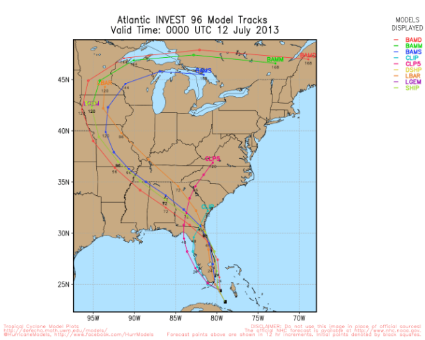
Chantal forecast track models (Credit: UWM)
Commenting rules and guidelines
We value the thoughts and opinions of our readers and welcome healthy discussions on our website. In order to maintain a respectful and positive community, we ask that all commenters follow these rules.