
Tropical Storm Leepi (Emong) moves toward Japan
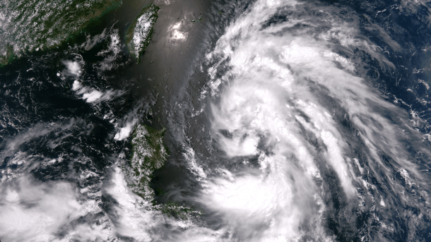
Featured image: Suomi NPP satellite image taken on June 18, 2013 at 04:45 UTC (Credit: NASA/SUOMI NPP)
Tropical depression east of Philippines gained more strength and became Tropical Storm Leepi (Emong) on June 18, 2013. After moving offshore of the Philippines, Tropical Storm Leepi is headed north towards Taiwan. It is forecast to continue northeast toward the coast of Japan. With current sustained winds of 40 mph, the storm is expected to strengthen over the next two days before possibly hitting the Japanese mainland.
.jpg)
According to latest report by Joint Typhoon Warning Center (JTWC), the center of Tropical Storm Leepi was located approximately 408 nm southward of Kadena AB. The system is moving northward at speed of 8 knots. Maximum sustained winds are 45 knots with gusts up to 55 knots. Tropical storm Leepi is expected to increase slightly in intensity while passing to the northeast of the Philippines. It is expected to move northward over the Pacific Ocean and affect Japan within the next few days.
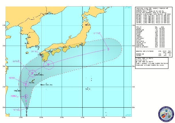
TS Leepi forecast track (Credit: JTWC)
The cyclone is tracking along the western periphery of a deep-layered subtropical ridge to the east. Animated multispectral satellite imagery shows formative banding continuing to wrap around the low-level circulation center with deep convection dissipating to the north and building to the south of the low-level circulation center.
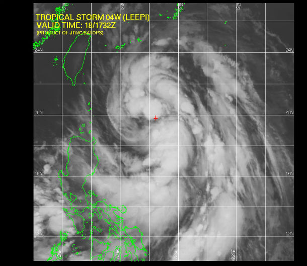
Multispectral satellite image of TS Leepi at 17:32 on June 18, 2013 (Credit: JTWC/SATOPS)
Upper-level analysis indicates a favorable environment with low to moderate (10-15 knot) vertical wind shear enhanced by strong radial outflow. Along-track sea surface temperatures are also favorable at 28-30 degrees Celsius. TS Leepi will experience moderate intensification as favorable vertical wind shear and warm waters persist along the track.

MTSAT floater visible satellite image of the system at 22:32 UTC on June 18, 2013 (Credit: NOAA/MTSAT)
Peak intensification is expected at approximately 36-48 hours due increased outflow from its initial exposure to the strong westerlies. Increasing vertical winds and cooler waters will lead to deterioration soon after. After the next 48 hours, Leepi will further accelerate into the mid-latitudes and commence extratropical transition, becoming a cold-core low after the next 72 hours.
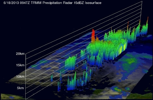
TRMM PR data were used to make this 3-D view of tropical storm Leepi's vertical structure. Some of the powerful storms near Leepi's center reached heights above 16.5km (~10.25 miles). (Credit: NASA/TRMM)
Currently, heavy rains and severe storms across the Philippines are increasing the risk of flooding and landslides as Leepi remains eastward enhancing the south west Monsoon. Heavy rains up to 150 mm are expected to batter Japan causing high risk of flash flooding and mudslides, especially on the steeper volcanic slopes in Western Japan.
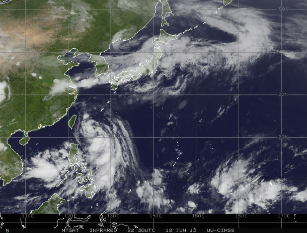
MTSAT Infrared satellite image of TS Leepi at 22:30 UTC on June 18, 2013 (Credit: MTSAT/CIMSS)
Satellite Animations
- Storm-Centered Infrared (MTSAT2; NOAA/SSD)
- Storm-Centered Infrared (Aviation Color Enhancement) (MTSAT2; NOAA/SSD)
- Storm-Centered Water Vapor (MTSAT2; NOAA/SSD)
- Storm-Centered Visible (MTSAT2; NOAA/SSD)
- Storm-Centered Visible (Colorized) (MTSAT2; NOAA/SSD)
- West Pacific/South China Sea Infrared (MTSAT2; NOAA)
- West Pacific/South China Sea Enhanced Infrared (MTSAT2; NOAA)
- West Pacific/South China Sea Water Vapor (MTSAT2; NOAA)
Commenting rules and guidelines
We value the thoughts and opinions of our readers and welcome healthy discussions on our website. In order to maintain a respectful and positive community, we ask that all commenters follow these rules.