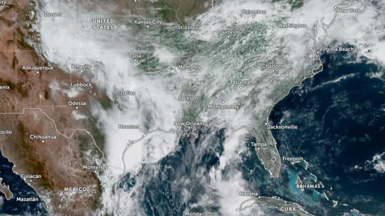
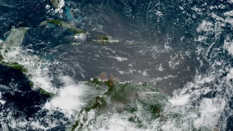
• Flood threat expands along Gulf Coast as Potential Tropical Cyclone One nears Louisiana

    Heavy rainfall, flash flooding, storm surge, and isolated tornadoes are expected across portions of the Gulf Coast as Potential Tropical Cyclone One tracks along the Texas coast on June 17, 2026. While the system is unlikely to develop into a tropical cyclone, it could bring rainfall totals of up to 500 mm (20 inches) to some areas along with the severe weather.

  • Moderate Risk of excessive rainfall across Texas and Louisiana, flood threat forecast through June 17

    Heavy rainfall is forecast from South Texas into the lower Mississippi Valley this week. Moderate Risk excessive rainfall outlooks remain in effect across parts of the Gulf Coast as multiple rounds of thunderstorms develop within an unusually moist tropical air mass. Rainfall totals could reach 100 to 150 mm (4 to 6 inches) in some areas, with locally higher amounts possible from June 15 to 17, 2026.

  • Severe thunderstorms and flooding threat forecast across the Plains through Thursday

    Repeated rounds of severe thunderstorms are forecast to develop across parts of the northern Plains and Upper Mississippi Valley through Thursday, June 4, bringing the potential for large hail, damaging winds, isolated tornadoes, and localized flooding. The Storm Prediction Center (SPC) placed parts of the eastern Dakotas and western Minnesota under a Slight Risk (level 2 of 5) for severe thunderstorms, while excessive-rainfall outlooks from the Weather Prediction Center (WPC) target portions of the eastern Dakotas, west Texas, and New Mexico.

  • Heavy rainfall and flash flooding forecast across Texas, the Gulf Coast, and the Appalachians

    A Slight Risk area for excessive rainfall remains in effect across southeast Texas, the central Gulf Coast, and parts of the Ohio Valley into the central Appalachians where slow-moving thunderstorms may produce flash flooding over saturated ground through May 27. Deep Gulf moisture and a slow-moving weather pattern are forecast to fuel multiple rounds of heavy rain from southeast Texas to the central Appalachians, increasing the risk of flash flooding in vulnerable areas through late week

  • Exceptional drought returns to Texas Panhandle and western Oklahoma for first time since July 2023

    Exceptional drought (D4) has returned to parts of the Texas Panhandle and western Oklahoma for the first time since July 2023, according to the National Weather Service Arkansas-Red Basin River Forecast Center (ABRFC). Drought conditions continue worsening across large parts of the Southern Plains following one of the driest and warmest starts to spring on record. Extreme Drought (D3) conditions are already affecting 36% of the Arkansas-Red Basin, while forecasters warned that very dry conditions are expected to persist across western portions of the region.

  • Giant hail up to 11.4 cm (4.5 inches) and damaging winds hit Texas

    Severe thunderstorms produced giant hail up to 11.4 cm (4.5 inches), damaging winds, power outages, and road blockages across parts of Texas on May 10 and 11, 2026, after the Storm Prediction Center (SPC) placed parts of west-central and north-central Texas under an Enhanced Risk. SPC storm reports included baseball-size hail in several counties, wind damage near Hamilton, more than 18 000 power outages in the Austin area, and gusts up to 135 km/h (84 mph) near Corpus Christi NAS.

  • Enhanced Risk issued for large hail and severe wind gusts in parts of north and central Texas

    An Enhanced Risk (level 3/5) for severe thunderstorms has been issued across parts of west-central and north-central Texas through May 10, 2026. Supercells capable of producing hailstones larger than 5 cm (2 inches) and wind gusts above 113 km/h (70 mph) are forecast to develop during the afternoon and evening hours. The severe-weather threat extends east-northeastward into the Ark-La-Tex region and parts of the lower Mississippi Valley.

  • Flash floods leave 1 dead in San Antonio, Texas

    One person died in San Antonio, Texas, on May 1, 2026, after flash floods spread across urban areas during periods of heavy rainfall. Police and fire crews recovered the victim from a drainage channel as floodwaters impacted roads and infrastructure.