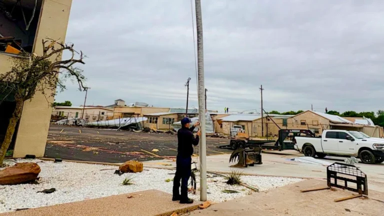
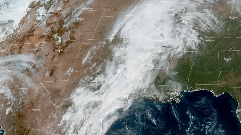
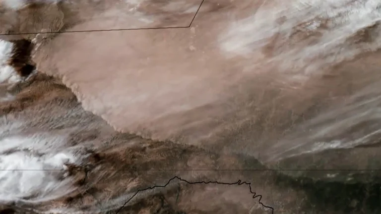
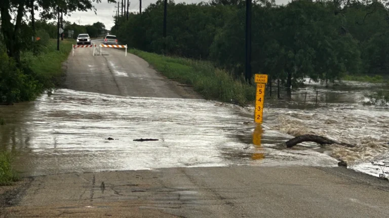
• Monster 18 cm (7.1 inch) hailstone sets new state record in Texas

    What initially looked like a discarded gallon jug in a roadside ditch turned out to be a record-breaking hailstone, now confirmed as the largest ever documented in Texas at roughly 18 cm (7.1 inches). It was discovered near Vigo Park in Swisher County by storm chaser Val Castor and his associates on June 2, 2024. They clicked several pictures of the hailstone alongside objects to provide a visual reference of size and submitted them to the Insurance Institute for Business and Home Safety (IBHS). The size of the hailstone was determined using photogrammetry and AI analysis along with the estimates from the storm chasers.

  • NWS rates Mineral Wells tornado EF3 after severe storms in Texas

    The National Weather Service preliminarily rated the Mineral Wells tornado in Texas as EF3, with estimated peak winds of 233 km/h (145 mph), after surveying damage from the April 28, 2026, severe weather event. NWS listed 5 injuries and 0 fatalities, while Mineral Wells officials kept a curfew in place for the affected area as cleanup and damage assessment continued.

  • Giant hail up to 11.4 cm (4.5 inches) reported in Texas, destructive 10.2 cm (4 inches) hail swath impacts Missouri

    Giant hail up to 11.4 cm (4.5 inches) was reported in Johnson County, Texas, late on April 28, 2026, while a separate corridor of 7.6–10.2 cm (3–4 inches) hail caused structural and vehicle damage across southwest Missouri earlier the same day. The storms were part of a multi-state severe weather outbreak stretching from Oklahoma and Arkansas into Mississippi, producing widespread reports of large hail, damaging winds, and isolated tornadoes. Confirmed impacts included broken windows, roof damage, and an animal fatality at a zoo in Springfield, Missouri.

  • Enhanced Risk of severe thunderstorms issued for northern Texas into lower Mississippi Valley

    Severe thunderstorms and heavy rainfall are forecast across parts of northern Texas into the lower Mississippi and Tennessee Valleys on April 28, 2026, with an Enhanced Risk issued for parts of the region. Very large hail, damaging winds, and a few tornadoes are to be expected, while repeated storm activity may increase the risk of flash flooding.

  • SPC issues Extremely Critical fire weather outlook for eastern New Mexico and far western Texas Panhandle

    The Storm Prediction Center issued an Extremely Critical Fire Weather Area for portions of eastern New Mexico into the far western Texas Panhandle on Sunday, April 26, 2026. Red Flag Warnings cover much of the southern High Plains as southwest winds of 40-55 km/h (25-35 mph), localized gusts of 80-95 km/h (50-60 mph), and very low relative humidity create conditions where any new fire could spread rapidly.

  • Possible tornado kills one in Runaway Bay, damages homes and sends at least six people to hospitals, Texas

    A possible tornado damaged homes in Runaway Bay, Wise County, Texas, shortly after 21:00 CDT on April 25, 2026 (02:00 UTC on April 26), sending at least six people to hospitals and displacing about 20 families. Wise County Judge J.D. Clark said one person has died during the event. At least one home was destroyed, and multiple homes were heavily damaged near the Cumberland Trail and Overland Trail on the west side of the city.

  • Severe thunderstorms possible across southwest and central Texas today

    The Storm Prediction Center placed parts of southwest and central Texas under a Slight Risk of severe thunderstorms on April 12, 2026, with isolated to scattered severe storms possible through this evening. The main concern is for redevelopment later today from southeast and south-central Texas into southwest Texas, where large hail and damaging wind gusts are possible.

  • Dust storm triggers multi-vehicle crash on U.S. 287 in northern Texas

    A multi-vehicle crash occurred on U.S. Highway 287 near Quanah in Hardeman County, northern Texas, on March 15, after strong winds generated blowing dust that rapidly reduced visibility and created dangerous driving conditions. Video footage recorded in the area shows dense dust moving across the highway as vehicles traveled through the corridor. Visibility deteriorated rapidly…

  • Red Flag Warnings issued for parts of Texas, New Mexico, Oklahoma and Colorado as critical fire weather spreads on March 15

    Strong winds and very dry air behind a powerful storm system are creating critical fire weather across parts of Texas, New Mexico, Oklahoma, and Colorado on March 15, 2026, prompting Red Flag Warnings across multiple forecast areas. Wind gusts may reach 105 km/h (65 mph), while relative humidity is forecast to fall as low as 6 to 15 percent in some areas, supporting rapid fire growth and spread.