
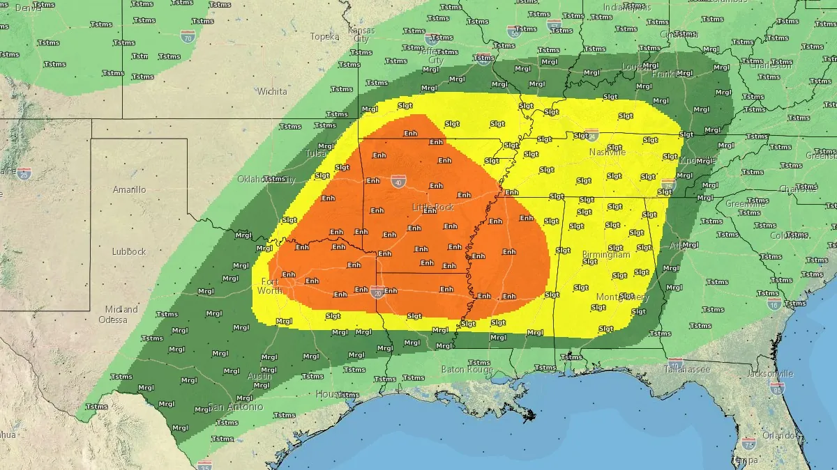
Enhanced Risk of severe thunderstorms issued for northern Texas into lower Mississippi Valley
Severe thunderstorms and heavy rainfall are forecast across parts of northern Texas into the lower Mississippi and Tennessee Valleys on April 28, 2026, with an Enhanced Risk issued for parts of the region. Very large hail, damaging winds, and a few tornadoes are to be expected, while repeated storm activity may increase the risk of flash flooding.
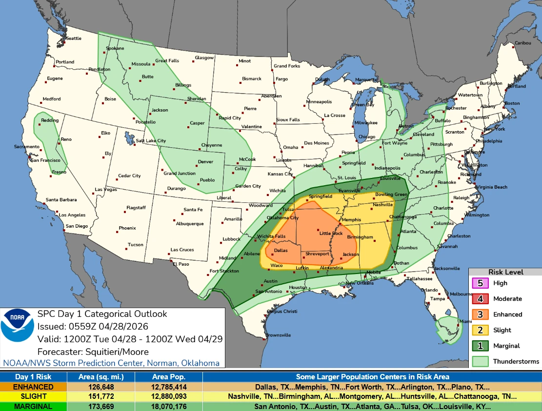
Convective Outlook valid 14:00 EDT on April 28 to 14:00 EDT on April 29, 2026. Credit: NWS/WPC
Multiple rounds of strong to severe thunderstorms are forecast to develop from Texas into the Tennessee Valley through April 28 as a slow-moving frontal boundary remains positioned across the region.
The Storm Prediction Center (SPC) has placed parts of northern Texas into the lower Mississippi Valley under an Enhanced Risk (level 3 of 5), with severe storms capable of producing significant impacts being forecast across the region.
The first batch of thunderstorms is forecast to develop during the morning hours over Texas and move eastward into the Mississippi Valley, bringing severe hail, damaging wind gusts, and periods of heavy rainfall as storms consolidate into a larger system.
A second, more intense round is forecast later in the afternoon and evening as surface heating strengthens instability.
The storms may repeatedly track across the same corridor, raising the risk of localized flash flooding where rainfall accumulates over short periods.
By April 29, the frontal boundary is forecast to shift southward toward the Gulf Coast, where storm activity is expected to decrease and both severe weather and excessive rainfall risks are reduced to Marginal levels. Farther north, the advancing segment of the front may trigger thunderstorms across parts of the Ohio Valley and Northeast, where isolated severe wind gusts and a brief tornado remain possible.
The pattern is expected to persist into April 30 as the front stalls over Texas and interacts with an upper-level disturbance, maintaining unsettled conditions across parts of the southern Plains and Southwest with additional thunderstorm development possible.
References:
1 Short Range Forecast Discussion – NWS/WPC– April 28, 2026
2 Day 1 Convective Outlook – NWS/SPC – April 28, 2026

I am an Assistant Editor and Severe Weather & Science Journalist at The Watchers, specializing in real-time severe weather coverage, geophysical event reporting, and research-driven scientific analysis. You can reach me at rishav(at)watchers(.)news.
Commenting rules and guidelines
We value the thoughts and opinions of our readers and welcome healthy discussions on our website. In order to maintain a respectful and positive community, we ask that all commenters follow these rules.