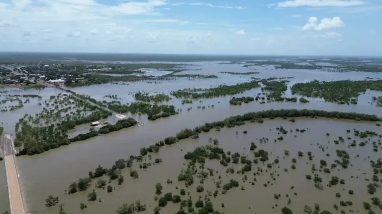
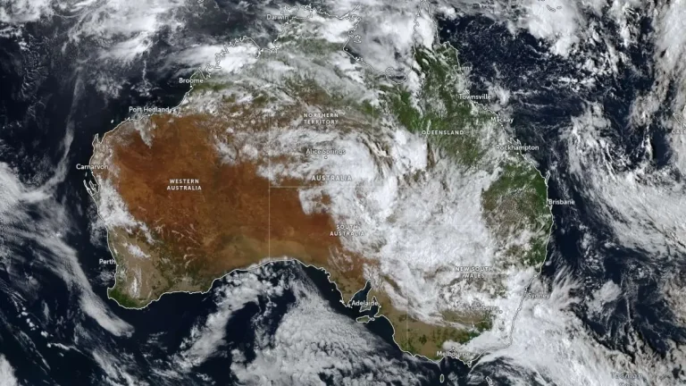
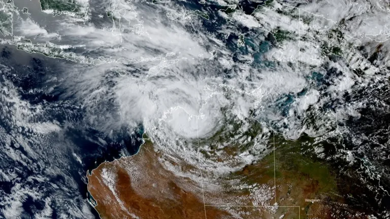
• Heavy rainfall and flooding impact Northern Territory as ex-Tropical Cyclone Narelle moves west

    Heavy rainfall from ex-Tropical Cyclone Narelle triggered flooding across parts of the Northern Territory, Australia, between March 21 and 23, 2026, inundating properties, disrupting infrastructure, and prompting evacuations. As of March 23, the system was moving west across the Kimberley and had a high chance of redeveloping into a tropical cyclone over waters off Western Australia by March 25, with further strengthening forecast. Severe weather was expected to continue across northern Kimberley through March 24.

  • Severe flooding hits Northern Territory and Queensland as rivers reach major levels, Australia

    Severe flooding affected parts of Northern Territory and Queensland, Australia during the first week of March 2026 after persistent monsoonal rainfall caused multiple rivers to exceed major flood levels. The Katherine River in Northern Territory peaked at 19.2 m (63 feet) before midnight on March 7, its highest level since 1998, while the Burnett River in Bundaberg, Queensland was forecast to reach about 7.6 m (25 feet) between March 10 and March 11, 2026. Evacuations, road closures, infrastructure disruptions, and widespread flood warnings were issued as rainfall totals exceeded 500 mm (20 inches) in parts of northern Australia.

  • Desert rainfall anomaly triggers major flooding across central Australia

    A near-stationary tropical low has triggered one of the most significant inland rainfall events in recent decades, inundating vast areas of central Australia and prompting disaster declarations across the Northern Territory. More than 600 mm (24 inches) of rain has been recorded at some remote stations, with additional heavy rainfall forecast to expand south into South Australia and Victoria through early next week, increasing the risk of further flooding. Meteorologists described it as a remarkable and highly unusual meteorological event.