
Early stratospheric warming in late November could disrupt the polar vortex and shift winter patterns
An early stratospheric warming developing over the Arctic in late November 2025 is raising the likelihood of colder conditions and increased snowfall across parts of the United States, Canada, and possibly Europe in December.

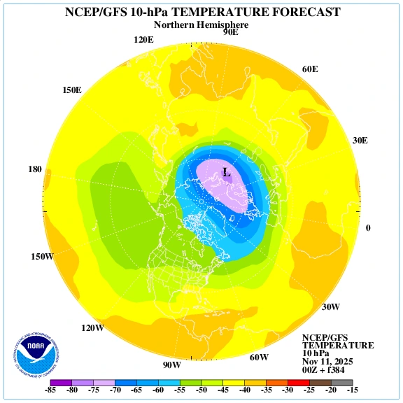
10hPa temperature anomaly model for November 24, 2025. Image credit: ECMWF
Forecast models from ECMWF and GFS indicate a developing stratospheric warming event above the Arctic during the second half of November 2025.
Ensemble runs show temperature anomalies forming in the upper stratosphere, suggesting the early stages of a polar vortex weakening phase that could reshape winter circulation patterns heading into December.
“The forecasts show a collapse of the polar circulation in the second half of the month, with cold weather and snow to follow across the United States and Canada, but with less clear impacts over Europe for now,” Andrej Flix of Severe Weather Europe (SWE) reported.
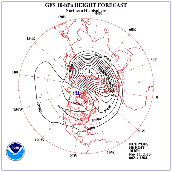
The latest ensemble guidance from GFS and ECMWF shows significant warming at around 10 hPa level. As this pattern evolves, the polar vortex is forecast to be either displaced or partially disrupted.
Historical data suggests that when such events occur, colder Arctic air masses tend to move southward, reaching mid-latitudes within roughly one to three weeks.
Currently, model consensus in ensemble subsets shows a higher probability of downstream cold air development across the northern and central United States, extending into parts of Canada.
Some ensemble members also indicate a greater chance of early-season snow systems forming under this evolving configuration. The European outlook remains more uncertain, with model divergence between ECMWF and GFS runs regarding the extent and timing of cold intrusions.
NOAA’s stratosphere–troposphere monitoring and the Met Office seasonal guidance both show signals consistent with an increased likelihood of a negative Arctic Oscillation by early December. However, these are probabilistic indicators rather than deterministic forecasts, and confidence at this stage remains moderate.
While the main warming pulse remains within the forecast range, persistent high-latitude pressure anomalies and cross-model alignment suggest a significant stratospheric shift is likely before the end of November.
If the warming continues to develop as projected, colder patterns and snow events could follow across North America and possibly Europe through December, depending on how the polar vortex responds in the coming weeks.

I am an Assistant Editor and Severe Weather & Science Journalist at The Watchers, specializing in real-time severe weather coverage, geophysical event reporting, and research-driven scientific analysis. You can reach me at rishav(at)watchers(.)news.
Commenting rules and guidelines
We value the thoughts and opinions of our readers and welcome healthy discussions on our website. In order to maintain a respectful and positive community, we ask that all commenters follow these rules.