
Tropical Depression One-E forms off the coast of southern Mexico
Tropical Depression 1-E formed off the coast of southern Mexico on May 28, 2025, as the first tropical depression of the 2025 eastern Pacific hurricane season. The system is forecast to develop into Tropical Storm Alvin on Thursday, May 30.
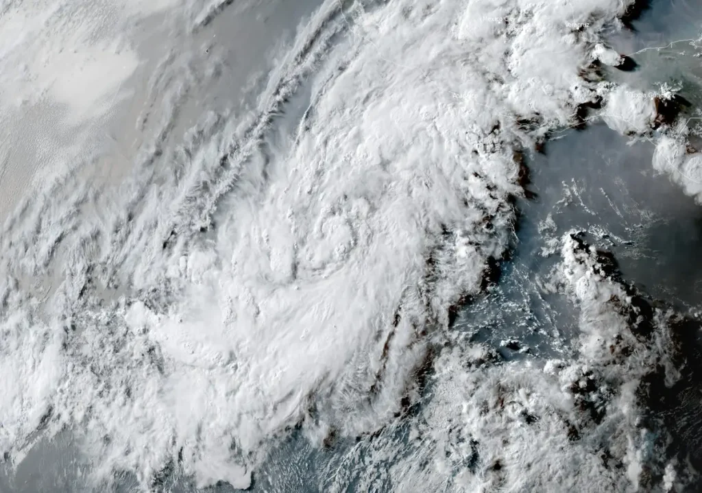
Satellite image of Tropical Depression One-E at 23:50 UTC on May 28, 2025. Credit: NOAA/GOES-East, RAMMB/CIRA, The Watchers
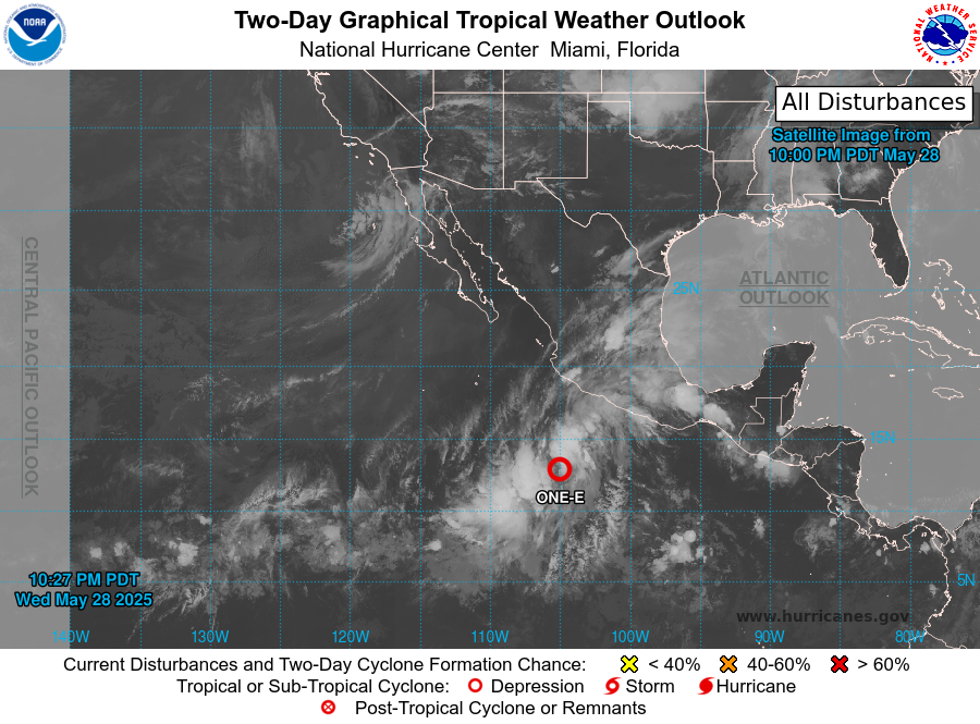
Tropical Depression One-E formed from Invest 90-E on May 28, becoming the first tropical depression of the 2025 eastern Pacific hurricane season.
As of 09:00 CST on May 28 (03:00 UTC), the system was located 1 240 km (770 miles) south-southeast of the southern tip of Baja California. It had maximum 10-minute sustained winds of 55 km/h (35 mph), with higher gusts.
The system had a minimum central pressure of 1 006 hPa and was moving north-northwest at 15 km/h (9 mph). It is forecast to continue moving in this direction through May 29.
The depression is forecast to strengthen into a tropical storm on May 30, within a weak vertical wind shear environment over warm waters.
Once it strengthens, the storm will be named Alvin, becoming the first tropical storm of the eastern Pacific hurricane season, which runs from May 15 to November 30.
The extent of strengthening will depend on whether the broad cyclone can develop a tighter inner core before environmental conditions become less favorable later in the week.
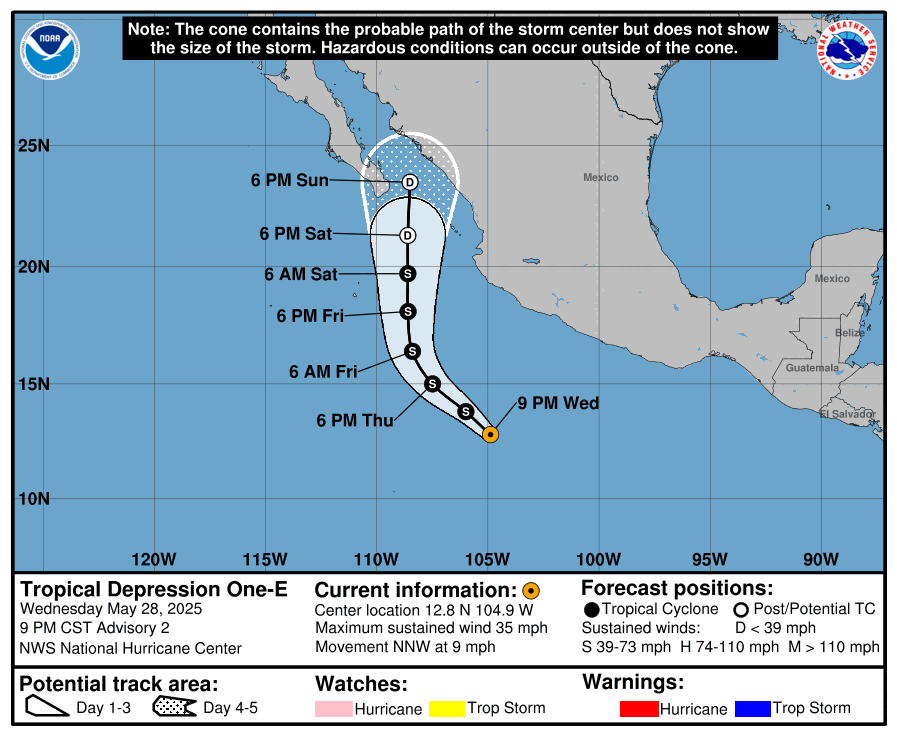
As the system gains latitude, increasing wind shear and a drier, more stable airmass are expected to disrupt its convective organization, leading to weakening.
The cyclone is forecast to become post-tropical by Saturday and dissipate by the end of the week. Based on the latest track and size forecasts, tropical-storm-force winds are not expected to affect the coast of mainland Mexico or Baja California.

I am an Assistant Editor and Severe Weather & Science Journalist at The Watchers, specializing in real-time severe weather coverage, geophysical event reporting, and research-driven scientific analysis. You can reach me at rishav(at)watchers(.)news.
Commenting rules and guidelines
We value the thoughts and opinions of our readers and welcome healthy discussions on our website. In order to maintain a respectful and positive community, we ask that all commenters follow these rules.