
Tropical Storm “Jerry” forms, forecast to become a hurricane near Leeward Islands
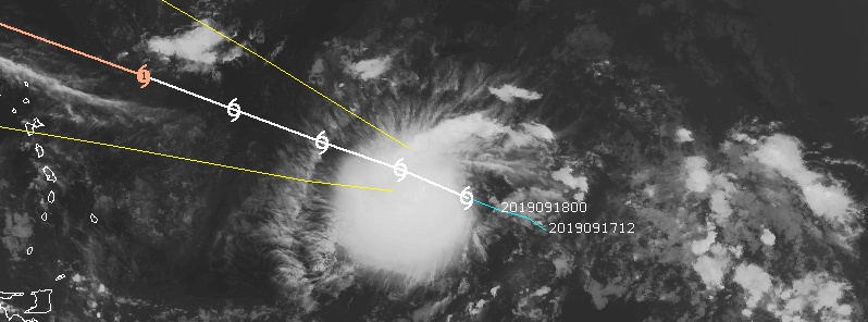
Featured image: Tropical Storm "Jerry" at 11:30 UTC on September 18, 2019. Credit: UW-CIMSS
Tropical Storm "Jerry" formed at 09:00 UTC on September 18 as the 10th named storm of the 2019 Atlantic hurricane season.
At the time, its center was located about 1 545 km (960 miles) E of Leeward Islands. Jerry had maximum sustained winds of 75 km/h (45 mph) and minimum central pressure of 1 004 hPa.
A WNW motion at a slightly faster forward speed is expected over the next few days.
Jerry will be near the northern Leeward Islands Thursday night of Friday, September 20.
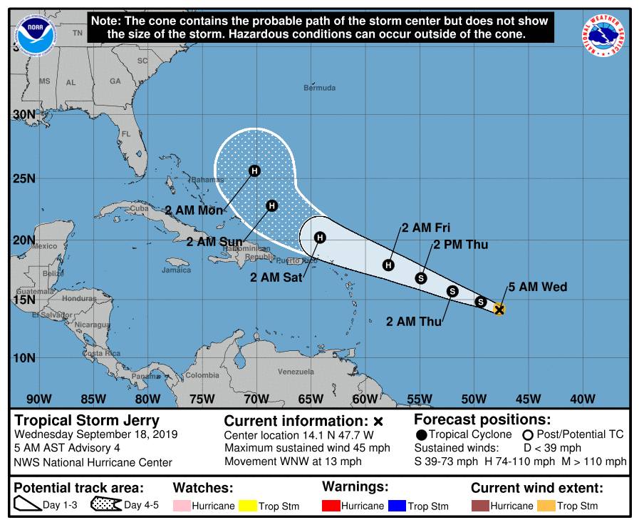
Further strengthening is expected during the next couple of days and Jerry is expected to strengthen and be a hurricane when its moves near the northern Leeward Islands Friday, September 20, although it is too soon to determine if there will be any direct impacts in the islands.
Interests there should ensure they have their hurricane plan in place and monitor the progress of this system, NHC said.
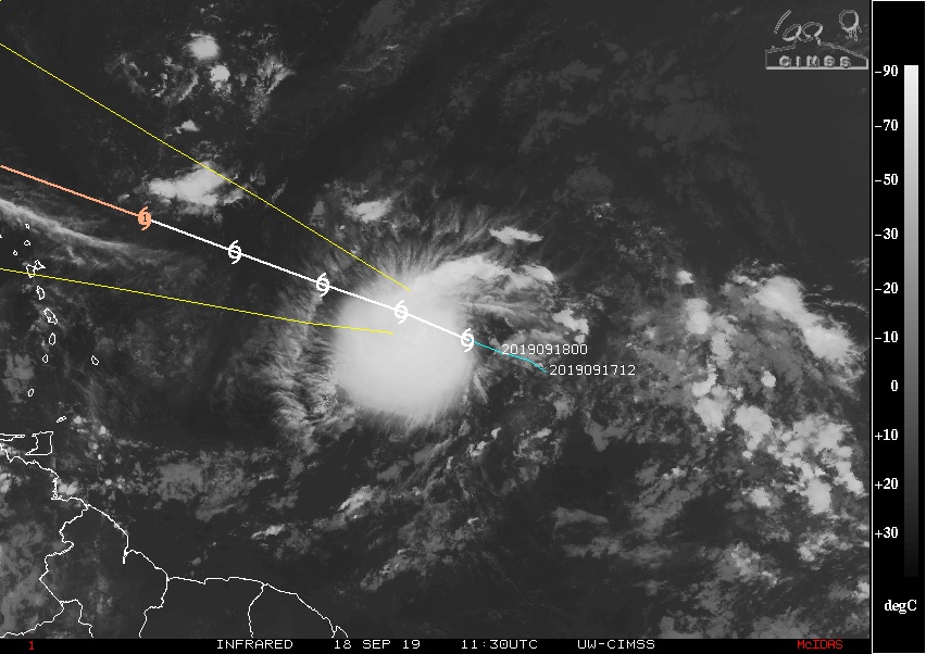
Image credit: UW-CIMSS
I'm a dedicated researcher, journalist, and editor at The Watchers. With over 20 years of experience in the media industry, I specialize in hard science news, focusing on extreme weather, seismic and volcanic activity, space weather, and astronomy, including near-Earth objects and planetary defense strategies. You can reach me at teo /at/ watchers.news.
Commenting rules and guidelines
We value the thoughts and opinions of our readers and welcome healthy discussions on our website. In order to maintain a respectful and positive community, we ask that all commenters follow these rules.