
Tropical Storm Jerry forms, forecast to become a hurricane near the northern Leeward Islands
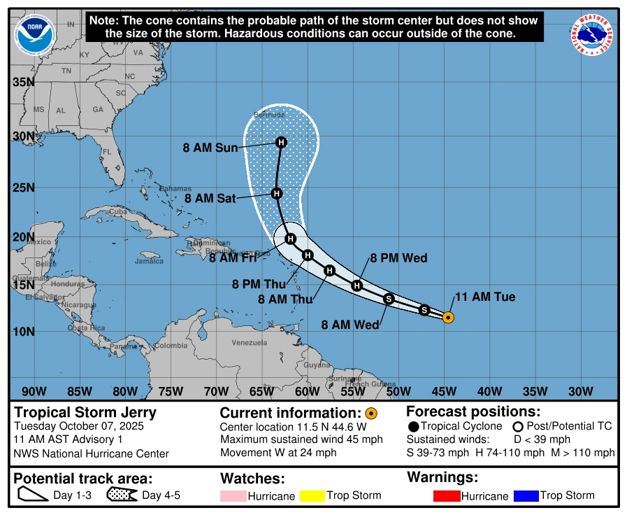
Tropical Storm Jerry formed over the tropical central Atlantic at 11:00 AST (15:00 UTC) on Tuesday, October 7, 2025, and is forecast to become a hurricane before passing near the northern Leeward Islands late Thursday and Friday, October 9 and 10, with a possible turn northward into the west-central Atlantic this weekend.

Satellite image of Tropical Storm Jerry at 15:40 UTC on October 7, 2025. Credit: NOAA/GOES-19, Zoom Earth, The Watchers
Tropical Storm Jerry formed in the central tropical Atlantic at 11:00 AST (15:00 UTC) on Tuesday. At the time, the storm was located 2 120 km (1 315 miles) east-southeast of the northern Leeward Islands.
Maximum sustained winds were 75 km/h (45 mph) with higher gusts, and the minimum central pressure was 1 006 hPa. Tropical-storm-force winds extended outward up to 220 km (140 miles) from the center. Jerry was moving west at 39 km/h (24 mph) on the south-southwest flank of a strong subtropical ridge.
According to the NHC discussion, environmental conditions near Jerry are favorable for intensification during the next 48–72 hours: upper-level winds are light, sea-surface temperatures are warm, and surrounding moisture is abundant.
Jerry is forecast to take a west-northwestward turn while slowing down as it approaches the southwestern edge of the subtropical ridge.
The system is forecast to become a hurricane by Wednesday or Thursday, October 8 or 9. It will then pass near or just north of the northern Leeward Islands late Thursday and Friday.
Model guidance shows a deep-layer trough amplifying over the western Atlantic late in the week, expected to erode the ridge and cause Jerry to turn northward over the west-central Atlantic this weekend; however, the NHC notes uncertainty in the timing and exact latitude of recurvature.
No coastal watches or warnings were in effect at the time of the advisory, but the NHC stated that Tropical Storm Watches could be required for portions of the northern Leeward Islands later the same day or night. Interests in those islands should monitor official products closely.
Swells generated by Jerry are forecast to reach the Leeward Islands on Thursday, producing dangerous surf and life-threatening rip currents. The NHC advised local authorities and the public to follow guidance from their regional weather offices.
Beyond the short-range forecast, model solutions diverge on Jerry’s longer-term intensity. Some tracks keep the cyclone in favorable upper-level conditions, while others move it into stronger shear. The NHC intensity forecast shows little change from days 3–5 but with low confidence.

I am an Assistant Editor and Severe Weather & Science Journalist at The Watchers, specializing in real-time severe weather coverage, geophysical event reporting, and research-driven scientific analysis. You can reach me at rishav(at)watchers(.)news.
Commenting rules and guidelines
We value the thoughts and opinions of our readers and welcome healthy discussions on our website. In order to maintain a respectful and positive community, we ask that all commenters follow these rules.