
Tropical Storm “Lorena” forecast to drop heavy rain over Guerrero, Michoacan, Colima and Jalisco, Mexico
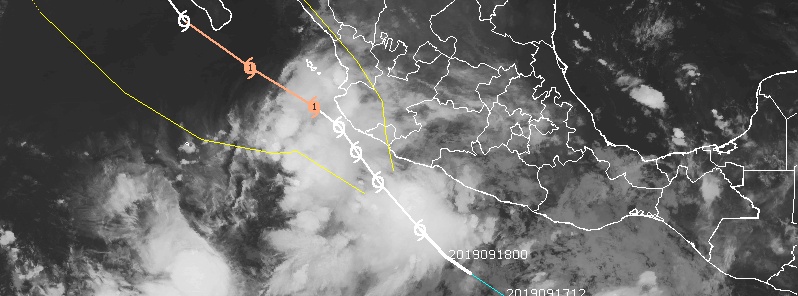
Featured image: Tropical Storm "Lorena" at 11:30 UTC on September 17, 2019. Credit: UW-CIMSS
Tropical Storm "Lorena" is forecast to cause heavy rain over portions of the Mexican states of Guerrero, Michoacan, Colima and Jalisco during the next few days. This rainfall may produce life-threatening flash flooding and mudslides. Lora is forecast to strengthen, as it moves NW, passing very close to the coast of Jalisco and Colima.
Lorena formed September 17 as the 14th named storm of the 2019 Pacific hurricane season.
A Hurricane Watch is in effect for Punta San Telmo to Cabo Corrientes, Mexico. Tropical Storm Warning is in effect for Zihuatanejo to Cabo Corrientes.
At 12:00 UTC on September 18, Lorena's center was located about 225 km (140 miles) SW of Zihuatanejo, Mexico. The storm had maximum sustained winds of 95 km/h (60 mph) and was moving NW at 22 km/h (14 mph). Its minimum central pressure was 1 000 hPa. A slower northwestward motion is expected during the next couple of days.
On the forecast track, Lorena is expected to move near or over the southwestern coast of Mexico Thursday and Thursday night, September 18.
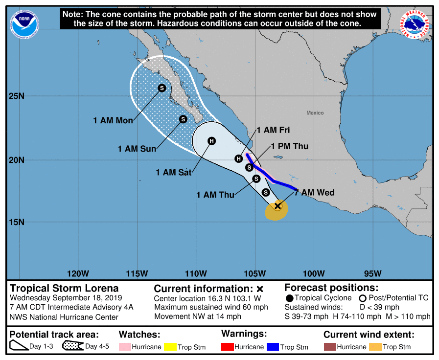
Strengthening is forecast during the next couple of days, and Lorena is expected to become a hurricane on Friday as it approaches the coast of Mexico.
Tropical-storm-force winds extend outward up to 150 km (90 miles) from the center.
Tropical storm conditions are expected within the southern portion of the warning area later today or tonight, and then are expected to spread northward along the coast through Thursday night. Hurricane conditions are possible within the watch area by early Thursday.
Lorena is expected to produce total rainfall accumulations of 125 – 250 mm (5 to 10 inches) with maximum amounts of 380 mm (15 inches) along the coastal sections of the Mexican states of Guerrero, Michoaca, Colima and Jalisco.
This rainfall may produce life-threatening flash floods and mudslides.
Swells generated by Lorena will affect portions of the southwest coast of Mexico during the next few days.
These swells are likely to cause life-threatening surf and rip current conditions.
I'm a dedicated researcher, journalist, and editor at The Watchers. With over 20 years of experience in the media industry, I specialize in hard science news, focusing on extreme weather, seismic and volcanic activity, space weather, and astronomy, including near-Earth objects and planetary defense strategies. You can reach me at teo /at/ watchers.news.
Commenting rules and guidelines
We value the thoughts and opinions of our readers and welcome healthy discussions on our website. In order to maintain a respectful and positive community, we ask that all commenters follow these rules.